West Des Moines Foundation Risk — Jordan Creek Watershed, Valley Junction-Era Homes, and Dallas County Loess
Soil data, dual-county geological analysis, and seasonal risk patterns for West Des Moines homeowners — from Valley Junction's pre-1940s stone foundations through Jordan Creek's modern construction, all on glacial till with a Dallas County loess overlay that complicates every assumption.
West Des Moines faces a dual foundation threat because it straddles the Dallas-Polk county line, where two distinct soil profiles — pure glacial till in the east and loess-over-till in the west — generate hydrostatic pressure through different mechanisms. The loess-over-till zone in western WDM creates perched water tables at the loess-till boundary, while the eastern glacial till traps water in a 45-to-60-foot impermeable deposit, pushing the water table to within 2 to 3 feet of the surface during spring.
Why Does West Des Moines Have Two Different Soil Profiles?
West Des Moines straddles the Dallas-Polk county line, and that administrative boundary happens to align with a genuine geological transition — the edge of the loess blanket that overlays glacial till in Dallas County but thins to nothing as you move east into Polk County. This makes WDM one of the few Des Moines suburbs where two distinct soil mechanisms threaten foundations within the same city limits. Eastern WDM, in Polk County, sits on the Dows Formation glacial till — 45 to 60 feet of unsorted clay, silt, sand, gravel, and Cretaceous shale fragments deposited by the Wisconsinan glacier 12,000 to 14,000 years ago. The till has moderate swelling potential and Hydrologic Soil Group D classification, meaning almost no natural drainage capacity.
Western WDM, in Dallas County, adds a loess layer on top of that glacial till — creating a two-layer system where water behavior changes at the boundary between the deposits. Loess is windblown silt deposited after the glacier retreated. It drains better than the till beneath it, which means rainwater moves downward through the loess relatively efficiently until it hits the till's impermeable surface. There it stops, pooling at the loess-till interface and creating what hydrogeologists call a perched water table. This perched table can sit at a different depth than the regional water table, and it generates hydrostatic pressure against foundation walls at an elevation that standard water table monitoring would not predict.
The practical consequence is that a foundation contractor working in Jordan Creek faces a different subsurface moisture pattern than one working in the older neighborhoods east of I-35. The loess-derived soils in western WDM — Sharpsburg, Otley, and Ladoga series — carry 35 to 42 percent clay content in their subsoil horizons. That is lower than Kansas City's montmorillonite formations, but high enough to produce moderate lateral pressure when saturated. Combined with the perched water table at the loess-till boundary, western WDM foundations face moisture loading from two directions at once. The foundation science page explains how layered soil profiles compound hydrostatic forces beyond what single-layer models predict.
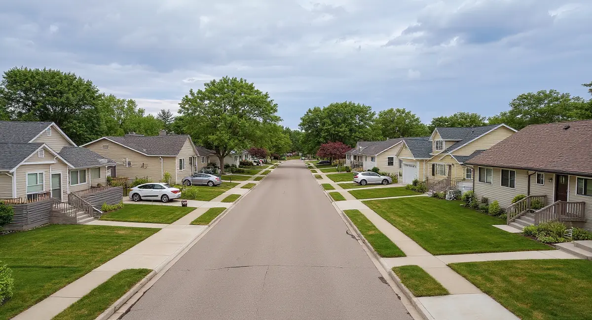
What Does West Des Moines's Three-Era Development History Mean for Foundation Risk?
West Des Moines contains the widest housing-age gradient in the Des Moines metro — spanning from Valley Junction's pre-1940s construction through the mid-century suburban ring to Jordan Creek's post-2000 development — and each era sits on different portions of the dual soil profile, creating distinct risk combinations. Valley Junction, the historic core near 5th Street, was established in the late 1800s and contains housing stock with stone foundations, early concrete block, and thin poured concrete walls. These materials were not engineered for hydrostatic resistance. After 80 to 120 years on glacial till, they have absorbed decades of moisture cycling that has degraded mortar, eroded stone surfaces, and produced cumulative displacement.
Valley Junction's stone foundations fail differently than modern poured concrete under glacial till pressure. Stone walls do not bow inward as a unit. Individual stones shift as mortar deteriorates, creating multiple discrete water entry points rather than the single horizontal crack line that characterizes poured concrete failure. Homeowners in Valley Junction may notice water seeping through seemingly random points in the basement wall during spring — each seep represents a mortar joint that has yielded to hydrostatic pressure. Foundation cracks in stone walls are harder to categorize using the standard crack-pattern diagnostics developed for poured concrete and concrete block.
The mid-century ring — roughly the 1950s through 1980s neighborhoods between Valley Junction and the Jordan Creek development corridor — represents the largest share of WDM's housing stock and the homes currently entering the peak symptom window. Concrete block basement walls from the 1960s and 1970s are inherently vulnerable to lateral pressure because they fail at mortar joints under horizontal force. These homes are now 40 to 70 years old on glacial till, well past the threshold where cumulative hydrostatic loading produces stair-step cracks along block mortar joints. Block walls in this age range should be inspected annually for any horizontal displacement or new cracking patterns, particularly during or immediately after the March-through-June peak moisture season.
Jordan Creek area construction — post-2000 homes in western WDM's Dallas County loess zone — benefits from modern building codes, poured concrete walls, and improved waterproofing systems, but sits on the most complex soil profile in the city. These homes are 5 to 25 years old, approaching or within the initial symptom window where glacial till and loess-derived soils begin producing visible effects on even well-built foundations. The perched water table at the loess-till boundary is a variable that was not routinely addressed in residential construction design during the early 2000s building boom. WDM's population tripled since 1990, and much of that growth landed on Dallas County's mixed deposits.
Why might a horizontal crack in a Jordan Creek (western WDM) basement appear at a different depth than a similar crack in an older eastern WDM neighborhood?
Which Foundation Symptoms Appear First in West Des Moines's Glacial Till Environment?
Hydrostatic pressure from glacial till produces a different symptom progression than the shrink-swell damage common in Kansas City — in WDM, the first visible sign is typically basement moisture or wall bowing rather than cracking. The glacial till's persistent lateral pressure pushes against basement walls continuously during wet periods rather than cycling between pressure and release. This sustained force deflects the wall inward gradually. Before a crack forms, the wall may develop a measurable bow — detectable with a straightedge or string line held against the wall surface. A bow of 1/4 inch or more across an 8-foot wall span signals that the wall has begun yielding to hydrostatic loading.
Once bowing progresses far enough, horizontal cracks develop at or just below grade level — the point of maximum lateral pressure on the wall. In WDM's eastern Polk County neighborhoods, this crack typically appears at a consistent depth corresponding to the water table's seasonal high point. In western Dallas County neighborhoods, the crack may appear at an unexpected depth corresponding to the perched water table at the loess-till boundary rather than the deeper regional water table. This depth discrepancy can confuse homeowners and even contractors who expect the damage to correlate with the standard water table position.
Vertical and diagonal cracking in WDM usually indicates differential loading — one section of the foundation experiencing more pressure than another due to uneven drainage, topographic variation, or proximity to the Raccoon River corridor. Homes on sloped lots where the downhill wall faces sustained water table pressure while the uphill wall stays relatively dry develop diagonal cracks at the transition between loaded and unloaded wall sections. Doors and windows sticking in one area of the house while operating normally elsewhere is a secondary indicator of this differential loading pattern.
Garage floor sinking is common across all three WDM development eras because garage slabs sit on shallower soils more directly affected by frost cycling and moisture fluctuation. Iowa's 42-inch frost depth means the entire soil column beneath a standard 4-inch garage slab undergoes annual freeze-thaw cycling. Sinking garage floors in WDM often appear within the first 10 to 15 years of construction as the glacial till beneath the slab compacts unevenly under repeated frost heave and settlement cycles.
When Does West Des Moines's Water Table Create the Most Foundation Stress?
The peak stress period runs from March through June, when snowmelt and spring rainfall push the water table to its annual maximum — often within 2 to 3 feet of the surface in WDM's poorly draining glacial till. The standard water table in WDM sits 4 to 10 feet below grade during dry periods. But the Dows Formation till drains so slowly that sequential moisture inputs — March snowmelt followed by April rain followed by the May-June rainfall peak — stack on top of each other rather than draining between events. By late May, the cumulative moisture in the soil column reaches its annual maximum, and so does the hydrostatic pressure against every basement wall in the city.
Western WDM faces an additional timing wrinkle: the perched water table at the loess-till boundary responds faster to rainfall than the deeper regional water table. A heavy April storm can elevate the perched table within days, generating sudden pressure spikes against foundation walls at the loess-till transition depth. The deeper regional table rises more gradually over weeks. This means Jordan Creek area homes can experience pressure loading events that do not correlate with the broader metro's water table monitoring data — a localized risk that standard regional assessments may understate.
The secondary risk period — October through November — matters more in WDM than in many Des Moines suburbs because of the Raccoon River's influence on northern WDM soil moisture. Fall rainfall saturates the alluvial deposits along the river corridor, and that saturation persists into the freeze season. Soil that enters winter at maximum moisture produces more aggressive frost heave within the 42-inch frost zone. Ice lens formation in saturated glacial till exerts lateral forces against foundation walls at unpredictable points within the frost depth, widening existing cracks and creating new stress fractures that will admit water during the following spring.
July through September offers the lowest foundation stress in most years, making it the optimal window for repair work and baseline monitoring. Reduced rainfall and warmer temperatures allow the water table to recede and soil pressure to decrease. Excavation around foundations is easier, concrete cure times are more predictable, and the soil is stable enough for accurate pier installation. Homeowners who suspect foundation movement should establish monitoring baselines during this low-stress period so that spring changes can be measured against a consistent reference point. The cost page discusses how seasonal scheduling affects repair project economics.
How Does WDM's Dual Soil Profile Affect Foundation Repair Decisions?
The soil profile beneath a WDM home determines which repair methods will perform long-term — and because WDM spans two distinct profiles, the correct approach in eastern Polk County neighborhoods may differ from the correct approach in western Dallas County developments. Wall stabilization for bowing caused by standard glacial till pressure typically uses wall anchors driven through the till to reach stable bearing material, or carbon fiber straps applied to the interior wall surface to prevent further inward deflection. Both methods work effectively in Polk County's uniform till profile where the pressure source and its behavior are predictable.
In Dallas County's loess-over-till profile, wall anchor placement must account for the layered soil — anchoring into loess alone is insufficient because loess can lose strength when saturated. Anchors need to reach through the loess and into competent till or deeper bearing material. Similarly, push pier installations for settlement correction must penetrate through both the loess and the till to reach load-bearing strata, which can increase pier depth requirements compared to standard Polk County installations. The homeowner's guide explains how soil profile depth affects pier selection and installation scope.
For Valley Junction's stone foundations, repair approaches must address the wall material itself, not just the soil pressure acting on it. Stone wall stabilization may involve repointing deteriorated mortar joints, installing interior drainage systems to relieve hydrostatic pressure before it acts on the wall, or in severe cases, partial wall replacement where the stone has deteriorated beyond effective repair. These projects are more complex and typically more expensive than comparable repairs on poured concrete walls, reflecting both the material challenges and the access constraints common in Valley Junction's densely built historic lots.
Concrete slab repairs — including polyjacking for settled garage floors and basement slabs — follow similar principles across both soil profiles, but drainage management after the lift is essential to prevent recurrence. Lifting a slab without addressing the moisture conditions that caused the settlement invites the same till compaction and frost heave cycle to repeat. In WDM, effective slab repair includes verifying that surface drainage directs water away from the lifted area and that the glacial till beneath the slab has a drainage path to prevent future hydrostatic loading from below.
- WDM straddles a genuine geological boundary — eastern Polk County glacial till versus western Dallas County loess-over-till — creating two distinct hydrostatic pressure mechanisms within one city.
- Valley Junction's pre-1940s stone foundations, mid-century block walls, and Jordan Creek's modern poured concrete each fail differently under glacial till pressure, requiring different repair approaches.
- The perched water table at the loess-till boundary in western WDM responds to rainfall within days, generating sudden pressure spikes that standard water table monitoring may not predict.
- March through June is the peak stress window when the water table rises to within 2 to 3 feet of the surface; July through September is the optimal repair and baseline monitoring period.
West Des Moines Foundation Questions
Why does West Des Moines have two different soil profiles within its city limits?
West Des Moines spans the Dallas-Polk county line, and that boundary roughly corresponds to a geological transition. The eastern portion of WDM in Polk County sits on glacial till from the Des Moines Lobe — the Dows Formation, 45 to 60 feet of unsorted clay, silt, sand, and gravel deposited directly by the Wisconsinan glacier. The western portion in Dallas County has a mixed profile: a loess layer — windblown silt deposited after the glacier retreated — sitting on top of the same glacial till. This layered profile in western WDM creates perched water tables where moisture collects at the loess-till boundary, generating hydrostatic pressure against foundations at a different depth than the standard water table would suggest. Two homes five miles apart in WDM can face the same type of pressure from fundamentally different soil configurations.
Are Valley Junction's older stone foundations more vulnerable to hydrostatic pressure than newer poured concrete?
Valley Junction's pre-1940s housing stock includes stone and early block foundations that were never engineered to resist hydrostatic pressure from glacial till. Stone foundations rely on gravity and mortar to hold individual stones in place, and mortar from the early 1900s degrades over a century of moisture exposure. When the water table rises to 2 to 3 feet below grade during spring — which it does regularly in WDM's glacial till — the lateral pressure acts on every mortar joint simultaneously. Stone walls do not bow inward the way poured concrete does; instead, individual stones shift and mortar crumbles, allowing water entry at multiple points. Modern poured concrete walls resist this pressure far more effectively, but they are not immune — they bow inward over decades under the same persistent loading. The failure mode differs, but neither material eliminates the glacial till moisture threat.
How does the Raccoon River affect foundation risk in northern West Des Moines?
The Raccoon River runs through northern WDM, introducing alluvial deposits — river-deposited sand, silt, and clay — that overlay the glacial till in the flood plain and near-channel areas. These alluvial soils drain differently than the upland till. They can saturate rapidly during flood events and retain moisture in the fine-grained layers. Homes near the Raccoon River corridor face a dual risk: the glacial till's persistent hydrostatic pressure from below, combined with alluvial moisture loading from the river's influence. After major rain events, the river's water level rises and pushes groundwater laterally into the alluvial deposits adjacent to the channel, elevating soil moisture in a zone that extends beyond the mapped flood plain. This river-influenced saturation compounds the already slow drainage of the glacial till beneath.
What foundation symptoms should Jordan Creek area homeowners watch for in homes built after 2000?
Jordan Creek area homes sit on Dallas County's loess-over-till profile, where a perched water table can form at the boundary between the upper loess and lower glacial till. The first symptoms in this soil configuration tend to be moisture-related rather than structural: basement humidity spikes during March through June, damp spots on lower wall sections, or efflorescence — white mineral deposits — on basement wall surfaces. These moisture indicators often precede structural symptoms by several years. As hydrostatic pressure accumulates through wet-dry cycles over 10 to 20 years, horizontal cracking at or below grade level may develop as the wall begins to deflect inward. Homes built in 2000 to 2010 are now entering this initial symptom window. Monitoring basement humidity and wall surfaces during the spring wet season is the most effective early detection approach.
When is the worst time of year for foundation problems in West Des Moines?
March through June produces the highest foundation stress in West Des Moines. Spring snowmelt begins in March, saturating the glacial till and raising the water table from its winter position. By April and May, the year's heaviest rainfall overlaps with the snowmelt moisture already trapped in the till, pushing the water table to its annual maximum — often within 2 to 3 feet of the surface. This is when hydrostatic pressure against basement walls peaks, existing horizontal cracks extend, and basement moisture intrusion is most likely to appear or worsen. A secondary risk window occurs in October and November, when fall rain saturates soil that will freeze through the winter. Soil that enters the cold season fully saturated produces more aggressive frost heave within Iowa's 42-inch frost zone, compounding any existing wall damage through the winter months.