Liberty Foundation Risk — Clay County Loess-Clay Soil, Shoal Creek, and a Wide Development Timeline
Soil mechanics, housing stock analysis, and seasonal risk data for Liberty, Missouri — Clay County's growth suburb, where a hybrid clay-loess soil profile creates foundation failure modes distinct from Jackson County's pure shrink-swell pattern.
Liberty sits on a hybrid clay-loess soil that creates a dual foundation threat not found in Jackson County suburbs: moderate seasonal shrink-swell from the clay fraction plus potential sudden collapse settlement from the loess fraction. The Shoal Creek flood corridor amplifies loess collapse risk by saturating the silt from below — the worst direction for triggering the capillary bond failure that causes rapid, non-reversible settlement.
How Does Clay County's Mixed Soil Profile Affect Liberty Foundations?
Liberty sits on a hybrid soil formation that combines weathered residual clay with Pleistocene-era loess — a mix fundamentally different from the pure Wymore-Ladoga clay that dominates Jackson County suburbs south of the Missouri River. Loess is windblown silt deposited during glacial periods, and in Clay County it forms layers ranging from inches to several feet thick, interbedded with or overlying the native clay. The clay fraction still exhibits shrink-swell behavior, but the loess component modifies the soil's overall response to moisture in ways that matter for foundations.
The loess fraction reduces Liberty's peak shrink-swell amplitude compared to Independence or Lee's Summit, where nearly pure montmorillonite clay dominates — but it introduces a failure mode those cities rarely experience. Loess-rich soil can collapse under saturation. The silt grains in undisturbed loess are held in an open, porous structure by weak capillary bonds between particles. When water infiltrates and breaks those bonds, the structure compresses suddenly and permanently. This collapse mechanism produces rapid, non-reversible settlement — different from the seasonal cycling of clay shrink-swell, and often more damaging because the soil does not rebound when it dries. The foundation science page explains both failure mechanisms in detail.
Clay County's soil composition varies across short distances in Liberty, creating neighborhoods with markedly different risk profiles sitting on the same underlying geology. Eastern Liberty, where development has pushed into formerly agricultural land, tends to have thicker loess deposits. Central Liberty near the historic core has had loess eroded or compacted over time, exposing more clay-dominant material. Western Liberty along the Shoal Creek corridor introduces a third variable: alluvial deposits from flood events layered on top of the clay-loess base. No single description of "Liberty soil" captures the full range.
Missouri's frost depth of 36 inches governs footing design in Liberty, placing the base of a code-compliant footing below both the frost line and the most active shrink-swell zone — but not necessarily below the loess collapse zone. If loess extends deeper than 36 inches at a given site, the footing sits on material that can lose bearing capacity when saturated. A soil boring is the only way to confirm bearing conditions at footing depth, and Liberty's variable loess thickness makes site-specific investigation more valuable here than in Jackson County's more uniform clay.
Why Does Liberty's Development Timeline Create Such Varied Foundation Risk?
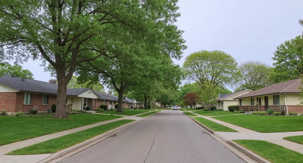
Liberty has the widest development era range in Clay County — from pre-1900 homes near William Jewell College and the historic downtown to subdivisions still under construction on the city's northeast edge — and each era interacts with the clay-loess soil differently. The oldest homes, concentrated within walking distance of the college and along the original town grid, were built with limestone rubble, early poured concrete, or unreinforced block foundations. These structures have endured over a century of soil interaction, and their survival to the present tells you they found stable bearing — but accumulated distress is visible in most of them.
Mid-century homes from the 1950s through 1970s form Liberty's second major stock, built during the initial northland suburban expansion when Clay County's population began growing with Kansas City's outward push. Block basement construction dominated this era, and block walls are the most vulnerable common wall type to lateral soil pressure. Horizontal cracks along the midpoint mortar joint — where the wall's bending stress is highest — are the characteristic failure pattern. After 50 to 70 years of moderate clay cycling and potential loess-related settlement, these block basements are the primary source of active foundation repair demand in Liberty. The horizontal cracks page details how lateral pressure manifests in block walls.
The post-2000 development boom, particularly northeast of I-35 and along the Liberty Triangle, brought modern poured concrete construction to land that had never supported structures. Grading for these subdivisions disturbed the natural loess structure, and fill placed during lot preparation may not have been compacted to the density needed to prevent future settlement. Homes in these newer areas are still within their initial settlement window — the period when fill consolidation, drainage pattern establishment, and the first full shrink-swell cycles interact to produce whatever distress the site will generate. Symptoms may not appear for 10 to 20 years after construction.
This era diversity means Liberty contractors encounter nearly every foundation type and failure mode within a single city — from century-old limestone walls to decade-old poured concrete slabs — each requiring different diagnostic approaches and repair methods. A push pier system designed to stabilize a settling newer home on collapsing loess is a fundamentally different project from bracing a bowed 1960s block wall under lateral clay pressure. The soil is the same county, but the interaction between soil, structure, and time produces distinct problems across Liberty's housing timeline.
A Liberty home near Shoal Creek develops cracks that appear suddenly and do not close during dry weather. How does this differ from typical clay shrink-swell cracking, and what Clay County soil mechanism explains it?
Which Foundation Failures Are Unique to Liberty's Soil?
Loess collapse settlement is the failure mode that distinguishes Liberty from Jackson County suburbs — and it looks different from standard clay-driven foundation distress. When loess beneath a footing saturates and collapses, the settlement is sudden and permanent. Cracks appear over days or weeks rather than developing gradually across seasons. Floors develop measurable slope in a short timeframe. Doors that closed properly last month now drag on the frame. The key diagnostic feature is that the displacement does not reverse: unlike clay shrink-swell cracks that close partially in dry weather, loess collapse cracks stay at or near their maximum width year-round.
The Shoal Creek corridor through western Liberty amplifies loess collapse risk by providing a recurring saturation mechanism that pure rainfall alone might not produce. Creek flooding and elevated water table conditions push moisture into the loess from below — the worst saturation direction for collapse-prone soil, because capillary bonds fail from the bottom up and the overburden weight of the soil above drives compression. Homes within several hundred feet of Shoal Creek, even those above the mapped flood zone, are exposed to repeated groundwater elevation cycles that progressively weaken loess bearing capacity. The sloping floors page describes how to assess whether floor slope indicates active settlement versus historic movement.
Clay County's moderate shrink-swell component still produces the familiar symptom set — diagonal cracks at window corners, sticking doors during wet months, and seasonal crack width variation — but at lower amplitude than Jackson County's extreme clay. A Liberty home may show 1/16-inch seasonal crack variation where an equivalent Independence home shows 1/8 inch. The lower amplitude does not mean lower risk; it means the shrink-swell component is operating alongside the loess collapse component, and the two can interact. A footing that has already settled from loess collapse is more vulnerable to subsequent shrink-swell cycling because the wall geometry has changed, concentrating stress at the settlement point.
Block basement walls in Liberty's 1950s-1970s housing stock show a specific pattern: horizontal cracking at the midpoint combined with vertical or stair-step cracking at corners. The horizontal crack comes from lateral clay pressure during wet seasons. The corner cracks come from differential settlement — often loess-related — that produces point loading at the wall intersection. When both patterns appear in the same wall, the foundation is responding to two simultaneous soil forces. Stair-step cracks running through the mortar joints at 45 degrees from a corner confirm the settlement component, while the horizontal crack confirms lateral loading. Repair planning must address both forces, not just the most visible one.
When Does Liberty's Clay-Loess Soil Cause the Most Damage?
Liberty's peak risk period runs from late March through June, when snowmelt and spring rainfall saturate both the clay and loess fractions simultaneously — driving clay expansion and threatening loess collapse in the same weather window. The Clay County area receives roughly 40 inches of annual rainfall, with May delivering the wettest month at over 5 inches. Extended wet periods in spring are more dangerous than individual heavy storms because sustained saturation is what triggers loess collapse. A single downpour may run off before fully saturating the loess; two weeks of intermittent rain soaks it thoroughly.
The Shoal Creek corridor adds a flood-driven risk calendar on top of the rainfall-driven one — creek flooding events can occur from spring through fall, and each event saturates the loess beneath nearby foundations from below. A home near Shoal Creek that survived the spring wet season without visible distress can still experience loess collapse settlement after a summer flood event raises the water table into the footing zone. This makes the risk calendar for Shoal Creek corridor homes longer and less predictable than for homes on higher ground elsewhere in Liberty.
Winter freeze-thaw cycling between December and February adds frost action within Missouri's 36-inch frost zone to the seasonal stress on Liberty foundations. Saturated clay that freezes generates ice lens pressure against basement walls, and repeated freezing and thawing incrementally displaces wall sections. Liberty's clay fraction is less extreme than Jackson County's, so frost-driven lateral displacement is somewhat moderated — but block walls from the 1950s-1960s building era, already weakened by decades of soil pressure, are vulnerable to frost action as a progressive failure mechanism. The carbon fiber strap method is one approach used to stabilize block walls that have deflected from combined lateral and frost pressure.
Late August through October is Liberty's lowest-risk window — the clay fraction has dried and contracted, loess is at its driest and most stable bearing condition, and freeze-thaw is months away. This is the best period to take baseline crack measurements, assess floor levelness, and photograph existing conditions. Measurements taken during this dry baseline can be compared to spring readings to determine whether crack growth is within normal seasonal cycling or represents progressive failure.
What Can Liberty Homeowners Do About a Soil Profile They Cannot Change?
Moisture management at the foundation perimeter is the single most effective risk reduction strategy in Liberty — and it addresses both the clay shrink-swell and loess collapse threats simultaneously. Gutters discharging at least six feet from the foundation, positive yard grading that moves water away from the house at a minimum 6-inch drop over ten feet, and downspout extensions all reduce the volume of water reaching the soil around footings. The goal is not to eliminate moisture variation — that is impossible in Missouri's climate — but to reduce the peak saturation events that trigger loess collapse and maximize clay expansion.
Homes near Shoal Creek need additional attention to subsurface drainage because surface grading alone cannot prevent groundwater-driven saturation from below. A functional footing drain system that intercepts groundwater before it rises into the bearing zone beneath the footing can reduce the loess collapse risk that Shoal Creek corridor homes face. If the existing footing drain is original 1960s clay tile, it may be partially collapsed or root-infiltrated — a common condition after 50-plus years in service. The repair cost page provides context on what footing drain replacement and foundation stabilization projects typically involve.
Quarterly crack monitoring with a simple crack gauge provides the data needed to distinguish seasonal cycling from progressive settlement — a distinction that determines whether a Liberty home needs immediate evaluation or continued observation. Record crack widths at the same locations in September (dry baseline), January (mid-freeze), and May (peak wet). A crack that returns to its September width each year is cycling with the clay. A crack that grows wider each September measurement — even by 1/32 inch — is progressing, and the underlying cause needs identification before additional movement occurs. The homeowner guide covers monitoring protocols in detail.
- Liberty's clay-loess hybrid soil creates a dual threat: moderate seasonal shrink-swell from the clay fraction plus sudden, non-reversible collapse settlement from the loess fraction — a combination Jackson County suburbs do not face.
- Shoal Creek corridor homes face extended risk because creek flooding saturates loess from below — the worst saturation direction for triggering capillary bond failure and rapid settlement, even without visible surface flooding.
- Cracks that appear suddenly and stay at maximum width year-round indicate loess collapse, not clay cycling — a critical diagnostic distinction that changes the repair approach from wall stabilization to pier-based foundation support.
- Quarterly crack monitoring across three seasons (September dry baseline, January mid-freeze, May peak wet) is essential for distinguishing between Liberty's three active soil mechanisms: clay cycling, loess collapse, and frost heave.
Liberty Foundation Questions
How is Clay County soil different from Jackson County soil for foundation purposes?
Clay County soil is a hybrid of weathered clay and loess — windblown silt deposited during the Pleistocene glacial period. Jackson County's Wymore-Ladoga formation is nearly pure montmorillonite clay with 60 to 80 percent clay content and extreme shrink-swell behavior. Clay County's loess component reduces the shrink-swell amplitude compared to Jackson County, but introduces a different risk: loess-rich layers can collapse under sudden saturation, producing rapid settlement that pure clay soils do not exhibit. Liberty foundations face a dual threat profile — moderate seasonal shrink-swell from the clay fraction plus potential collapse settlement from the loess fraction — rather than Jackson County's single dominant shrink-swell mechanism.
Does Shoal Creek flooding affect Liberty foundations even if water doesn't reach the house?
Yes. Shoal Creek's periodic flooding raises the water table in adjacent neighborhoods even when floodwater stays within the creek banks. Elevated groundwater saturates the loess layers beneath foundations from below, and loess that saturates from below is particularly prone to structural collapse — the silt grains lose the capillary tension that held them in place, and the soil compresses suddenly. Homes within the Shoal Creek corridor that have never experienced visible flooding can still undergo settlement caused by repeated groundwater elevation cycles that weaken the loess bearing capacity over time.
Are newer Liberty subdivisions safer from foundation problems than older William Jewell College area homes?
Newer construction benefits from modern building codes and deeper footings, but it is not immune to Clay County's soil behavior. Post-2000 subdivisions on Liberty's northeast side were built on previously undeveloped land where the natural soil moisture regime was disrupted during grading. Cut-and-fill construction places homes on compacted fill that settles independently from the native clay-loess below it. The William Jewell College area homes, while older and more susceptible to cumulative wear, sit on soil that has been in equilibrium with structures for decades. Newer homes are still in their initial settlement phase and may not show symptoms for another 10 to 15 years.
What does loess collapse settlement look like compared to normal clay shrink-swell cracking?
Clay shrink-swell produces cracks that open and close seasonally — wider in spring when wet, narrower in late summer when dry. Loess collapse settlement is different: it produces sudden, permanent downward movement that does not reverse with the seasons. A foundation experiencing loess collapse will show cracks that appear quickly and do not close back up, floors that develop a slope over weeks rather than months, and doors that stick permanently rather than cycling between sticking and freeing with the seasons. The permanence of the displacement is the key diagnostic difference.
How deep do footings need to be in Liberty to handle both frost and Clay County soil?
Missouri code requires footings at a minimum of 36 inches below finished grade to sit below the frost line. In Liberty, the 36-inch depth also places footings below the most active shrink-swell zone of the clay fraction, where seasonal moisture variation is greatest. However, if the loess layer extends below 36 inches at a particular site — which it does in portions of Liberty's eastern neighborhoods — the footing may rest on collapse-prone material even at code-compliant depth. A site-specific soil boring is the only way to confirm whether the bearing stratum at footing depth is stable clay, collapse-prone loess, or a transitional mix.