Shawnee Foundation Risk: Mid-Century Block Basements and Mill Creek Drainage on Wymore-Ladoga Clay
Shawnee's compact geography and 1960s-1980s development peak created a city where block basements dominate — and where the same aggressive Johnson County clay that affects all of the metro has had 50 to 60 years to work against those walls.
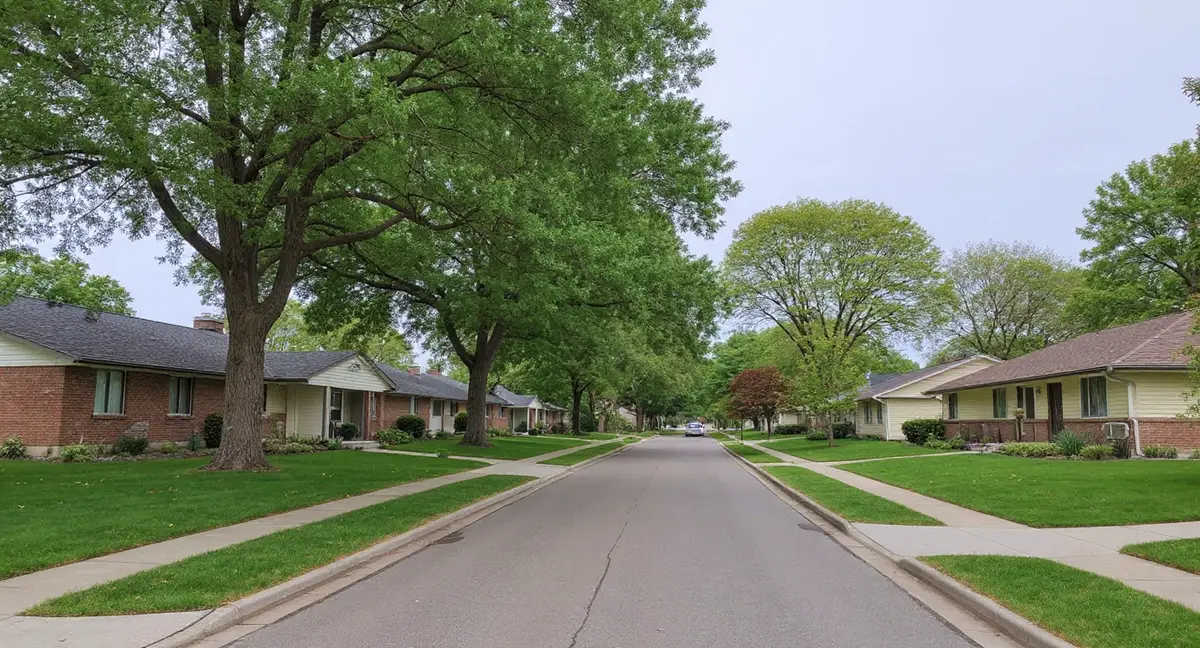
Shawnee's compact geography and 1960s-1980s development peak gave the city the highest concentration of concrete block basements in Johnson County outside of Prairie Village. These block walls have endured 50 to 60 years of Wymore-Ladoga clay shrink-swell cycling, and the Mill Creek corridor through central Shawnee keeps adjacent soil saturated longer than upland areas, amplifying lateral wall pressure.
What Soil and Drainage Conditions Create Foundation Risk in Shawnee's Mill Creek Corridor and Upland Neighborhoods?
Shawnee sits on the Wymore-Ladoga soil complex — the dominant clay formation across Johnson County, with 60 to 80 percent clay content classified by the USDA as "very high" shrink-swell and assigned to Hydrologic Soil Group D, the lowest infiltration category in the classification system. Group D designation means Shawnee's soil sheds water rather than absorbing it. When Johnson County's 42 inches of annual rainfall accumulates at the surface, it saturates the clay laterally rather than draining downward, creating sustained perimeter moisture conditions around every basement in the city. The clay does not care how old the foundation is — it exerts lateral pressure based on its moisture content, not the home's age.
Shawnee's location in eastern Johnson County means portions of the city's residential areas sit atop Peorian loess deposits, which can reach up to 17 feet in thickness in this part of the county. Where loess layers underlie Shawnee neighborhoods, the soil profile is layered: loess above, Wymore-Ladoga clay below. Loess-over-clay profiles can produce compound foundation behavior — the loess compresses under load while the clay below shrinks and swells seasonally. Homes on these layered profiles may experience both gradual settlement from loess compression and cyclic movement from clay expansion, making the pattern of cracking more complex than pure clay or pure loess sites. The foundation science page addresses how layered soil profiles create differential settlement.
Mill Creek is Shawnee's central drainage corridor, running through the heart of the city and collecting runoff from a substantial residential watershed before carrying it through established neighborhoods toward its confluence with the Kansas River system. Homes along the Mill Creek corridor — particularly in the central Shawnee neighborhoods that were built closest to the creek in the 1960s-1970s — experience higher baseline soil moisture than Shawnee's upland areas. The creek maintains a local groundwater gradient that keeps adjacent clay from drying fully even during late-summer drought periods.
Turkey Creek in eastern Shawnee provides a second drainage corridor with its own zone of elevated soil moisture, affecting neighborhoods along the eastern edge of the city where Shawnee borders Merriam and Lenexa. Turkey Creek's eastern Shawnee flooding history is relevant to foundation risk because periodic flood events deposit saturated sediment around affected properties and drive soil moisture deep into the clay profile along the creek margins. Clear Creek in southwestern Shawnee creates a third drainage zone affecting newer western development.
Johnson Drive — the city's primary commercial corridor running east-west through central Shawnee — is flanked on both sides by residential development that dates to the 1960s-1970s, precisely when the Johnson Drive corridor adjacent housing was platted. The commercial corridor itself generates significant impervious surface runoff that concentrates at the edges and drains into adjacent residential soil. Homes immediately north and south of Johnson Drive face slightly elevated perimeter moisture loads from this commercial runoff contribution on top of standard residential drainage patterns. Shawnee receives the same 42 inches of annual rainfall as the rest of the metro, with May averaging 5.7 inches and January averaging 1.5 inches — a seasonal moisture swing that drives the full shrink-swell cycle in the underlying clay.
When Were Shawnee Homes Built — and Why Does the Mid-Century Concentration Matter for Foundations?
Shawnee's residential development was largely complete by 1990, with the city's housing stock concentrated in a tighter era range than most Johnson County neighbors — primarily the 1960s through the 1980s, with meaningful pockets of 1950s stock near the Nieman Road historic downtown district. This temporal compression is the defining characteristic of Shawnee's foundation risk profile. Unlike Overland Park, which developed across seven decades, or Olathe, which is still growing, Shawnee's geographic compactness means the city was built out within a roughly 30-year window. That window happened to correspond exactly with peak concrete block basement construction.
The earliest Shawnee stock — the 1950s homes near Old Shawnee around Nieman Road — represents the city's founding residential layer, built as some of the first postwar Johnson County development outside of established Kansas City, Kansas. These homes sit on some of the city's oldest block foundations, now 70-plus years into their lifecycle on Wymore-Ladoga clay. Block basements from this era were built with mortar mixes that have hardened and become brittle over decades, making the joints more susceptible to failure under the continuing lateral pressure of the clay.
The Monticello neighborhood — established 1960s-1970s residential development in central-western Shawnee — typifies the city's dominant housing era and foundation type. Ranch-style and split-level homes on block basements characterize this neighborhood and dozens of similar Shawnee developments from the same period. By the 1960s, Shawnee Mission Park had already become a central amenity, and the neighborhoods that formed the residential ring around the park — built in the late 1960s and 1970s — added another large cluster of block-basement homes to the city's inventory.
The transition from block to poured concrete construction occurred in Shawnee primarily in the 1980s, with the newest construction — the western Shawnee K-7 expansion into the 1990s-2000s — built entirely with poured concrete walls. This means Shawnee has a clear geographic stratification of foundation types: block basements dominate in the established central and eastern neighborhoods, while poured concrete is more common in the newer western developments. A homeowner can estimate their likely foundation type from their neighborhood's development era — though verification during any inspection is always necessary, as individual builder practices varied.
Why does Shawnee have a higher proportion of block basements than most other Johnson County suburbs?
Most Common Foundation Problems in Shawnee Homes
The dominant problem pattern in Shawnee — a direct consequence of the city's 1960s-1970s block basement concentration — is lateral wall displacement: block walls that have moved inward from their original position under decades of cumulative clay pressure. Unlike a fresh crack that has appeared in a previously undamaged wall, lateral displacement represents the accumulated movement of multiple shrink-swell cycles. Stair-step cracks in mortar joints are the visible indicator, but the more critical measurement is whether the wall plane has moved inward. A wall that has displaced more than one inch at mid-height requires professional evaluation for stabilization or replacement.
Horizontal cracking at the lower third of block walls — approximately two to four courses above the footing — is common in Shawnee's older neighborhoods and indicates that the clay is applying its maximum lateral force at that depth. Horizontal cracks in block walls are structurally more serious than stair-step diagonal cracks because they indicate bending stress rather than shear. A horizontal crack that spans the full width of a wall segment indicates the wall is actively rotating inward at the crack line.
Along the Mill Creek and Turkey Creek corridors, efflorescence and active seepage are more prevalent than in upland Shawnee neighborhoods, where the clay-driven basement moisture intrusion follows a more clearly seasonal pattern. Creek-corridor homes in Shawnee report moisture intrusion at wall-floor joints and through block face throughout the year, not just during spring saturation peaks. See the diagnostic guidance on horizontal cracks and basement moisture for distinguishing hydrostatic seepage from surface drainage infiltration — the remediation approach differs significantly.
In western Shawnee's poured concrete neighborhoods and the newer K-7 corridor development, the problem pattern shifts to vertical mid-span cracks and corner cracks rather than the block-specific stair-step pattern. Diagonal cracks at poured wall corners indicate differential movement between the wall and the footing, typically driven by clay contraction pulling the footing down during summer drought. These cracks may appear cosmetic but warrant monitoring because active differential movement can widen them progressively over successive dry seasons.
When Do Foundation Problems Get Worse in Shawnee?
For Shawnee's block-basement majority, the highest-risk period is the late spring saturation window — May through early June — when Johnson County's peak rainfall of 5.7 inches in May drives the Wymore-Ladoga clay to maximum expansion and applies peak lateral pressure against block walls. This is the period when existing stair-step cracks in block mortar are most likely to widen visibly and when horizontal cracks at wall mid-height are most likely to open. Block walls that were borderline at the end of the previous fall can show meaningful displacement after a wet May. Shawnee Mission Park area homes, which have the longest exposure history of any Shawnee neighborhood block basements, are particularly worth inspecting after wet springs.
Mill Creek corridor homes enter the high-risk window earlier than upland Shawnee properties because their baseline soil moisture is already elevated going into spring. The clay along Mill Creek may reach near-saturation with March and April rains — before the May peak — and the corresponding lateral pressure buildup begins sooner. Homeowners along the Mill Creek drainage path should treat their first spring inspection as a late-April task rather than waiting for June.
Late summer — August through September — produces the contraction phase, when drought conditions dry the clay and remove bearing support from footings throughout the city. For Shawnee's mid-century housing stock, which has already undergone 50 or more annual shrink-swell cycles, this is when incremental settlement is most likely to advance. Doors that have functioned normally through spring may begin to stick in August as differential settlement racks the door frame. The January rainfall low of 1.5 inches represents the annual moisture minimum for upland soils, though Mill Creek corridor clay never fully reaches this low due to sustained creek recharge.
The transition months — late March through April and late September through October — are the optimal inspection periods because the clay is actively changing moisture state and any active wall movement is most detectable. For Shawnee's older block basements specifically, the fall transition is the better of the two windows for crack documentation: the clay is contracting, which sometimes reveals cracks that were partially held closed by spring-summer pressure. A crack that opens further during fall contraction confirms it is active.
How to Protect Your Shawnee Home's Foundation
For Shawnee's block-basement majority, establishing a documented crack monitoring record is the most important proactive step available to homeowners — more valuable than any single repair, because it converts anecdotal concern into measurable data. Photograph every crack in basement walls with a coin or ruler for scale, and record the date. Re-photograph the same cracks in late spring, late summer, and fall for two or three consecutive seasons. Cracks that remain stable over three annual cycles are low priority; cracks that widen measurably season over season, or that show horizontal displacement at crack edges, need professional evaluation.
Shawnee homeowners should pay particular attention to downspout management given Johnson County's Hydrologic Soil Group D runoff classification. Group D soils do not absorb roof drainage — every gallon from your downspout must be directed away from the foundation or it will accumulate against the clay that is already pressing on your walls. Splash blocks are insufficient for Shawnee's rainfall volumes; extenders that carry discharge at least six feet from the foundation are the minimum standard. For homes near Mill Creek or Turkey Creek, verify that downspouts are not inadvertently draining toward the creek corridor gradient.
Homes along the Nieman Road historic district and Old Shawnee area should include a mortar joint inspection in their annual maintenance routine. Block walls that have aged 60-plus years have mortar that has gone through hundreds of freeze-thaw cycles in addition to the annual clay shrink-swell. Deteriorating mortar on exterior block surfaces — crumbling, recessed joints — should be repointed before it allows water infiltration that accelerates internal joint failure. See the wall anchors page for context on how mortar joint condition affects the decision between repair and wall replacement.
For a full self-assessment framework organized by foundation type and construction era, see the homeowner's foundation guide. Shawnee homeowners can use the block basement section for 1960s-1980s stock and the poured concrete section for western Shawnee K-7 expansion homes.
- Shawnee's 1960s-1980s development concentration means concrete block basements dominate the city's housing stock — the highest-risk foundation type on Wymore-Ladoga clay.
- Mill Creek's central drainage corridor keeps adjacent clay wetter year-round, and Turkey Creek in eastern Shawnee adds a second high-moisture zone along the city's border with Merriam and Lenexa.
- Lateral wall displacement — block walls that have moved inward from their original position under decades of cumulative clay pressure — is the dominant structural concern, with horizontal cracking at the lower wall third indicating active bending stress.
- Documented crack monitoring over two to three seasons is the most valuable proactive step, converting anecdotal concern into measurable data that determines whether repair is needed.
Foundation Questions Shawnee Homeowners Ask
Why do so many Shawnee homes have block basements compared to other Johnson County suburbs?
Shawnee's residential development was concentrated in the 1960s and 1970s — a period when concrete block was the dominant basement wall material for new residential construction throughout the Kansas City region. Unlike Olathe, which expanded primarily in the 1980s-2000s when poured concrete had largely replaced block, or Overland Park, which has a broader span of eras, Shawnee's compact geography means most of the city was built within a two-decade window that corresponds precisely to peak block basement construction. Neighborhoods like Monticello, the Shawnee Mission Park ring, and the areas along Johnson Drive all reflect this 1960s-1970s construction era. Block basements on Wymore-Ladoga clay are the highest-risk foundation combination in the Kansas City metro.
How does the Mill Creek corridor affect foundation risk in Shawnee?
Mill Creek runs through central Shawnee as the city's primary drainage corridor, and homes within its drainage basin experience sustained soil moisture levels that upland neighborhoods do not. The Wymore-Ladoga clay along Mill Creek remains wetter throughout the growing season because the creek continuously recharges soil moisture in adjacent ground. This sustained saturation means the clay adjacent to Mill Creek maintains higher average lateral pressure against basement walls than clay in drier upland locations. Shawnee's Johnson County Group D soil classification worsens this by limiting how quickly any rainfall can drain away — in Group D soils, water moves laterally and along the surface, pooling near foundations and creek margins rather than percolating downward.
Is Old Shawnee near Nieman Road at higher risk than newer Shawnee neighborhoods?
The oldest Shawnee neighborhoods around Nieman Road and the historic downtown district contain housing from the 1950s and some pre-1950s stock that represents the earliest postwar Johnson County development. These homes have accumulated 70 or more years of Wymore-Ladoga clay shrink-swell cycling, far more than newer Shawnee neighborhoods. The block basements in this area are the oldest in the city and have experienced the most cumulative damage. However, age alone does not determine condition — a well-maintained 1955 block basement that has had drainage improvements and crack repairs can be in better functional condition than a neglected 1975 block wall with advancing lateral displacement. The key variable is cumulative inward movement, not age alone.
What foundation problems are most common in the Shawnee Mission Park neighborhood ring?
Homes in the residential ring surrounding Shawnee Mission Park were built primarily in the late 1960s and 1970s, placing them squarely in the era of block basement construction on unweathered Wymore-Ladoga clay. The most common problems in this neighborhood cluster are stair-step cracks through block mortar joints, horizontal cracking at the lower third of basement walls where lateral clay pressure is highest, and efflorescence indicating sustained moisture migration through block. Because Shawnee Mission Park itself is a large permeable surface that intercepts and slowly releases rainfall, adjacent neighborhoods benefit from somewhat slower runoff accumulation — but the clay surrounding these homes is still the same Group D formation with the same shrink-swell characteristics.
Is western Shawnee west of K-7 substantially different from the rest of the city for foundation purposes?
Western Shawnee — the 1990s-2000s development west of K-7 — represents a distinct era compared to the 1960s-1980s bulk of the city. These newer homes were built with poured concrete basement walls and met higher code standards than the city's older stock. The Clear Creek area in southwestern Shawnee adds a drainage variable: homes near Clear Creek sit in a lower-moisture creek corridor similar to Mill Creek's influence in central Shawnee. Despite the newer construction era, western Shawnee still sits on Wymore-Ladoga clay — the soil does not change with the date on the permit. Homeowners in this area are earlier in their soil exposure cycle and tend to see foundation issues developing in the 20-to-40-year range rather than the 10-to-20-year range of older construction.