Ames Foundation Risk — Story County Loess Over Glacial Till, ISU-Area Housing, and Skunk River Drainage
Soil mechanics, housing stock analysis, and seasonal risk data for Ames, Iowa — 30 miles north of Des Moines, sitting deep in the Des Moines Lobe till plain with some of the thickest glacial deposits and flattest terrain in the metro coverage area.
Ames sits deeper into the Des Moines Lobe till plain than any core Polk County suburb, on potentially thicker glacial deposits with flatter terrain that drains surface water more slowly -- producing more persistent hydrostatic pressure against basement walls. The Clarion-Nicollet-Webster soil association, extensively studied by Iowa State University, creates variable drainage conditions where homes on Webster soils in low terrain hold water closest to the surface and face the highest foundation risk.
What Soil Is Under Ames Foundations?
Ames sits deep in the Des Moines Lobe till plain — farther from the terminal moraine than any core Polk County suburb — on glacial till from the Dows Formation that is potentially thicker and more uniformly deposited here than in the Des Moines metro core. Story County occupies the broad, flat ground moraine well north of where the glacier reached its farthest advance. The Dows Formation till beneath Ames is composed of unsorted clay, silt, sand, gravel, and Cretaceous shale fragments deposited directly by the retreating Wisconsinan glacier 12,000 to 14,000 years ago. This till has moderate swelling potential, but its primary threat to foundations is the hydrostatic pressure it generates by trapping water in its low-permeability matrix.
The Clarion-Nicollet-Webster soil association dominates Story County — a well-studied agricultural soil series that Iowa State University researchers have mapped and characterized in extraordinary detail. Clarion soils occupy the better-drained upland positions, Nicollet soils sit on intermediate slopes with somewhat poor drainage, and Webster soils fill the low-lying, poorly drained depressions and swales. This three-part association means that two homes on opposite sides of the same Ames subdivision can sit on soils with measurably different drainage rates and moisture-holding capacities. Webster soils in low terrain positions hold water closest to the surface and produce the highest hydrostatic pressure against adjacent basement walls.
Story County's flat terrain — among the flattest in the Des Moines metro coverage area — creates a drainage problem that directly compounds the glacial till's low permeability. Where rolling terrain in suburbs like Indianola or the Kansas City metro sheds surface water along slope gradients, Story County's minimal topographic relief means water sits on the surface longer, percolating slowly into the till rather than running off. Flat terrain combined with poorly draining glacial till produces the conditions for persistently elevated water tables — the mechanism that drives hydrostatic pressure against basement walls through months-long wet periods. For the detailed mechanics of hydrostatic pressure in glacial till, see the foundation science page.
Iowa's frost depth of 42 inches governs all residential footing design in Story County, and Ames' position 30 miles north of Des Moines means it experiences slightly colder winters and more sustained freezing than the metro core. Story County's average winter temperatures run two to three degrees colder than Polk County, and annual snowfall is slightly higher. The deeper and more sustained frost penetration means a thicker zone of glacial till undergoes freeze-thaw cycling against the foundation wall each winter, forming ice lenses that push laterally against basement walls at multiple points within the frost zone. Footings that do not reach the full 42 inches are vulnerable to frost heave in addition to the till's hydrostatic pressure.
How Does the Skunk River Change Foundation Conditions in Ames?
The Skunk River cuts through Ames from northwest to southeast, depositing alluvial sediments along its corridor that differ fundamentally from the glacial till covering the rest of Story County. Alluvial deposits along the Skunk River are river-laid — sorted by water flow into layers of sand, silt, and clay that have different engineering properties than the unsorted glacial till on the uplands. These alluvial soils drain faster in some layers but trap water in others, creating unpredictable moisture profiles that can produce uneven settlement beneath foundations built on or near the flood plain.
Water table elevation along the Skunk River corridor fluctuates with river stage, adding a variable that upland glacial till sites do not face. During spring snowmelt and the May-June rainfall peak, the Skunk River rises, and the adjacent water table rises with it. Homes within the river's influence zone — roughly a quarter-mile of the channel, though the actual extent depends on local geology — experience water table peaks that coincide with the river's high stage rather than simply responding to local rainfall. This means horizontal cracks and basement moisture intrusion along the Skunk River corridor may appear or worsen during river flood events even if local rainfall has been moderate.
The transition zone where alluvial deposits meet glacial till creates a boundary with variable soil properties across short distances. A home's front foundation wall may sit on river-influenced alluvial soil while the back wall rests on glacial till — producing differential settlement as the two soil types respond differently to moisture loading. This transition zone effect is a recognized risk factor for diagonal cracks and sloping floors in Ames homes near but not directly on the Skunk River flood plain. Homes in this transition zone require careful site-specific evaluation rather than assumptions based on either the upland till or the alluvial plain alone.
What Does Ames' Housing Stock Mean for Foundation Risk?
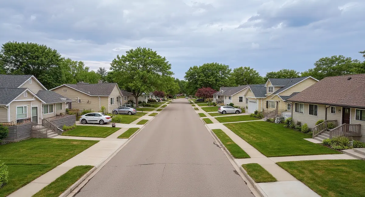
Ames' housing stock follows a north-south development era gradient: the oldest homes cluster near the Iowa State University campus and the original town center, with progressively newer construction radiating outward toward North Ames and the ISU Research Park area. This gradient means foundation risk varies by neighborhood in a predictable pattern — older construction has endured more freeze-thaw cycles and hydrostatic pressure loading on less capable materials, while newer construction benefits from modern codes but sits on the same glacial till.
The campus-area housing core — Campustown, Old Town, the neighborhoods between Lincoln Way and the university — contains pre-1940s homes, many dating to the early 1900s, with stone, early block, and thin poured concrete foundations. A significant portion of this housing stock serves as rental property for the university community, which historically correlates with deferred maintenance: gutters left damaged through multiple seasons, grading that has reversed over decades, and foundation symptoms that go unaddressed because tenants do not report them or landlords defer repairs. A pre-1900 stone foundation in the campus area has endured over 120 years of Story County's hydrostatic pressure and 42-inch frost cycling — a cumulative load that produces visible crack networks, mortar deterioration, and wall displacement that accelerates once the initial damage creates pathways for additional moisture entry.
West Ames neighborhoods built during the 1960s through 1980s suburban expansion represent the city's largest mid-century housing inventory, constructed primarily with concrete block basement walls. Block walls are inherently vulnerable to the lateral pressure that glacial till generates — they fail at mortar joints under horizontal force, producing stair-step crack patterns that follow the mortar bed lines. Homes in this era band are now 40 to 60 years old, well into the age range where cumulative hydrostatic pressure from Story County's deep till produces visible wall displacement. Wall anchors and carbon fiber straps are the standard stabilization methods for block walls that have begun to bow inward under this lateral pressure.
North Ames and the Somerset area represent the 2000s-era development wave — modern poured concrete construction built to current Iowa building code standards with footings at or below the 42-inch frost line. These homes benefit from improved concrete mix designs, proper drainage systems, and better site grading practices than their mid-century predecessors. However, they sit on the same Clarion-Nicollet-Webster soils and face the same hydrostatic pressure from Story County's deep glacial till. Homes built in the early 2000s are now approaching 20 to 25 years of age — the point where even well-constructed foundations begin showing the first indicators of glacial till's persistent moisture pressure in the form of minor cracks and early-stage basement moisture.
Why do two homes on opposite sides of the same Ames subdivision sometimes have dramatically different foundation moisture histories?
What Foundation Problems Are Most Common in Ames?
Horizontal cracks at mid-wall height in concrete block basements are the most common foundation symptom across Ames' 1960s-1980s housing stock — the direct signature of hydrostatic pressure from glacial till pushing laterally against the wall. Story County's deep till and flat terrain produce sustained lateral loading during the spring wet season that acts uniformly across the wall face. When the cumulative pressure exceeds the wall's resistance at the weakest horizontal mortar joint, the wall cracks and begins bowing inward. A horizontal crack at the third or fourth course from the top of a block wall indicates the wall has begun to yield to this pressure. Left unaddressed, the bowing accelerates because the cracked wall has less resistance to future pressure cycles.
Campus-area pre-1940s homes show a different symptom profile: cumulative settlement producing sticking doors and windows, sloping floors, and wide crack networks from decades of unaddressed movement. These older foundations were not designed with modern soil mechanics in mind, and the materials — particularly lime-based mortars in stone foundations — deteriorate under Story County's persistent moisture exposure. Settlement in these homes is often non-uniform because the original foundations vary in depth and material quality across their perimeter, producing differential movement that worsens over time.
Homes near the Skunk River corridor show moisture-related symptoms as their dominant pattern: persistent basement dampness, efflorescence on wall surfaces, and floor slab heaving from upward hydrostatic pressure. The alluvial water table along the river rises faster and higher than the upland till water table, producing more aggressive vertical pressure against floor slabs and more persistent lateral pressure against basement walls during the March-through-June wet period. Crack injection can seal individual fractures, but addressing the root cause typically requires managing the water pressure through drainage solutions combined with structural stabilization where walls have already displaced.
When Is Foundation Risk Highest in Ames?
The peak risk period in Ames runs from March through June, when snowmelt and spring rainfall saturate the glacial till and push water tables to their annual maximum — producing the highest hydrostatic pressure against basement walls. Ames receives slightly more snowfall than Des Moines due to its northern position, which means more snowmelt moisture enters the soil profile each spring. Story County's flat terrain prevents this moisture from draining away efficiently, so the till absorbs it and holds it. The result is a prolonged period of elevated water tables that can extend into early July in wet years.
Winter in Ames is not a dormant period for foundation stress — the 42-inch frost line drives ice lens formation deep into the glacial till, creating lateral heave forces against basement walls that persist for weeks at a time. Ames' colder winters compared to the Des Moines core mean frost penetration reaches the full 42-inch design depth more reliably and sustains freezing at that depth for longer periods. The freeze-thaw cycling that occurs during mid-winter warm spells is particularly damaging: frozen till thaws partially, absorbs additional moisture, then refreezes and expands, progressively widening cracks in foundation walls through the mechanism of ice wedging.
Late summer — July through September — offers the lowest foundation stress and the best conditions for repair work in Ames. Water tables drop, soil dries to its lowest annual moisture content, and excavation conditions are most favorable. This is also the best period for establishing monitoring baselines: measuring crack widths, documenting wall plumb, and noting floor level readings during the low-stress season provides the reference points needed to assess whether spring changes represent normal seasonal cycling or progressive structural movement. The repair cost page provides context on pricing for repairs in the Des Moines metro area.
What Repair Methods Are Most Relevant for Ames Foundations?
Wall stabilization is the most common repair category in Ames because the dominant failure mode — lateral bowing from hydrostatic pressure — is a wall problem rather than a footing problem. Carbon fiber straps are appropriate for block walls with minor bowing (less than two inches of inward displacement) where the goal is to arrest further movement. Wall anchors are used for more significant displacement or where the goal is to gradually straighten the wall over time by tightening the anchor system across seasonal cycles. The choice between the two depends on the severity of displacement and whether the homeowner's objective is stabilization or correction.
Settlement repair using push piers or helical piers is most common in the campus-area housing core and along the Skunk River corridor, where soil conditions produce vertical settlement in addition to lateral wall pressure. Push piers are driven through the glacial till to reach competent bearing material below the Dows Formation — a depth that varies across Ames but is generally deeper than in communities closer to the terminal moraine. Helical piers are torqued into the soil and can be installed in tighter access conditions typical of older campus-area homes with limited excavation space between structures.
Concrete slab repair using slab piers or polyjacking addresses the sinking garage floors and settled interior slabs that develop when glacial till beneath the slab consolidates or erodes from water movement. Story County's persistent moisture loading washes fine particles from beneath slabs over time, creating voids that allow the slab to settle. Polyjacking lifts and stabilizes slabs by injecting expanding polyurethane foam into the void, filling it and raising the slab to its original position. Slab piers provide permanent support by transferring the slab load to stable soil below the zone of seasonal movement.
- Story County's deep Des Moines Lobe till and flat terrain produce more persistent hydrostatic pressure than the rolling terrain in southern metro suburbs, because water sits on the surface longer and percolates slowly into the low-permeability till.
- The Clarion-Nicollet-Webster soil association creates variable drainage across short distances -- homes on poorly drained Webster soils face higher hydrostatic risk than neighbors on better-drained Clarion soils.
- Campus-area pre-1940s homes with stone or early block foundations have endured 80-plus years of 42-inch frost cycling and hydrostatic pressure on materials that were marginal when new.
- The Skunk River alluvial corridor introduces variable soil and river-stage-driven water table fluctuations that produce different foundation symptoms than the upland glacial till.
Ames Foundation Questions
Does Ames have different soil than the core Des Moines metro suburbs?
Yes, measurably. Story County sits deeper into the Des Moines Lobe till plain than Polk County, meaning the glacial till beneath Ames is potentially thicker and the terrain is flatter. The dominant soil association in Story County is Clarion-Nicollet-Webster — a well-documented agricultural series studied extensively by Iowa State University — rather than the soil associations found closer to the terminal moraine in Des Moines proper. The practical difference for foundations is that Story County's flatter terrain drains surface water more slowly, and the thicker till deposits hold moisture longer, producing more persistent hydrostatic pressure against basement walls through the spring and early summer months.
Are older homes near the Iowa State University campus at higher foundation risk?
Campus-area homes carry the highest cumulative foundation risk in Ames. Many homes in the Campustown, Old Town, and near-campus residential neighborhoods date to the early 1900s or even the late 1800s — built with stone, early block, or thin poured concrete foundations that were not engineered for Story County's glacial till conditions. Decades of deferred maintenance common in rental and student housing compounds the problem: delayed gutter repairs, poor grading, and ignored early symptoms allow hydrostatic pressure damage to accumulate unchecked. A pre-1940 campus-area home with original foundation walls has endured 80-plus years of freeze-thaw cycling through the 42-inch frost zone on materials that were marginal when new.
How does the Skunk River affect foundation conditions in Ames?
The Skunk River runs through Ames from northwest to southeast, and properties near the river corridor sit on alluvial deposits — river-laid sediments with different engineering properties than the upland glacial till that covers most of Story County. Alluvial soils along the Skunk River tend to be sandier and more variable in composition, with higher water tables that fluctuate more dramatically with river stage. Homes in neighborhoods adjacent to the Skunk River flood plain face a dual risk: the alluvial soils can settle unevenly under foundation loads, and the elevated water table generates hydrostatic pressure against basement walls during high-water periods in spring and early summer.
What foundation symptoms appear first in Ames homes built in the 1960s through 1980s?
West Ames neighborhoods built during the 1960s through 1980s suburban expansion typically show horizontal cracks in basement walls as the earliest symptom — the signature of sustained lateral pressure from glacial till pushing inward against the wall. These homes predominantly used concrete block basement construction, and block walls fail at mortar joints under horizontal force. A horizontal crack appearing at roughly mid-wall height, or a series of stair-step cracks following mortar joints, indicates that hydrostatic pressure from the till has exceeded the wall's lateral resistance at that point. These cracks tend to worsen during the March-through-June peak moisture period when water tables are highest.
When is the best time to schedule foundation repairs in Ames?
July through September is the preferred repair window in Ames. Water tables drop to their annual low during late summer, making excavation easier and reducing the risk of water interference during pier installation or wall stabilization work. Ames sits slightly north of Des Moines, which means spring thaw and snowmelt extend later into the season — the March-through-June high-water-table period can persist into early July in wet years. Scheduling repairs for August or September provides the driest soil conditions and the most stable excavation environment. Concrete products also cure more predictably in the moderate temperatures of late summer than in the temperature extremes of winter or the saturated conditions of spring.