Urbandale Foundation Risk — Walnut Creek Corridor, Mid-Century Ranch Homes, and Polk-Dallas County Till
Soil data, housing stock analysis, and seasonal risk patterns for Urbandale homeowners — from the Merle Hay Road older residential corridor to the Walnut Creek drainage system to the Polk-Dallas county soil transition at Urbandale's western edge.
Urbandale's predominantly 1960s-1990s housing stock sits squarely in the 30-to-50-year cumulative damage window for glacial till hydrostatic pressure — the age range where decades of annual pressure cycling produce visible structural symptoms in both concrete block and poured concrete walls. The Walnut Creek drainage corridor through central Urbandale maintains an elevated water table within a quarter-mile of its banks, extending the hydrostatic pressure season for nearby foundations.
What Soil Conditions Define Urbandale's Foundation Landscape?
Urbandale straddles the Polk-Dallas county line, and this boundary corresponds to a meaningful transition in the soil profile that sits beneath the city's foundations. Eastern Urbandale — the older, more established portion of the city — sits on Polk County's core glacial till, the same Dows Formation deposit that underlies Des Moines, Johnston, and Ankeny. Western Urbandale crosses into Dallas County, where the glacial till is overlain by a thicker loess deposit — windblown silt that modifies drainage behavior and creates a layered profile with different pressure characteristics than the pure till beneath the eastern neighborhoods.
The Dows Formation glacial till beneath Urbandale is the same 45-to-60-foot-thick unsorted mixture of clay, silt, sand, gravel, and Cretaceous shale fragments deposited by the Des Moines Lobe during the Wisconsinan glaciation 12,000 to 14,000 years ago. Its low permeability defines the foundation risk across the entire city: water entering the soil profile drains slowly, building hydrostatic pressure against basement walls and floor slabs. The mechanism is not the dramatic shrink-swell cycling of montmorillonite clay found in Kansas City — it is the persistent, relentless lateral pressure of water trapped in poorly draining soil, pressing continuously against the foundation envelope during wet periods.
The loess-derived soils on Urbandale's uplands belong to the Sharpsburg, Otley, and Ladoga series, carrying 35 to 42 percent clay content — enough to retain moisture but not enough to generate the extreme expansion forces associated with pure montmorillonite formations. In western Urbandale where the loess overburden is thicker, this creates a dual-layer drainage problem. The upper loess drains moderately; the underlying glacial till drains poorly. Water percolates through the loess and stalls at the loess-till boundary, creating a perched water table that generates horizontal pressure at a specific depth — typically 3 to 5 feet below grade, corresponding to mid-wall height in most basements.
Walnut Creek runs through Urbandale and serves as the primary drainage corridor, connecting through Clive into the broader Des Moines River watershed. The creek maintains an elevated local water table within approximately a quarter-mile of its banks, meaning homes along the Walnut Creek corridor experience sustained hydrostatic pressure for longer periods after precipitation than homes on higher ground. The creek's drainage function also means upstream rainfall events — including stormwater from commercial and residential development upstream — can elevate creek-corridor water tables in Urbandale even during periods of moderate local rainfall.
Why Does Urbandale's Mature Housing Stock Face Peak Cumulative Risk?
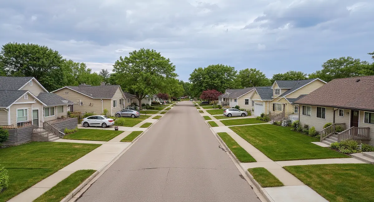
Urbandale is a mature, established suburb where the majority of residential construction occurred between the 1960s and the 1990s — placing the housing stock squarely in the 30-to-50-year cumulative damage window where glacial till hydrostatic pressure has had enough time to produce visible, measurable structural effects. This distinguishes Urbandale from fast-growing suburbs like Ankeny and Waukee, where much of the housing is less than 20 years old and still in the early phase of glacial till exposure. Urbandale's foundations have weathered three to five decades of annual pressure cycles — spring hydrostatic peaks, summer drying, fall resaturation, winter frost — and the cumulative effect of these cycles produces damage that is different in character and severity from what newer construction has experienced.
The Merle Hay Road corridor and Meredith Drive area contain Urbandale's oldest residential stock — 1960s and early 1970s construction built predominantly with concrete block basement walls. Block walls are the most vulnerable common foundation type against lateral hydrostatic pressure because they fail at mortar joints, which are weaker than the blocks themselves. After 50 to 60 years of hydrostatic pressure cycling on these mortar joints, many Merle Hay Road area homes show stair-step cracking through the block wall pattern, visible inward bowing at mid-wall height, and deteriorated mortar that admits both water and soil gas. These are not cosmetic issues — they indicate the wall has displaced past its original position and the mortar joints have lost their original structural integrity.
The 86th Street corridor and neighborhoods developed in the 1980s and early 1990s transitioned to poured concrete basement walls — a stronger construction method that resists lateral pressure more effectively than block walls but is not immune over multi-decade exposure periods. Poured concrete walls in Urbandale's 1980s-era homes have now accumulated 35 to 45 years of hydrostatic pressure cycling. The typical progression in these homes begins with hairline horizontal cracks at mid-wall height, followed by efflorescence and moisture weeping at crack faces, progressing to measurable inward displacement if the pressure continues without intervention. Homes in this age range are frequently in the transition phase between early cracking and active bowing.
Living History Farms, the large undeveloped historical attraction in northwestern Urbandale, creates a drainage buffer zone where natural vegetation and ungraded terrain affect water table behavior for surrounding residential neighborhoods. The undeveloped land absorbs and distributes rainfall differently than residential lots with impervious surfaces, lawns, and concentrated downspout discharge. Homes adjacent to Living History Farms on its south and east boundaries may experience different soil moisture patterns than homes in fully developed neighborhoods — in some configurations benefiting from the undeveloped land's drainage capacity, in others receiving concentrated runoff from the attraction's hillier terrain.
An Urbandale home built in 1975 near Merle Hay Road has stair-step cracks in its basement walls. What is the most likely cause?
What Foundation Problems Appear Most Often in Urbandale?
Inward bowing of basement walls is the dominant foundation problem in Urbandale, and the city's mature housing stock means many of these walls have progressed past the early-crack stage into measurable structural displacement. In the older block-wall homes near Merle Hay Road and Meredith Drive, bowing typically manifests as a visible inward curve at mid-wall height, with stair-step cracking through mortar joints and water seepage at crack faces. In the 1980s-era poured concrete homes along the 86th Street corridor, bowing shows as horizontal cracks with measurable offset — the wall above the crack has shifted inward relative to the wall below. The wall anchors method page covers the stabilization approach for walls with significant displacement, while carbon fiber straps are appropriate for walls with less than 2 inches of inward movement.
Basement moisture intrusion is pervasive in Urbandale's older housing stock because the same mortar deterioration and concrete cracking that allows wall displacement also creates pathways for water entry. In block-wall homes, water enters through deteriorated mortar joints, through porous block faces, and through the wall-floor joint where the wall meets the slab. In poured concrete homes, water enters through horizontal cracks, through the cold joint at the wall-footing connection, and through any construction joint or tie-rod hole that has degraded over decades of pressure cycling. The water is being pushed through these openings by hydrostatic pressure — it is not surface runoff from poor grading, although inadequate surface drainage compounds the problem.
Differential settlement occurs in Urbandale but is less common than pressure-driven wall bowing, and when it does appear, it is typically associated with localized soil conditions near Walnut Creek or with poorly compacted fill from the original construction era. Settlement symptoms include diagonal cracks at wall corners, chimney separation from the house structure, and sloping floors that tilt toward one side of the home. In Urbandale's glacial till, settlement is most often caused by soil washout near drainage corridors or by localized zones where the till composition varies — pockets of sandier material within the till that compact differently under foundation loads than the surrounding clay-rich matrix.
Garage floor sinking and driveway settlement are common in Urbandale's mature neighborhoods because these flatwork elements sit on shallow fill over glacial till and are subject to both hydrostatic pressure from below and frost heave cycling from above. The 42-inch frost depth means the full thickness of a typical 4-inch garage slab and the soil beneath it to 42 inches undergoes annual freeze-thaw cycling. Over 30 to 50 years, this cycling compacts the subgrade unevenly, producing garage floor sinking that is often most pronounced at the center of the slab where drainage is poorest. Polyjacking can lift and level settled flatwork without full replacement, provided the slab itself is structurally intact.
When Is Foundation Risk Highest in Urbandale?
Urbandale's peak foundation risk runs from March through June — the same window as the broader Des Moines metro — when spring snowmelt and peak rainfall push the glacial till to maximum saturation and the water table to its annual high point within 2 to 3 feet of the surface. This period generates the strongest hydrostatic pressure against basement walls, the most basement moisture intrusion, and the widest opening of existing cracks. For Urbandale's 30-to-50-year-old housing stock, each spring peak adds another cycle of pressure loading to walls and mortar joints that have already accumulated decades of similar cycles. The March-through-June period is when progressive damage — damage that worsens year over year — is most likely to cross a visible threshold.
Winter temperatures averaging 12 degrees Fahrenheit drive the frost line to 42 inches below grade — six inches deeper than Kansas City's 36-inch frost depth — creating a substantial zone of annual freeze-thaw cycling against the foundation wall. Ice lens formation within the glacial till at Urbandale's frost depth generates lateral heave forces that push against the wall at variable depths within the frost zone. For Urbandale's older homes, where decades of hydrostatic pressure have already introduced cracks and mortar joint deterioration, frost cycling widens these existing damage pathways. Water that enters cracks during the fall wet season freezes and expands by 9 percent volume, mechanically widening the crack before the spring thaw refills it with liquid water under hydrostatic pressure.
The October-November pre-winter saturation period is a critical secondary risk window because soil moisture entering the winter freeze determines the severity of frost damage over the following three to four months. Glacial till that enters winter fully saturated produces continuous frost pressure throughout the cold months rather than intermittent freeze-thaw cycling. For Urbandale homes near Walnut Creek where fall water tables may already be elevated, this pre-winter saturation can push soil conditions past the threshold for aggressive ice lens formation. Monitoring cracks in both April and October captures the maximum and minimum pressure states and reveals whether seasonal fluctuation is producing cumulative displacement.
July through September offers the lowest foundation stress and the best conditions for repair work, with the water table at its annual low and soil moisture at its minimum. Foundation repairs — particularly exterior excavation for waterproofing, wall anchor installation, and pier work — perform best when groundwater interference is minimal and soil is stable enough to support excavation walls. Concrete products and epoxy systems cure optimally in warm, dry conditions. Homeowners who identify problems during the spring inspection window should plan repairs for the summer construction season. The cost and economics page provides repair cost ranges specific to the Des Moines metro market.
What Can Urbandale Homeowners Do to Manage Cumulative Foundation Risk?
For Urbandale's mature housing stock, the priority shifts from prevention to early detection and timely intervention — because 30 to 50 years of hydrostatic pressure cycling means most foundations have already accumulated some degree of damage, and the question is whether that damage is stable or progressing. Quarterly crack monitoring is the most cost-effective tool available. Placing adhesive crack gauges or pencil marks across existing cracks and measuring width in April, July, October, and January captures the full annual pressure cycle. A crack that opens seasonally and returns to baseline is responding to normal hydrostatic fluctuations. A crack that ratchets wider with each measurement cycle is experiencing cumulative displacement that will eventually require structural repair.
Surface water management — positive grading, gutter maintenance, downspout extensions — remains important in Urbandale even though the primary threat operates below grade, because surface water infiltration at the foundation perimeter adds to the regional hydrostatic pressure load. Older Urbandale neighborhoods were built when grading standards were less rigorous than current code, and decades of landscaping, patio additions, and soil settlement have altered original grading in many cases. Walking the foundation perimeter after a heavy rain and noting where water pools against the wall identifies the highest-priority grading corrections. Each pooling point concentrates moisture into the till adjacent to the foundation, locally amplifying the pressure against the wall at that location.
Interior sump pump systems with battery backup are the primary moisture management tool for Urbandale basements, particularly in homes near the Walnut Creek corridor where the water table routinely reaches foundation-critical depths during the spring peak. A properly sized sump system manages the water that hydrostatic pressure forces through the wall-floor joint, reducing standing water contact with concrete and preventing the long-term material degradation that standing water causes. For homes with active water entry through wall cracks, crack injection can seal individual entry points — but if the water table is above the floor slab, injection alone will not address the volume of water entering through the wall-floor joint. Comprehensive moisture management typically requires both crack repair and active water removal.
Urbandale homeowners considering finished basement projects in homes built before 1990 should evaluate foundation condition before investing in finish materials, because the cost of removing finished walls and flooring to access a deteriorating foundation frequently exceeds the cost of the foundation repair itself. A pre-finishing foundation evaluation identifies existing cracks, bowing, moisture entry points, and mortar joint condition before they are concealed behind drywall and carpet. Addressing foundation issues before finishing the basement is substantially less expensive and less disruptive than addressing them after — and for homes in the 30-to-50-year cumulative damage window, the probability of needing foundation attention during the life of the finished basement is high enough to justify the evaluation cost.
- Urbandale's 1960s-1990s housing stock has accumulated 30 to 50 years of hydrostatic pressure cycling — placing it in the peak window where cumulative glacial till damage produces visible, measurable structural symptoms.
- The Merle Hay Road corridor's 1960s block-wall homes show the most advanced damage patterns, while 1980s-era poured concrete along the 86th Street corridor is transitioning from early cracking to active bowing.
- Walnut Creek maintains an elevated water table within a quarter-mile of its banks, extending hydrostatic pressure duration for nearby homes beyond what upland neighborhoods experience.
- For homes in the 30-to-50-year window, the priority shifts from prevention to early detection — quarterly crack monitoring distinguishes stable historical damage from active progressive displacement.
Urbandale Foundation Questions
Why is Urbandale's 1960s-1990s housing stock at higher foundation risk than newer Des Moines suburbs?
Urbandale's housing stock falls squarely in the 30-to-50-year cumulative damage window for glacial till hydrostatic pressure. Homes built in the 1960s through 1990s have endured three to five decades of annual hydrostatic pressure cycles from the Dows Formation glacial till — enough time for mortar joints in block walls to deteriorate, for poured concrete walls to develop hairline cracks that admit water, and for minor bowing to accumulate into measurable structural displacement. Newer suburbs like Ankeny and Waukee have housing stock that has experienced fewer than 20 years of these cycles, placing them earlier in the damage progression. The soil beneath all of these suburbs is the same; the difference is time.
How does Urbandale's position on the Polk-Dallas county line affect its soil profile?
Eastern Urbandale sits on Polk County glacial till — the standard Dows Formation deposit that underlies the metro core. Western Urbandale crosses into Dallas County, where the glacial till incorporates a thicker loess overburden — windblown silt deposited on top of the till. This loess layer drains faster than the underlying till, creating a layered soil profile where water can become trapped at the loess-till boundary. The result is a perched water table that generates hydrostatic pressure at a different depth than the regional water table, meaning western Urbandale homes can experience mid-wall pressure effects even when the deeper water table is below foundation depth.
Does Walnut Creek increase foundation risk for nearby Urbandale homes?
Walnut Creek runs through Urbandale and functions as a primary drainage corridor that maintains an elevated local water table within approximately a quarter-mile of its banks. Homes near Walnut Creek experience sustained hydrostatic pressure for longer periods after rainfall and snowmelt than homes on higher ground further from the creek. The creek connects through Clive and into the broader Des Moines drainage system, meaning upstream rainfall can elevate creek-corridor water tables in Urbandale even when local rainfall is moderate. Foundation walls near the creek corridor accumulate hydrostatic pressure damage faster than comparable walls on upland sites because the pressure duration is longer each season.
What foundation symptoms are most common in Urbandale homes near Merle Hay Road?
The Merle Hay Road corridor contains some of Urbandale's oldest housing stock — 1960s and early 1970s construction with concrete block basement walls. The most common symptoms in this area are stair-step cracking through block wall mortar joints, visible inward bowing at mid-wall height, and basement moisture intrusion through deteriorated mortar and block faces. These homes have accumulated 50 to 60 years of hydrostatic pressure cycling, placing them at the high end of the cumulative damage spectrum. Water staining, efflorescence, and persistent basement humidity are often present alongside the structural cracking, because the same mortar deterioration that allows wall displacement also allows water entry.
When should Urbandale homeowners schedule foundation inspections?
The most informative inspection window is April through early June, when spring snowmelt and peak rainfall have pushed the water table to its annual maximum and all hydrostatic pressure symptoms are at their most visible and measurable. Existing cracks will be at their widest, wall bowing at its most pronounced, and moisture intrusion at its highest volume during this period. A second measurement in September or October, when soil moisture is at its annual minimum, allows comparison between peak and trough conditions — this comparison reveals whether damage is seasonal and elastic or permanent and progressive. Repair work is best scheduled for July through September when lower water tables and drier soil conditions favor excavation and material curing.