Independence Foundation Risk: The KC Metro's Oldest Housing Stock on Its Most Diverse Foundation Types
Independence, Missouri carries more pre-1939 housing than any other suburb in the Kansas City metro batch — stone foundations in Truman-era neighborhoods, block in postwar areas, poured concrete on the east side — all sitting on Wymore-Ladoga clay with a 36-inch frost depth.
Independence carries the KC metro's widest range of foundation types — stone rubble in the Truman Historic District, postwar block, and 1970s-era poured concrete — all on Wymore-Ladoga clay with pre-1939 footings as shallow as 24 inches sitting inside Missouri's 36-inch frost zone. This combination of the oldest housing stock and the most diverse construction methods makes Independence's foundation risk vary more by neighborhood than any other suburb in the metro.
What Environmental Conditions Drive Foundation Risk in Independence?
Independence sits on the Wymore-Ladoga complex — Jackson County's dominant soil formation with 60 to 80 percent clay content, a USDA shrink-swell classification of "very high," and Hydrologic Soil Group D, the lowest infiltration category in the system. This montmorillonite clay expands when saturated and contracts when it dries, cycling against foundation walls and footings with each seasonal swing. Independence receives 42 inches of annual rainfall, with May averaging 5.7 inches and January dropping to just 1.5 inches — a four-to-one wet-dry ratio that produces the maximum volume change the clay is capable of generating. For the molecular mechanics behind this expansion force, see the foundation science page.
Rock Creek runs through central Independence and concentrates surface drainage from surrounding residential neighborhoods into a corridor where soil saturation is more intense than on upland lots. Homes on slopes that drain toward Rock Creek receive moisture from a larger contributing area, causing the Wymore-Ladoga clay to saturate faster and expand with more sustained pressure than homes on topographic ridges. In some sections along the Rock Creek corridor, alluvial soil deposits — creek-deposited silt and sand — replace the upland clay, introducing lower bearing capacity as an additional risk factor separate from shrink-swell.
The Little Blue River defines Independence's eastern boundary and creates a flood plain with alluvial soil conditions fundamentally different from the upland Wymore-Ladoga clay. Alluvial soils — silty and sandy river deposits — have lower bearing capacity than the clay, meaning footings on these soils bear on material with less resistance to load. Periodic flood saturation can undermine footings outright. Homes within the Little Blue River flood plain carry FEMA flood zone designations visible in FIRM maps, and their foundation risk profile includes both alluvial soil limitations and flood exposure that upland Independence homes do not face.
Missouri's frost depth code requires residential footings to extend at least 36 inches below grade — critical for Independence, where the oldest homes have footings at 24 to 30 inches that sit within the frost zone rather than below it. At 36 inches, the ground freezes to the base of a code-compliant footing, and ice lens formation exerts upward heave pressure on anything shallower. Winter temperatures averaging 20°F with 15 inches of annual snowfall provide the moisture source for this freeze-thaw process. Pre-1939 homes on shallow footings face frost heave forces that modern-era foundations in eastern Independence simply do not experience.
What Is the Housing Stock Profile in Independence?
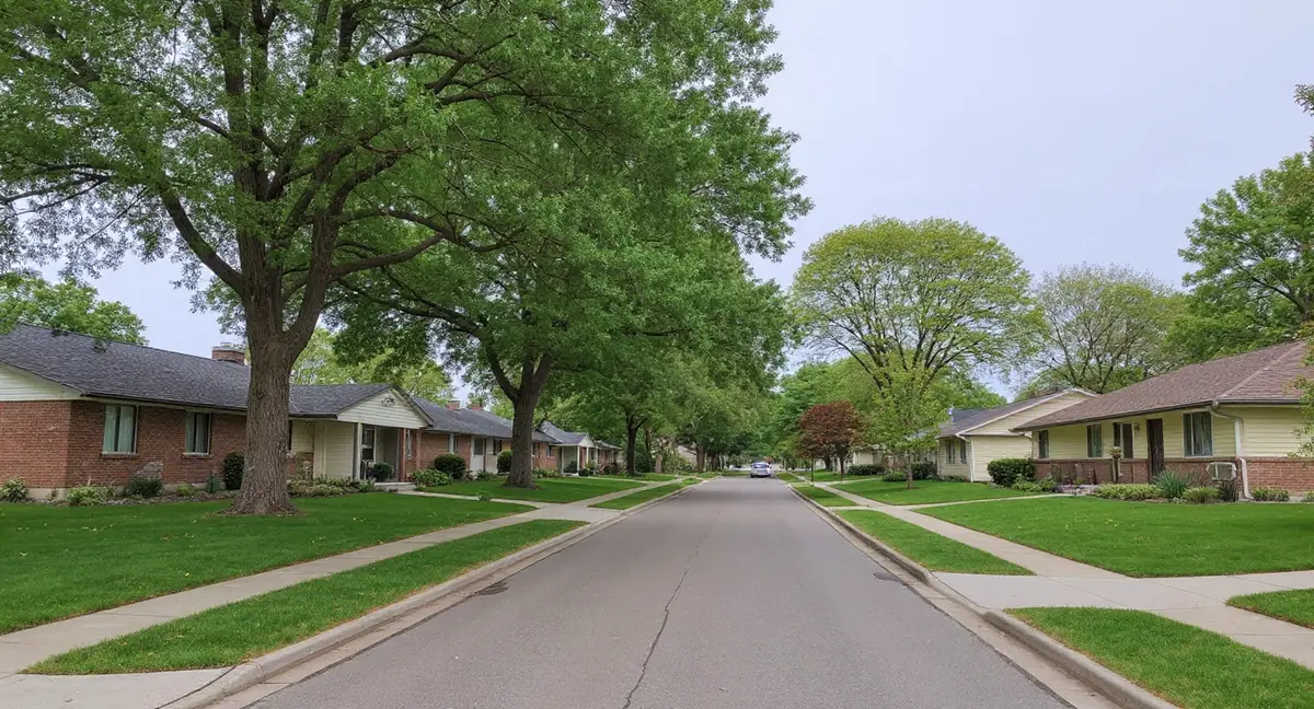
Independence has the oldest and most diverse foundation stock of any suburb in the Kansas City metro batch — ranging from pre-1920s stone rubble basements in Truman-era neighborhoods to 1970s and 1980s poured concrete on the east side — with no other suburb in this group having significant stone foundations at all. This era spread means foundation risks in Independence vary more by neighborhood than in any other suburb: a home in the Truman Historic District faces different failure modes, different repair considerations, and different inspection priorities than a home built in eastern Independence in 1985.
The Truman Historic District and surrounding western Independence neighborhoods contain the highest concentration of pre-1920s homes in the metro, with stone rubble and early cut-stone foundations that predate modern reinforced concrete by decades. The Englewood neighborhood and Fairmount historic residential area also carry substantial pre-1939 stock — early block and stone construction from the first decades of the twentieth century. These foundations were built when lime mortar was the standard binding material, and lime mortar requires periodic repointing to maintain structural integrity as it erodes from moisture cycling.
The postwar era (1940s through 1960s) produced the block basement homes that dominate mid-century Independence neighborhoods. Sugar Creek — the incorporated city within Independence's orbit — has a concentration of industrial-era housing built near refinery sites during this period, with block foundations that have now accumulated 60 to 80 years of shrink-swell stress on the same Wymore-Ladoga clay. The 1970s through 1990s brought poured concrete wall construction to eastern Independence as development expanded toward Blue Springs, producing a substantially more durable foundation type that is now entering middle age.
A Truman Historic District home built in 1915 shows crumbling mortar between foundation stones but no large diagonal cracks. Why does this pattern differ from what you would see in a 1970s poured concrete basement in eastern Independence?
What Foundation Problems Are Most Common in Independence?
Stone foundation mortar deterioration is the defining problem pattern for Independence's oldest neighborhoods — a slow erosion process where moisture cycling progressively weakens lime mortar joints until the wall loses the capacity to resist lateral soil pressure. Unlike poured concrete, which fails with identifiable cracks, a deteriorating stone foundation develops diffuse crumbling at mortar joints, localized stone displacement, and eventual loss of wall plumb. By the time the problem is visible from inside, significant mortar loss has already occurred on the exterior soil face. Foundation crack patterns in stone walls are often subtle until structural capacity is substantially reduced.
Block walls in postwar Independence neighborhoods produce the stair-step crack pattern that runs diagonally through mortar joints — the signature failure mode for concrete block under lateral clay pressure. When Wymore-Ladoga clay expands in spring, it pushes horizontally against block walls. The wall is only as strong as its weakest mortar joint, so force concentrates and opens the mortar in a diagonal stair-step path that follows the joint layout of the block. Stair-step cracks in block walls are the clearest early indicator of lateral pressure buildup and deserve immediate monitoring.
Pre-1939 homes across western Independence and the Truman Historic District experience settlement from the combined effect of shallow footings within the frost zone and 80 to 100 years of shrink-swell cycling. Each annual cycle ratchets settlement incrementally — the footing drops slightly during clay contraction but does not fully recover when clay re-expands. The cumulative effect is sloping floors, racked door frames, and diagonal cracking in the structure above that reflects differential movement between foundation elements.
When Is Foundation Risk Highest in Independence?
The peak risk period for Independence runs from late April through June, when May's 5.7 inches of rainfall saturates the Wymore-Ladoga clay and produces the year's maximum lateral pressure against basement walls. Stone foundations feel this as increased moisture infiltration through mortar joints; block foundations register it as stair-step crack widening; poured concrete foundations on the east side show it as minor crack extension at existing openings. Independence's oldest foundations — with 80 to 100 years of accumulated damage — respond more dramatically to this annual saturation peak than newer foundations do.
Late summer (August through September) brings the secondary risk period, when drought-driven clay contraction removes bearing support from footings and settlement accelerates. On pre-1939 homes with 24- to 30-inch footings, this contraction phase is doubly damaging: the clay shrinks away from the shallow footing, creating a void beneath the bearing surface, while the next frost cycle will push upward against the same shallow footing from below. Homes in the Truman Historic District and Englewood that show new floor slopes or newly sticking doors in September should be assessed before winter frost cycling begins.
Winter introduces freeze-thaw stress that acts specifically on the shallow-footing inventory concentrated in western Independence. Missouri's 36-inch frost depth means footings at 24 to 30 inches sit within the zone of active freezing, exposed to ice lens formation and upward heave pressure that code-compliant 36-inch footings avoid. March and April, as frost releases and clay begins re-saturating, are the best months to measure existing cracks because the soil is actively transitioning and any movement over winter will be measurable at the transition.
How Should Independence Homeowners Monitor and Protect Their Foundations?
Stone foundation owners in the Truman Historic District and Englewood should inspect mortar joints annually — specifically looking at the exterior soil face during fall when soil has pulled away from the wall and the joint surface is visible. Interior inspection alone misses exterior mortar erosion, which is often more advanced than what shows inside. Active mortar crumbling, missing sections between stones, or visible daylight through joints indicate repointing is overdue. Repointing with period-appropriate lime mortar (not modern Portland cement, which is too rigid for stone walls) is a standard maintenance intervention for these foundations. The homeowner's guide covers inspection protocols for older foundation types.
Block wall owners in mid-century Independence neighborhoods should monitor stair-step crack widths quarterly using the pencil-width standard — a crack wider than a pencil (approximately 6mm) that is actively widening warrants professional evaluation. Mark crack termini with a pencil date-stamp and photograph each measurement. Carbon fiber strap systems and wall anchors are the standard stabilization methods for block walls under active lateral pressure; both halt movement without requiring full wall replacement in most cases.
All Independence homeowners should maintain grading that slopes away from the foundation at a minimum of one inch per foot for the first six feet, and keep downspout extensions discharging at least four feet from the foundation wall. On Hydrologic Soil Group D soil — the lowest infiltration category — surface drainage management is the single most effective measure available to homeowners because the clay cannot absorb rainfall quickly and surface water pooling is the primary pathway for foundation-adjacent soil saturation. For cost context on professional stabilization options, see the cost and economics page.
- Independence has the KC metro's oldest and most diverse foundation stock — stone, block, and poured concrete — each requiring different inspection priorities and repair methods.
- Pre-1939 homes in the Truman Historic District and Englewood have footings at 24 to 30 inches, within Missouri's 36-inch frost zone, exposing them to both frost heave and 100-plus years of clay shrink-swell cycling.
- Stone foundation owners should inspect exterior mortar joints annually during fall and repoint with lime-based mortar — never Portland cement, which is too rigid for stone walls.
- Block wall owners should monitor stair-step cracks quarterly using the pencil-width threshold: cracks wider than 6mm that are actively widening warrant professional evaluation.
Frequently Asked Questions: Independence Foundation Risk
Why do Independence stone foundations crack differently than block or concrete foundations?
Stone foundations use lime mortar between irregular rubble or cut stone, and lime mortar is intentionally softer than the stone itself — it is designed to crack and be repointed rather than to hold indefinitely. When Wymore-Ladoga clay expands against a stone foundation in spring, the mortar joints absorb the movement rather than the stone cracking. Over decades, this repointing cycle falls behind, mortar erodes, and the wall loses structural integrity. Block and poured concrete foundations fail at different points under different load types.
Is the Truman Historic District at higher foundation risk than newer Independence neighborhoods?
Yes, for two compounding reasons. Homes in the Truman Historic District were built before 1920, giving them 100+ years of shrink-swell exposure on Wymore-Ladoga clay. Their stone and early block foundations also have footings at 24 to 30 inches — within Missouri's 36-inch frost zone — making them vulnerable to frost heave that modern 36-inch footings avoid. East-side Independence neighborhoods from the 1970s and 1980s have newer poured concrete foundations with properly deep footings and significantly lower cumulative damage.
How does Rock Creek affect foundation risk for homes in central Independence?
Rock Creek runs through central Independence and creates a drainage basin that collects surface runoff from surrounding residential areas. Homes on slopes draining toward Rock Creek experience more concentrated soil saturation during heavy rainfall — the clay absorbs water from a larger contributing area, expanding more aggressively than on ridge-top lots. Homes near the Rock Creek corridor also sit on creek-deposited alluvial soils in some sections, which have different bearing characteristics than upland Wymore-Ladoga clay.
Does the Little Blue River flood plain affect foundation risk in eastern Independence?
The Little Blue River runs along Independence's eastern boundary and defines a flood plain that introduces alluvial soil deposits — silty and sandy materials with lower bearing capacity than the upland clay. Homes within or near this flood plain face two distinct risks: reduced bearing capacity from the alluvial soil itself, and periodic flood saturation that can undermine footings. These areas also carry FEMA flood zone designations that affect insurance and are visible in FIRM maps.