Pleasant Hill Foundation Risk — Four Mile Creek Floodplain, Mixed-Era Housing, and Southeast Polk Till
Soil mechanics, housing stock analysis, and seasonal risk data for Pleasant Hill, Iowa — a Polk County southeast metro suburb where dense glacial till from the Des Moines Lobe traps groundwater against basement walls, and Four Mile Creek shapes the regional water table across the Highway 163 corridor.
Pleasant Hill's primary foundation threat is hydrostatic pressure from Dows Formation glacial till that traps groundwater against basement walls -- not the shrink-swell clay mechanism found in other regions. The city's 1960s-1980s established core faces the highest risk because 40-to-60-year-old clay drain tile systems have frequently failed, removing the drainage protection that shields basement walls from the full force of the spring water table peak at 2-3 feet below grade.
What Glacial Till Conditions Exist Beneath Pleasant Hill?
Pleasant Hill sits on glacial till deposited by the Des Moines Lobe during its most recent advance — a dense, heterogeneous mixture of clay, silt, sand, and gravel known as the Dows Formation, typically 45 to 60 feet thick across southeastern Polk County. This till is fundamentally different from the shrink-swell clay that drives foundation damage in Kansas City. The Des Moines Lobe till does contain clay minerals with moderate swelling potential, but the primary foundation threat is not the clay expanding and contracting. The threat is water. Glacial till is dense enough to function as a near-impervious barrier, trapping rainfall and snowmelt in the upper soil profile and forcing it laterally against any vertical surface it encounters — including basement walls.
Polk County's southeast quadrant — where Pleasant Hill occupies the transition between the metro core and the more rural terrain toward Runnells — carries pure glacial till without the loess overlay that complicates soil conditions in western suburbs like West Des Moines and Waukee. Loess is wind-deposited silt that sits on top of the till in parts of Dallas County and western Polk County, creating a two-layer soil system with different drainage characteristics at each level. Pleasant Hill does not have this complication. The till extends from the surface organic layer directly down through the full profile, which means the drainage behavior is consistent from grade to footing depth. That consistency simplifies soil analysis but does not reduce risk — it simply means the entire profile resists drainage uniformly.
The Dows Formation till beneath Pleasant Hill was deposited as an unsorted mass — not layered or stratified like sedimentary deposits — which means it contains random pockets of sand and gravel embedded within the clay-silt matrix. These pockets create localized drainage channels that can concentrate water flow toward foundation walls unpredictably. A home on one lot may have a gravel lens directing subsurface water toward the southeast corner of the basement, while the neighbor 50 feet away has uniform till with no preferential flow path. This heterogeneity is why two Pleasant Hill homes on the same block, built in the same year, can have dramatically different basement moisture histories. The foundation science page explains how subsurface water movement translates into structural loading.
Iowa's 42-inch frost depth penetrates well into the glacial till profile, and the freeze-thaw cycle interacts with the till's moisture-trapping behavior to create a seasonal pressure amplifier. When the upper 42 inches of till freezes during a central Iowa winter — with average January temperatures near 12 degrees Fahrenheit — the ice locks moisture in place at the surface while deeper groundwater continues to migrate upward through capillary action. As the frost retreats in March and early April, the thawing till releases this accumulated moisture in a concentrated pulse that coincides with the beginning of spring rainfall. The result is a surge of hydrostatic pressure against basement walls during March through May that exceeds what rainfall alone would produce.
How Does Pleasant Hill's Mixed-Era Housing Stock Shape Foundation Risk?
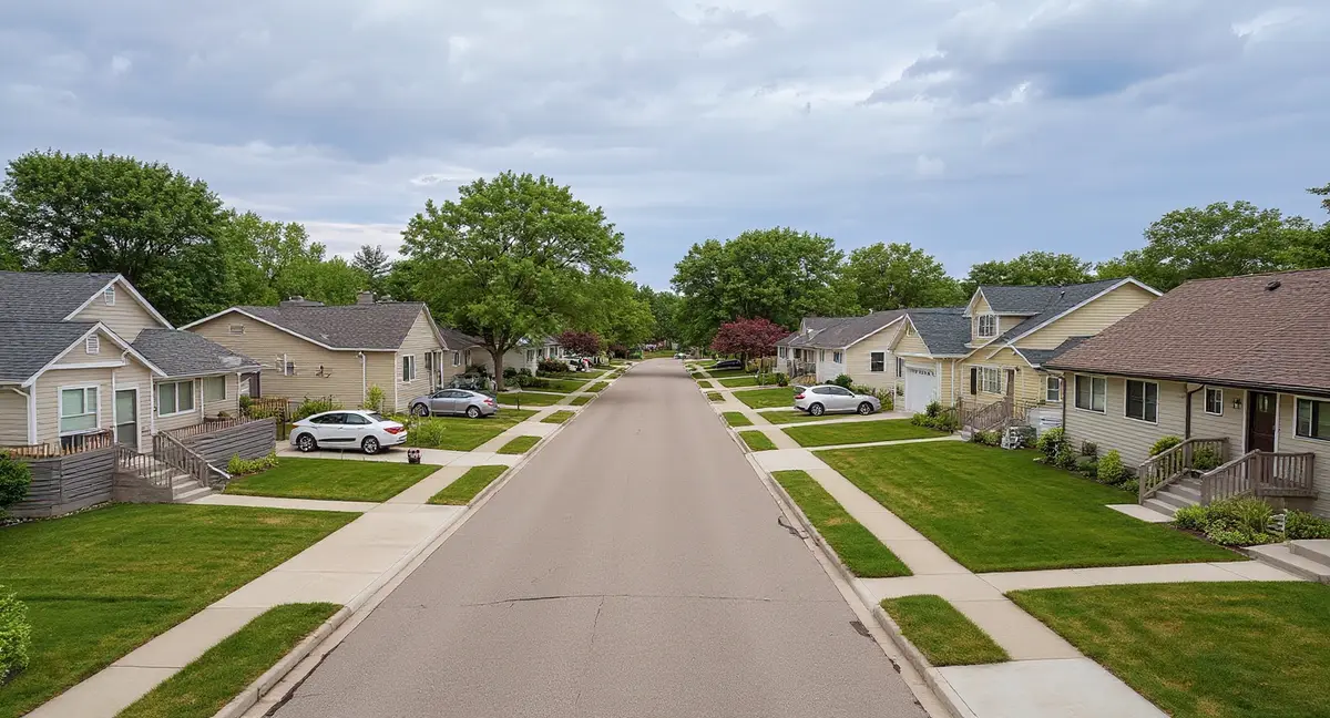
Pleasant Hill's residential development spans three distinct eras — a 1960s through 1980s established core, a transition wave from the 1990s, and a post-2000 expansion including the Copper Creek development area — each with different construction methods, drainage systems, and exposure histories on the same glacial till. The established core, concentrated along the original town grid and the roads feeding into the Highway 163 corridor, contains the housing stock with the longest exposure to hydrostatic pressure cycling. These homes have experienced 40 to 60 spring moisture-loading events, each one testing the integrity of their basement walls, perimeter drainage, and waterproofing systems. The post-2000 development has experienced roughly 25 cycles — enough to reveal construction defects but not yet enough to exhaust properly installed drainage systems.
The 1960s through 1980s Pleasant Hill core used poured concrete basement walls with clay drain tile — a standard combination for the era that has a predictable failure timeline on glacial till. Clay drain tile, installed in short segments with open joints, relies on gravity drainage to a daylight outlet or sump pit to intercept groundwater before it reaches the wall. After 40 to 60 years in glacial till, these clay tile systems are frequently compromised by root penetration at the joints, sediment accumulation inside the pipe, and displacement from frost heave in the upper soil profile. When the drain tile fails, the basement wall transitions from a protected condition — hydrostatic pressure intercepted before it reaches the wall face — to an unprotected condition where the full water column bears directly on the concrete. Horizontal cracks appearing in walls that were previously sound often trace back to drain tile failure rather than any change in the wall itself.
The Copper Creek area and other post-2000 Pleasant Hill development zones benefit from modern drainage engineering — corrugated plastic drain tile with filter fabric, engineered backfill, sump pump systems with battery backup, and lot grading designed to direct surface water away from foundations. These systems are fundamentally more durable than the clay tile they replaced. However, they are not permanent. Filter fabric can clog with fine glacial till particles over 20 to 30 years, reducing flow capacity gradually enough that the homeowner may not notice until basement moisture appears. Sump pumps have a mechanical lifespan of 7 to 12 years and require replacement before failure, not after. Newer Pleasant Hill homes are better protected, but that protection depends on active maintenance that many homeowners overlook.
Pleasant Hill's position as a more established suburb than Bondurant to the east, but less dense than the Des Moines core, creates a specific housing stock pattern: moderate lot sizes with mature landscaping that has been accumulating for decades around the established core. Mature trees within 20 feet of a foundation on glacial till create two competing effects. During summer, root systems draw moisture from the till and can reduce hydrostatic pressure by lowering the local water table — a beneficial effect. During spring, the same root systems may have invaded and damaged clay drain tile joints, eliminating the drainage protection the home depends on — a damaging effect. The net result depends on species, proximity, and drain tile condition. Homeowners in Pleasant Hill's established neighborhoods with large trees near the foundation should have the drain tile inspected by camera before assuming the drainage system is functional.
In Pleasant Hill's established 1960s-1980s core, what is the single highest-risk condition for basement wall damage on glacial till?
What Damage Patterns Does Hydrostatic Pressure Produce in Pleasant Hill Basements?
The signature damage pattern in Pleasant Hill is a horizontal crack at or near the mid-height of the basement wall, accompanied by measurable inward displacement of the wall above the crack. This pattern results from sustained lateral hydrostatic pressure — water-saturated glacial till pressing against the wall face with a force that increases linearly with depth below grade. The wall is restrained at the top by the floor framing and at the bottom by the footing and slab, leaving the midpoint as the weakest section. When the cumulative pressure exceeds the wall's bending capacity, the concrete yields at mid-height, producing a horizontal fracture and allowing the upper wall section to rotate inward. This is a structural failure mode, not a cosmetic crack.
Vertical cracks in Pleasant Hill basement walls typically indicate a different mechanism than horizontal cracks — either thermal contraction during curing, minor settlement, or localized stress concentration at corners and pipe penetrations. A narrow vertical crack that has remained stable in width for years and shows no moisture migration is generally a low-priority finding on glacial till. However, a vertical crack that weeps water during spring months, shows white efflorescence deposits on the interior face, or has widened measurably over consecutive monitoring periods indicates that hydrostatic pressure is exploiting the crack as a drainage path. Crack injection with polyurethane or epoxy can seal these cracks against water transmission, but injection alone does not address the pressure that is driving the water — if the pressure is not relieved through drainage improvement, it will find or create another path.
Sloping floors in Pleasant Hill homes can indicate either settlement or heave, and distinguishing between the two requires understanding the glacial till's behavior under the specific structure. Settlement occurs when the bearing soil compresses under the foundation load — relatively uncommon on glacial till, which is dense and typically provides excellent bearing capacity. Heave occurs when hydrostatic pressure lifts a basement slab from below, creating a dome or localized high point in the floor. In Pleasant Hill, floor slope that is highest near the center of the slab and lowest at the perimeter walls is more likely heave than settlement. The till beneath the slab center is farthest from the perimeter drains and retains moisture longest, generating the greatest upward pressure at the point farthest from any drainage relief.
Sticking doors and windows in Pleasant Hill homes follow a seasonal pattern that directly tracks the hydrostatic pressure cycle — worst in April through June when soil moisture is at maximum, improving through August and September as the water table drops. When a basement wall displaces inward under spring hydrostatic pressure, the floor structure it supports shifts with it. That shift transmits upward through the framing, racking door and window openings out of square on the first floor. The amount of racking depends on the magnitude of wall displacement and the stiffness of the framing path. Older homes with balloon framing transmit more displacement to upper floors than platform-framed homes, which is why the 1960s Pleasant Hill core tends to show more pronounced seasonal door binding than post-2000 construction built with platform framing and modern sheathing.
When Is Foundation Risk Highest in Pleasant Hill's Southeast Metro Location?
March through June is the critical risk window for Pleasant Hill foundations — the period when frost thaw, spring rainfall, and snowmelt converge to produce the year's maximum hydrostatic pressure against basement walls. Central Iowa's 26 inches of average annual snowfall accumulates primarily between December and February, and that snowpack melts during March and early April as temperatures rise above freezing. The meltwater enters the glacial till from above while the frost line is still retreating, creating a temporary perched water table in the upper soil profile. By mid-April, spring rainfall adds to the meltwater load. The till's low permeability prevents this combined volume from draining downward at the rate it accumulates, so it builds laterally — and the nearest vertical surface is the basement wall.
Pleasant Hill's southeast metro position creates a specific drainage direction that differs from the western Des Moines suburbs: surface and subsurface water moves generally eastward and southeastward toward the Des Moines River, passing through the Four Mile Creek system along the way. This regional drainage gradient means that homes on the western and northern edges of Pleasant Hill receive subsurface moisture migration from upslope terrain to the west, in addition to the rainfall and snowmelt that falls directly on their lots. The Four Mile Creek corridor, which runs through Pleasant Hill, functions as the local drainage outlet for this regional flow. Homes near the creek benefit from its drainage effect during normal conditions, but during high-water spring events, the creek's capacity can be overwhelmed, raising the water table across adjacent neighborhoods and increasing hydrostatic pressure even on homes that are normally well-drained.
Summer conditions from July through September provide the only sustained relief from hydrostatic pressure, as evapotranspiration and reduced rainfall allow the glacial till to partially dewater. Average summer temperatures reaching 86 degrees Fahrenheit drive significant evaporation from the upper soil profile, and the till slowly releases stored moisture downward through the formation over the dry months. This is the window when basement walls are under the least lateral stress and when existing cracks may appear to close slightly as the wall recovers elastic deformation. However, it is a mistake to evaluate crack severity during this low-pressure window. A crack that appears narrow and dry in August may be actively weeping and visibly wider in April. The homeowner guide explains the importance of monitoring during peak conditions rather than quiescent periods.
The transition from fall into winter — October through December — introduces frost-related risk that compounds the hydrostatic cycle by physically displacing footings and slabs that sit within the 42-inch frost zone. When temperatures drop below freezing and the frost front advances downward through saturated glacial till, ice lenses form at the freezing boundary and generate upward heave pressure. Properly placed footings at 42 inches or deeper are below this zone, but attached structures such as garage slabs, stoops, and porches with shallow footings are vulnerable. A sinking or heaving garage slab in Pleasant Hill often reflects frost action on a slab that was poured directly on glacial till without adequate gravel sub-base to interrupt capillary moisture rise.
What Should Pleasant Hill Homeowners Do Based on Their Home's Construction Era?
Homeowners in the established 1960s through 1980s Pleasant Hill core should treat drain tile assessment as the highest-priority investigation — because on glacial till, the condition of the perimeter drainage system determines whether the basement wall faces manageable moisture or destructive hydrostatic pressure. A camera inspection of the drain tile, performed by a contractor equipped with a push camera designed for small-diameter pipe, reveals root intrusion, sediment blockage, pipe collapse, and joint separation. If the drain tile is compromised, restoring drainage — either by clearing and relining the existing tile or installing a new interior perimeter system with a sump pump — eliminates the hydrostatic loading that drives wall cracking. This drainage restoration is not a cosmetic improvement. It is the structural intervention that determines whether the wall continues to degrade or stabilizes at its current condition.
For walls that have already developed horizontal cracks or measurable inward bow, carbon fiber straps or wall anchors provide the structural reinforcement needed to arrest further displacement — but these methods work most effectively when the hydrostatic pressure has been addressed through drainage improvement first. Installing carbon fiber straps on a wall that is still receiving full hydrostatic loading is treating the symptom while leaving the cause in place. The straps will resist further movement, but the ongoing pressure accelerates the degradation of the concrete between the straps. The most durable repair sequence on Pleasant Hill glacial till is drainage first, structural reinforcement second. Push piers or helical piers are less commonly needed in Pleasant Hill than in settlement-prone areas, because the glacial till generally provides excellent bearing capacity — the problem is lateral pressure, not vertical support failure.
Newer-era Pleasant Hill homeowners in the Copper Creek area and post-2000 subdivisions should focus on maintaining the drainage systems that are currently protecting their foundations — because those systems will eventually degrade, and the glacial till beneath them has not changed. Annual sump pump testing, battery backup verification, gutter maintenance, and downspout extension checks are the minimum maintenance cycle. Grading around the foundation should slope away from the wall at a minimum of six inches of fall over the first ten feet — verify this with a level and a straightedge each spring, because settlement of backfill against the foundation wall gradually flattens or reverses the grade over time. The repair cost page shows the financial difference between preventive drainage maintenance and after-the-fact structural repair.
All Pleasant Hill homeowners should document basement wall conditions with photographs and crack width measurements twice per year — once in May at peak hydrostatic pressure and once in September at minimum moisture — to create the monitoring baseline that distinguishes seasonal behavior from progressive structural damage. A crack that opens under spring pressure and closes during summer is cycling with the water table. A crack that is wider each September than it was the previous September is progressing independently of the seasonal cycle, indicating that either the drainage system has deteriorated or the wall has exceeded its structural capacity to recover. Progressive widening warrants professional evaluation. The foundation crack identification page provides reference images for distinguishing crack types and tracking their progression.
- Pleasant Hill's primary foundation threat is hydrostatic pressure from glacial till -- not shrink-swell clay -- making drainage management the highest-leverage prevention and repair strategy.
- In the 1960s-1980s core, failed clay drain tile is the single highest-risk condition: when perimeter drainage stops working, basement walls face the full hydrostatic load they were never designed to resist continuously.
- Four Mile Creek's drainage corridor elevates the water table in adjacent neighborhoods, amplifying spring hydrostatic pressure beyond what higher-ground homes experience on the same Polk County till.
- Document basement wall conditions with photographs and crack measurements twice per year -- May at peak pressure and September at minimum moisture -- to distinguish seasonal cycling from progressive structural damage.
Pleasant Hill Foundation Questions
Why does hydrostatic pressure matter more than shrink-swell clay for Pleasant Hill foundations?
Pleasant Hill sits on glacial till from the Des Moines Lobe — a dense, low-permeability formation that traps water above it rather than allowing drainage through it. When spring snowmelt and rainfall saturate the upper soil profile, the glacial till acts as a barrier, and water accumulates laterally against basement walls. This hydrostatic pressure pushes water through any crack, joint, or porous section of the wall. Unlike Kansas City's shrink-swell mechanism — where the clay itself expands and contracts — Pleasant Hill's primary threat comes from water pressure building against walls that were not designed to resist sustained lateral hydraulic force. The distinction matters because the repair approach is different: managing water pressure requires drainage solutions alongside structural stabilization, not structural repair alone.
Are Pleasant Hill's 1960s-1980s homes at greater risk than the newer Copper Creek development?
Yes, but for different reasons than simple age. Homes built in Pleasant Hill's established core during the 1960s through 1980s typically have poured concrete basement walls with perimeter drain tile that has been in service for 40 to 60 years. Clay drain tile from that era is vulnerable to root intrusion, joint separation, and sediment clogging — all of which reduce or eliminate the drainage capacity that protects the basement wall from hydrostatic pressure buildup. The Copper Creek area and other post-2000 developments use corrugated plastic drain tile with filter fabric, sump pump systems, and grading engineered to current stormwater standards. These newer systems are still functional, while many of the older drain tile systems in the established core have partially or fully failed. A failed drain tile system on glacial till is the single highest-risk condition for basement wall damage in Pleasant Hill.
How does Four Mile Creek affect foundation risk in Pleasant Hill?
Four Mile Creek runs through Pleasant Hill and influences the regional water table across the neighborhoods closest to its corridor. During spring runoff — March through June — the creek system carries snowmelt and rainfall from upstream areas, raising the water table in adjacent zones. Homes within a few blocks of Four Mile Creek experience higher baseline soil moisture than homes on the ridgelines along Highway 163, even though both sit on the same Dows Formation glacial till. The elevated water table near the creek means that hydrostatic pressure against basement walls begins building earlier in the spring season and persists longer into early summer. Homeowners near the Four Mile Creek corridor should monitor basement walls and sump pump activity more closely during the March through June window than homeowners on higher ground.
What foundation symptoms indicate hydrostatic pressure damage versus normal settling in Pleasant Hill?
Hydrostatic pressure produces a specific symptom pattern distinct from settlement. Horizontal cracks at mid-wall height — where inward pressure is greatest between the footing restraint below and the floor structure above — indicate sustained lateral force from water-saturated glacial till. White mineral deposits (efflorescence) on interior basement walls confirm that water is migrating through the concrete under pressure. Damp or wet basement floors during spring without visible surface water entry points suggest pressure-driven moisture transmission through the slab. Settlement, by contrast, produces vertical or diagonal cracks that follow structural stress patterns from downward movement. In Pleasant Hill, most basement wall distress is pressure-driven rather than settlement-driven, because the glacial till provides a stable bearing surface but creates severe drainage problems.
Does Iowa's 42-inch frost depth create additional foundation risk in Pleasant Hill?
Iowa's 42-inch frost depth is six inches deeper than Missouri's 36-inch standard, which means footings must be placed deeper to avoid frost heave. Homes built to code in Pleasant Hill have footings at or below 42 inches — safely beneath the frost penetration zone. However, additions, porches, stoops, and garage slabs that were constructed with shallow footings are vulnerable to frost heave every winter. When ice lenses form in the moisture-retentive glacial till above the frost line, they generate upward force that can lift a shallow footing a quarter inch or more per freeze event. Over decades, this frost-driven displacement accumulates and compounds whatever hydrostatic pressure damage the structure is experiencing from spring moisture loading. Any structure attached to a Pleasant Hill home that shows seasonal upward movement during winter — doors binding in January that free up in April — likely has a footing above the 42-inch frost line.