North Kansas City Foundation Risk — Alluvial Soil, Industrial Heritage, and the Oldest Housing in Clay County
Soil mechanics, housing stock analysis, and seasonal risk data for North Kansas City, Missouri — Clay County's smallest and oldest residential municipality, where Missouri River alluvial deposits combine with loess-clay soil to create a dual-threat foundation environment.
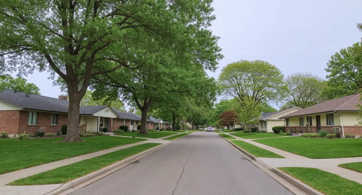
North Kansas City faces a dual-threat soil environment unique among Clay County suburbs: Missouri River alluvial deposits with low bearing capacity overlay the native clay-loess formation, creating both gradual consolidation settlement from the alluvium and seasonal shrink-swell from the clay fraction. As the oldest residential municipality in Clay County — with pre-1940s limestone foundations and 1940s-1950s block basements — NKC's housing stock has been exposed to this dual soil environment for 70 to 100-plus years.
How Do Missouri River Alluvial Deposits Change the Soil Equation in North Kansas City?
North Kansas City sits at the transition between Clay County's native clay-loess formation and the Missouri River's alluvial floodplain — giving the city a dual soil profile that neither Gladstone nor Liberty fully shares. The alluvial component is sediment deposited by the Missouri River over millennia of flooding: a variable mix of silt, sand, clay, and organic material laid down in layers that reflect individual flood events. This alluvial material has fundamentally different engineering properties from the residual clay and windblown loess found at higher elevations in Clay County. It compresses under load, holds water in unpredictable ways, and provides lower bearing capacity than undisturbed clay.
Low bearing capacity is the primary engineering concern with alluvial soil beneath foundations — the soil simply cannot support as much weight per square foot as native clay or even loess without deforming. A footing on alluvial soil distributes the structure's load onto material that yields more readily than clay, producing gradual settlement that can be uniform or differential depending on how the alluvial layers vary across the footprint of the foundation. Uniform settlement — where the entire foundation drops evenly — causes fewer visible symptoms than differential settlement, but both are occurring in NKC's alluvial zones. The foundation science page explains bearing capacity, settlement mechanics, and how soil type determines foundation performance.
The Clay County loess component is present in NKC as well, particularly in the slightly elevated residential neighborhoods south of 18th Avenue, where the terrain rises above the alluvial floodplain influence. These higher-elevation lots rest on the same clay-loess hybrid that characterizes Gladstone and Liberty — with its moderate shrink-swell behavior and loess collapse potential. Homes on these lots face the Clay County risk profile rather than the alluvial risk profile. The boundary between alluvial-dominant and clay-loess-dominant soil runs through NKC's small land area, meaning homes separated by a few blocks may sit on fundamentally different ground.
Missouri's frost depth of 36 inches governs footing design in NKC, but the alluvial soil's frost behavior differs from clay's. Alluvial silt-sand mixtures are less frost-susceptible than clay because they drain more freely and hold less capillary water for ice lens formation. However, poorly drained alluvial pockets — common where the soil includes clay-rich flood deposits — can be as frost-susceptible as native clay. NKC footings at the code-required 36-inch depth are protected from frost action in most conditions, but the bearing quality of what they rest on at that depth varies with the alluvial stratigraphy at each individual lot.
Why Does NKC Have the Oldest and Most Vulnerable Housing Stock in Clay County?
North Kansas City was incorporated in 1912 as an industrial suburb, and its residential neighborhoods were built to house workers for the adjacent industrial operations — making NKC's housing stock 20 to 40 years older than Gladstone's and 50-plus years older than Liberty's newer subdivisions. The pre-1940s homes that form NKC's oldest residential layer were built with limestone rubble foundations, early unreinforced concrete, or single-wythe brick — materials and methods that predate any formal understanding of how Missouri soils interact with residential structures. These foundations were designed to carry the weight of the house, not to resist lateral soil pressure or accommodate the settlement behavior of alluvial deposits.
The 1940s and 1950s construction wave added block basements to NKC's inventory — the same construction type that dominates Gladstone, but 10 to 20 years older on average. An NKC block basement from 1945 has experienced roughly 80 years of soil interaction compared to 60 years for a Gladstone block basement from 1965. That additional 20 years of cumulative shrink-swell cycling, freeze-thaw action, and potential alluvial settlement represents thousands of additional loading cycles on walls and mortar joints. The horizontal crack pattern characteristic of block wall bending under lateral pressure appears in NKC block basements at higher frequency and greater severity than in Gladstone's slightly younger stock.
NKC's compact residential grid — blocks roughly 300 feet square with small lots, narrow setbacks, and alleys — creates drainage conditions that amplify soil moisture variation at foundation perimeters. Small lots mean foundations are close together, impervious surface coverage is high, and there is little permeable ground to absorb rainfall before it reaches the soil around a footing. The grid pattern concentrates surface runoff along alley corridors and lot boundaries where multiple foundations sit within feet of the drainage path. Aging storm drainage infrastructure — some of it original to the city's early development — compounds the problem when it backs up during heavy rainfall and saturates soil that would otherwise drain.
The adjacency of industrial and commercial zones to NKC's residential areas introduces soil conditions that purely residential suburbs do not face. Industrial operations alter soil through vibration, chemical exposure, and grading for commercial use. Residential lots bordering former industrial parcels may sit on fill soil of unknown composition placed during industrial site preparation. Fill soil settles differently from native soil — typically faster and less predictably — and its bearing capacity depends on what material was used and how it was compacted. A residential foundation on uncharacterized fill carries higher uncertainty about long-term performance than one on documented native soil.
An NKC home shows no interior wall cracks but the front step has risen relative to the door threshold and window wells sit higher than original. What soil mechanism explains visible exterior grade changes without dramatic interior cracking?
Which Foundation Failures Show Up in NKC's Dual-Threat Soil Environment?
Gradual uniform settlement is the characteristic alluvial-soil failure mode — and it is harder to detect than the dramatic cracking that clay shrink-swell produces, because a foundation that settles evenly does not crack at the same rate as one experiencing differential movement. A home that has settled 1/2 inch uniformly over 50 years may show no interior cracks at all, but the grade around the foundation has changed: window wells sit higher relative to the sill than originally, the front step has risen relative to the threshold, and surface water that once drained away now pools against the foundation because the house has dropped relative to the surrounding grade. These subtle signs are easy to overlook and difficult to attribute to foundation movement without historical reference points.
Differential settlement — where one section of the foundation settles more than another — produces the visible damage that homeowners recognize: diagonal cracks at window and door corners, sloping floors, and doors that swing open or closed on their own. In NKC, differential settlement occurs when the alluvial stratigraphy varies across the footprint of the house. One corner of the foundation may rest on a sand lens with adequate bearing capacity while the opposite corner sits on a silt pocket that compresses more under the same load. The resulting uneven settlement racks the frame and produces the classic diagonal crack pattern radiating from the point of maximum differential displacement.
Block wall lateral displacement — the dominant failure mode in Gladstone — also appears in NKC's 1940s-1950s block basements, compounded by the additional decades of soil cycling these older walls have absorbed. NKC block walls show the same horizontal midpoint cracking from lateral clay pressure, but the total accumulated displacement tends to be greater because the walls have been in service longer. A block wall in NKC that has deflected 3/4 inch inward from its original position represents a more advanced failure state than a Gladstone wall at 1/2 inch — and the repair urgency increases with displacement because the wall's remaining resistance decreases as it moves further from plumb. The vertical cracks page describes how vertical fractures in block walls indicate a different stress pattern from the horizontal bending crack.
The pre-1940s limestone and early concrete foundations in NKC's oldest homes exhibit a failure mode specific to their material: mortar erosion and stone displacement from sustained moisture exposure. Limestone rubble walls rely on lime-based mortar to hold irregularly shaped stones in position. Decades of moisture cycling — particularly in alluvial soil that holds water against the wall for extended periods — dissolves the lime mortar and loosens the stones. The wall does not crack in the way block or poured concrete does; instead, it deteriorates from the mortar outward, losing structural integrity gradually until stones begin to shift under load. Foundation wall replacement is sometimes the appropriate response when mortar erosion has progressed beyond the point where repointing can restore structural capacity.
When Are NKC Foundations Under the Most Stress from Soil and Weather?
NKC faces a broader risk calendar than inland Clay County suburbs because Missouri River hydrology adds a water table variable that is independent of local rainfall. The river's water level is controlled by upstream conditions, dam releases, and regional snowmelt — events that can raise the groundwater table beneath NKC weeks after local weather has been dry. Elevated groundwater saturates alluvial soil from below, reducing its bearing capacity and increasing settlement risk. A May flood pulse from upstream snowmelt can arrive in NKC while local conditions are relatively dry, creating a disconnect between what the homeowner sees on the surface and what the soil is experiencing at footing depth.
The April-through-June local rainfall peak still drives the clay-loess fraction of NKC's soil through its annual expansion maximum, generating lateral pressure against block basement walls during the same window when alluvial groundwater may be elevated. The convergence of local rainfall saturation and river-driven groundwater rise during spring means NKC foundations can experience maximum lateral pressure on block walls and reduced bearing capacity in alluvial soil simultaneously. This dual loading condition is specific to NKC's position at the intersection of Clay County's clay-loess terrain and the Missouri River's alluvial floodplain. The repair cost page provides context on how multi-factor foundation problems affect project scope and cost.
Winter freeze-thaw action within Missouri's 36-inch frost zone affects NKC's clay-loess soil the same way it affects Gladstone and Liberty — ice lens formation pushes laterally against basement walls, incrementally displacing block construction through repeated cycles. NKC's alluvial soil zones experience less frost-driven lateral pressure because the silt-sand mixture is more free-draining and less prone to ice lens formation than clay. However, clay-rich alluvial pockets and the loess-clay zones at higher elevation within NKC still generate significant frost pressure. The net effect is spatially variable frost risk within a city that is less than one square mile in area.
Late summer — August through early October — is the lowest-risk window for NKC foundations, when both the clay fraction and the alluvial soil are at their driest and most stable condition. The Missouri River is typically at its lowest seasonal level during late summer, reducing groundwater elevation beneath the city. The clay fraction has contracted, lateral pressure is minimized, and alluvial bearing capacity is at its seasonal maximum. This is the best time for foundation assessment, crack measurement, and floor level documentation. The homeowner guide provides detailed monitoring protocols for establishing the dry-season baseline that makes spring comparisons meaningful.
What Can NKC Homeowners Do About Soil Conditions a Century of Development Created?
Surface drainage management is the first line of defense for NKC foundations — directing water away from the foundation perimeter reduces moisture loading on both the clay-loess and alluvial soil components. Gutters discharging at least six feet from the foundation, positive yard grading at a minimum 6-inch drop over the first ten feet, and sealed joints between the driveway and foundation wall all reduce the volume of surface water reaching the soil around footings. NKC's small lot sizes make this more challenging than in suburbs with large yards, but even incremental improvements in surface drainage reduce the peak moisture loading that drives both lateral wall pressure and alluvial settlement.
Subsurface drainage is equally critical in NKC — and the original footing drains in pre-1940s homes are almost certainly no longer functional. Clay tile footing drains installed 80-plus years ago are subject to root intrusion, joint separation, collapse, and sediment blockage. A non-functional footing drain allows groundwater to accumulate at the base of the foundation wall, maintaining saturation in the bearing soil beneath the footing. Replacing failed footing drains with modern perforated pipe routed to a sump system can meaningfully reduce the moisture loading on NKC's alluvial and loess soil at the most critical location — directly beneath the foundation. Helical piers can address settlement that has already occurred by transferring the foundation load to stable bearing material below the alluvial layer.
For NKC's pre-1940s limestone and rubble foundations, mortar repointing with appropriate lime-based mortar can restore wall integrity before deterioration progresses to the point of stone displacement. Modern Portland cement mortar is too rigid for old limestone walls — it transfers stress to the stones instead of absorbing it, causing the stones to crack. Lime-based mortar matching the original formulation allows the wall to flex under soil pressure without fracturing the stone. Repointing is a maintenance intervention, not a structural repair, but maintaining mortar integrity prevents the progressive deterioration that eventually requires full wall replacement.
Monitoring is particularly important in NKC because the dual soil environment produces failure modes that develop on different timescales — alluvial settlement is gradual while loess collapse can be sudden — and distinguishing between them requires data collected over time. Quarterly measurements of crack width, floor elevation at reference points, and door clearance provide the trend data needed to identify whether movement is stable, seasonal, or progressive. A crack that grows steadily by 1/32 inch per year is alluvial consolidation settlement. A crack that appears suddenly and does not close is loess collapse. A crack that opens and closes with the seasons is clay shrink-swell. Each pattern points to a different soil mechanism and a different repair approach, and only consistent monitoring reveals which pattern is active.
- NKC's dual soil profile — Missouri River alluvial deposits over Clay County clay-loess — creates both gradual consolidation settlement and seasonal shrink-swell, requiring monitoring that can distinguish between these mechanically distinct failure modes.
- Uniform settlement on alluvial soil is harder to detect than differential settlement: look for grade changes (steps rising, window wells appearing higher) rather than interior wall cracks.
- Missouri River hydrology adds a water table variable independent of local rainfall — upstream flood pulses can saturate NKC's alluvial soil weeks after local weather has been dry, reducing bearing capacity without visible surface water.
- Pre-1940s limestone foundations require lime-based mortar repointing — never Portland cement — to maintain wall integrity, as Portland cement is too rigid and transfers stress to the stones, causing them to crack.
North Kansas City Foundation Questions
How does Missouri River proximity change the soil under North Kansas City foundations?
The Missouri River deposited alluvial sediment across the NKC area over thousands of years of flooding before modern levee construction. This alluvial material — a mix of silt, sand, and fine-grained sediment — has lower bearing capacity than the native Clay County clay-loess formation found at higher elevations in Gladstone or Liberty. Alluvial soil compresses under load more readily, holds water differently, and can undergo consolidation settlement over extended periods. A foundation built on alluvial material may settle gradually and uniformly as the soil beneath it slowly compresses — a different pattern from the differential settlement caused by clay shrink-swell or loess collapse.
Are pre-1940s foundations in North Kansas City worth repairing?
That depends on the extent of damage and the repair method, not the age of the structure. Many pre-1940s NKC homes have limestone or early concrete foundations that have performed adequately for 80-plus years on alluvial soil — the long service life indicates the foundation found stable bearing despite the soil's limitations. Where settlement or wall displacement has occurred, modern repair methods like push piers can stabilize and sometimes lift a settled foundation regardless of its age or original material. The economics of repair versus replacement depend on the specific structure, but age alone does not disqualify a foundation from effective repair.
Does NKC's industrial history affect residential foundation soil?
Industrial activity can alter soil conditions through vibration compaction, chemical contamination that changes soil properties, and grading or fill placement that modifies the natural soil profile. In NKC, where industrial and residential zones are closely adjacent, some residential lots near former or active industrial properties may sit on fill soil placed during industrial development rather than on native alluvial or clay-loess material. Fill soil settles differently from native soil — typically more and faster — and its composition may be unknown. A foundation on uncharacterized fill faces higher uncertainty about future behavior than one on documented native soil.
What foundation repair methods work best on NKC's alluvial soil?
Push piers and helical piers are the primary stabilization methods for foundations on alluvial soil, because both systems extend through the weak alluvial layer to reach competent bearing material below. Push piers use the weight of the structure to drive steel pipe sections through soft soil until they reach refusal on a load-bearing stratum. Helical piers are screwed into the ground to a predetermined depth and torque, anchoring in firm soil or bedrock below the alluvial deposits. Both methods bypass the alluvial layer entirely, transferring the foundation load to stable material that the alluvial soil cannot provide. Surface-level methods like polyjacking can address slab settlement but do not solve the underlying bearing capacity problem if the alluvial soil continues to compress.
How do NKC's older drainage systems contribute to foundation problems?
North Kansas City's compact grid street pattern dates to the early 1900s, and the storm drainage infrastructure was designed for the development density and rainfall patterns of that era. Undersized storm drains that cannot handle modern rainfall intensity back up and saturate the soil around foundations. Combined sewer systems — where stormwater and sanitary sewage share the same pipes — can overflow during heavy rain events, introducing additional water into the soil at connection points. Aging clay tile footing drains beneath individual homes may be partially collapsed, root-infiltrated, or disconnected, allowing groundwater to accumulate at the footing rather than draining away. Each of these infrastructure limitations increases the moisture loading on foundation soil.