Merriam, Kansas Foundation Risk Profile
Soil data, housing stock analysis, and seasonal risk patterns for Merriam — Johnson County's most compact suburb, where Turkey Creek's flood corridor, I-35's impervious runoff, and 1950s-1970s block basements create a concentrated foundation risk environment.
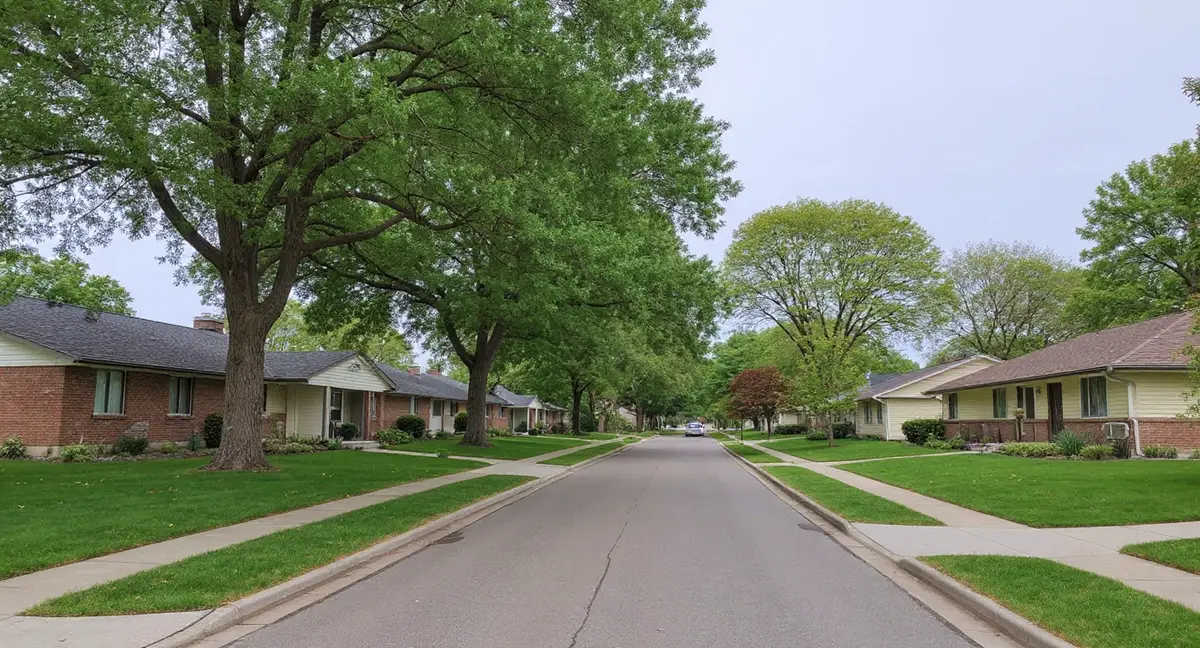
Merriam is Johnson County's most compact suburb (~4.5 square miles), and Turkey Creek runs through its geographic center, placing a disproportionately large share of the city's residential lots within the creek's flood influence zone. The city's 1950s-1970s housing stock straddles the block-to-poured-concrete transition era, with all foundations now 50 to 70 years old on Wymore-Ladoga clay and tight lot spacing amplifying neighbor-to-neighbor drainage impacts.
Why Does Merriam's Soil Put Foundations at Risk?
Merriam sits on the same Wymore-Ladoga clay complex that underlies all of Johnson County — a montmorillonite formation with 60 to 80 percent clay content rated "very high" shrink-swell by the USDA and classified as Hydrologic Soil Group D, the lowest infiltration and highest runoff category. The clay expands when saturated and contracts when dry, generating lateral pressure against basement walls during wet periods and removing bearing support from footings during dry periods. Group D soil means rainwater moves laterally across the surface rather than draining downward, pooling against foundations and saturating the clay at the perimeter before slowly evaporating. This is the same soil mechanism that drives foundation damage across Johnson County — what makes Merriam different is not the soil itself but how the city's geography and built environment interact with it.
Turkey Creek is the defining drainage feature in Merriam, running through the geographic center of this 4.5-square-mile city and placing a disproportionately large percentage of the residential housing stock within its flood influence zone. In larger suburbs like Overland Park or Lenexa, Turkey Creek affects a relatively narrow corridor within a much larger land area. In Merriam, the creek's moisture influence zone extends across a significant portion of the city's total residential footprint. The creek collects cumulative upstream runoff from Shawnee before entering Merriam, meaning the flood volumes passing through Merriam are higher than the creek's local watershed alone would produce. The foundation science page explains how sustained soil saturation from creek proximity amplifies lateral earth pressure against basement walls.
I-35 bisects Merriam roughly north-to-south, and the highway's impervious surface generates concentrated stormwater runoff that drains into the residential zones flanking both sides. Highway runoff enters Merriam's storm drainage system at higher velocity and volume than residential runoff, contributing to Turkey Creek's total flow and to localized ponding in the residential areas immediately adjacent to the highway corridor. The practical result is that homes near I-35 receive drainage contributions from the highway's impervious surface on top of the standard residential runoff from their own neighborhood — an additive moisture load that the Wymore-Ladoga clay absorbs and holds against foundation walls.
The frost depth in the Kansas City metro is 36 inches, and Merriam's older foundations are particularly susceptible to freeze-thaw damage because decades of clay-driven cracking have created entry points for water that freezes and expands inside the wall. Ice formation inside an existing crack widens it by approximately 9 percent with each freeze event. For block walls that already have stair-step cracks through mortar joints from 50 to 70 years of clay cycling, each winter adds incremental mechanical damage that the clay pressure alone did not produce. The freeze-thaw mechanism and the clay shrink-swell mechanism work on different seasonal timelines — clay peaks in spring and contracts in late summer, while freeze-thaw operates from November through March — creating year-round stress on foundation walls with no fully dormant period.
How Does Merriam's Construction History Shape Foundation Vulnerability?
Merriam's housing stock was built predominantly between the 1950s and 1970s, placing the city squarely in the transition era between concrete block and poured concrete basement construction — meaning the city contains a genuine mix of both foundation types within a very compact geography. Earlier Merriam homes from the 1950s and early 1960s are predominantly block basements — the same construction type that dominates in Prairie Village and the older portions of Shawnee. Later homes from the late 1960s and 1970s include more poured concrete walls, reflecting the industry-wide shift that was occurring during that period. Unlike Overland Park or Olathe, which contain large homogeneous zones of one era, Merriam's small land area means block and poured concrete foundations can sit on adjacent lots within the same block.
Merriam's character differs from other Johnson County suburbs in ways that affect foundation risk: smaller lot sizes, tighter home spacing, and proximity to commercial and industrial zones that generate higher per-acre runoff than residential land. In suburbs with half-acre lots and generous setbacks, one homeowner's drainage problem is buffered by distance before reaching the neighbor's foundation. In Merriam, where lot widths can be 50 to 60 feet and homes sit closer together, surface water from one property reaches the adjacent foundation with minimal travel distance and minimal absorption. This density effect means that foundation cracks in Merriam homes can sometimes be traced to drainage conditions on the neighboring lot rather than the homeowner's own property.
The Merriam Town Center area, which has seen commercial redevelopment, sits adjacent to residential neighborhoods with 1950s-1960s housing stock — creating an interface where modern commercial impervious surfaces drain toward aging residential foundations. Commercial redevelopment increases impervious surface area and alters drainage patterns that were established when the surrounding residential neighborhoods were built. Homes adjacent to the Town Center area may experience increased perimeter moisture loads from commercial runoff that did not exist when the homes were originally constructed.
Merriam has approximately 11,000 residents across roughly 4,800 housing units — the smallest residential base of any Johnson County suburb — and the city is fully built out with no remaining land for new development. Like Prairie Village, this means the foundation stock is a closed population with no new construction introducing modern engineering standards. Every foundation in Merriam is at minimum 50 years old, and many are approaching 70. The city's housing stock represents a frozen snapshot of mid-century residential construction practices aging uniformly on aggressive clay soil.
Why does Merriam's compact lot size (50-60 foot widths) amplify foundation risk compared to suburbs with larger lots?
Which Parts of Merriam Face the Most Foundation Pressure?
The Turkey Creek corridor through central Merriam represents the highest-risk zone in the city, where creek-driven soil saturation compounds the standard clay shrink-swell problem that affects all Johnson County foundations. Homes within the creek's flood influence zone — roughly the area where the ground elevation is close enough to the creek's flood stage to experience periodic saturation from high-water events — face a dual risk mechanism. The clay around these foundations stays wetter on average than upland soils, maintaining higher baseline lateral pressure against basement walls through the growing season. During actual flood events, direct water contact with foundation walls adds hydrostatic pressure and water infiltration through any existing cracks.
The Antioch Park neighborhood, in the eastern portion of Merriam, contains 1950s-1960s housing stock on block basements with 60 to 70 years of cumulative clay exposure. The neighborhood benefits from the park's permeable green space, which absorbs rainfall that would otherwise run off toward residential foundations. However, the homes in this area are among Merriam's oldest, and their block walls have endured the longest exposure to Wymore-Ladoga shrink-swell cycling. Stair-step cracking through mortar joints and horizontal cracking at the lower courses of block walls are the characteristic damage patterns in this vintage of construction.
Residences immediately flanking I-35 on both the east and west sides occupy a unique risk position: they receive highway stormwater runoff, experience ground vibration from heavy commercial traffic, and sit on the same aging foundations as the rest of the city. The highway corridor effect is most relevant for homes within approximately 200 feet of I-35's travel lanes. Ground vibration from truck traffic does not cause foundation damage in structurally sound walls, but it can accelerate crack propagation through mortar joints that are already under stress from clay pressure. A block wall with existing stair-step cracks adjacent to I-35 may see faster crack advancement than an identical wall in a quieter location.
Western Merriam, where the city borders Shawnee, contains later 1960s-1970s construction that is more likely to include poured concrete basement walls. These homes are still 50 to 60 years old on Wymore-Ladoga clay, but poured concrete walls resist lateral pressure more effectively than block walls over equivalent exposure periods. The dominant damage pattern in western Merriam's poured walls is vertical cracking at mid-span and diagonal cracks at corners where differential settlement has racked the wall — different from the stair-step mortar joint failure that characterizes the older eastern neighborhoods.
When Is Foundation Damage Most Active in Merriam?
May through early June is the peak risk period for Merriam foundations, when Johnson County's highest monthly rainfall — averaging 5.7 inches in May — saturates the Wymore-Ladoga clay to full expansion and drives maximum lateral pressure against basement walls. Block walls in Merriam's older neighborhoods can develop new stair-step cracks or show visible inward displacement after a single wet May. Turkey Creek corridor homes enter this peak window earlier than the rest of the city because the creek begins recharging adjacent soil with April rains before the May peak arrives. Homes near the creek may see their basement walls under near-peak pressure by late April.
Late July through September represents the contraction phase, when summer heat and reduced rainfall dry the clay and remove bearing support from footings. This is the period when differential settlement advances — the clay shrinks away from the underside of footings, and the structural load above drops into the void. Cape Cod and two-story homes settle more aggressively than single-story ranches during this phase because of the higher bearing load. Sloping floors and binding doors are the most noticeable interior symptoms during the contraction season. The seasonal rainfall minimum — January at 1.5 inches — represents the driest soil condition, though Turkey Creek corridor soils rarely reach this minimum because the creek maintains residual moisture.
The transition months of late March through April and September through October are the optimal inspection windows for Merriam homeowners because the soil is actively changing moisture states and any foundation movement is most detectable. Mark existing cracks with pencil lines and dates on the wall beside them, or photograph them with a ruler for scale. Re-check at the end of each transition period. Cracks that widen measurably between readings confirm active movement. Cracks that remain stable across multiple seasonal transitions are likely historical and lower priority.
Winter freeze-thaw cycling from November through March adds a third damage mechanism on top of the clay shrink-swell and the creek-driven saturation. The 36-inch frost depth means ice forms inside any crack face that has absorbed water during fall rains. Each freeze event widens the crack by the volumetric expansion of the ice, and each thaw allows more water to penetrate deeper into the wall. For Merriam's block basements, where mortar joints provide natural entry points for water, freeze-thaw is a meaningful accelerant on clay-initiated damage.
How Can Merriam Homeowners Protect Their Foundations?
Drainage management is the highest-leverage prevention measure for Merriam homeowners, and the city's compact lot sizes make it both more important and more challenging than in suburbs with larger properties. Positive grading away from the foundation — at least six inches of fall over ten feet — is the baseline requirement. In Merriam, where the neighbor's wall may be 15 feet from your own, achieving this grade in both directions simultaneously requires coordination. Where grading alone cannot solve a drainage conflict between adjacent properties, a French drain along the property line can intercept subsurface water before it reaches either foundation. The homeowner's guide provides a drainage assessment checklist.
Gutter and downspout systems require more frequent maintenance in Merriam than homeowners might expect, because the city's mature tree canopy fills gutters rapidly and because the consequences of overflow are amplified by tight lot spacing. A clogged gutter overflowing at the foundation wall dumps concentrated water directly into the clay zone that is already pressing against the basement wall. Downspout extensions carrying discharge at least six feet from the foundation are the minimum. For homes where six feet of extension would reach the neighbor's lot line, directing the discharge into a subsurface drain pipe that outlets at the street or into the storm system may be necessary.
For Turkey Creek corridor homes, sump pump systems with battery backup are a practical necessity rather than an optional upgrade. Creek corridor properties face periodic water intrusion from high-water events that surface drainage alone cannot prevent. A sump pump removes water that penetrates through the foundation wall-floor joint or through crack injection failure points before it can damage finished basement spaces. Battery backup addresses the common scenario where flooding and power outages occur simultaneously during severe storms.
Merriam homeowners considering foundation repair should understand that the city's block-to-poured transition era means the repair approach depends heavily on which type of wall they have. Block walls with stair-step cracking and moderate inward displacement are candidates for carbon fiber strap stabilization. Poured concrete walls with vertical or diagonal cracks from differential settlement may require helical pier installation to stabilize the footing. Combining wall stabilization with pier-based settlement correction is common in Merriam's older stock where both lateral pressure and settlement have been active for decades. The cost page breaks down pricing by repair method and scope.
- Turkey Creek runs through Merriam's geographic center, and because the city is only 4.5 square miles, a disproportionately large percentage of homes sit within the creek's flood influence zone.
- Merriam's 1950s-1970s housing stock straddles the block-to-poured-concrete transition, with all foundations now 50-70 years old on Wymore-Ladoga clay — a fixed, aging population with no new construction entering the inventory.
- Compact lot sizes (50-60 foot widths) mean one property's drainage problem directly impacts the neighbor's foundation, and I-35's impervious surface adds concentrated stormwater runoff to residential zones on both sides.
- Turkey Creek corridor homes need sump pump systems with battery backup as a practical necessity, while all Merriam homeowners should prioritize downspout extensions of at least six feet from the foundation.
Merriam Foundation Questions
Why does Turkey Creek create a higher foundation risk in Merriam than in other suburbs it passes through?
Turkey Creek runs through the geographic center of Merriam, and because Merriam is one of the smallest suburbs in Johnson County — roughly 4.5 square miles — a disproportionately large percentage of the city's residential properties sit within the creek's flood influence zone. In larger suburbs like Lenexa or Overland Park, Turkey Creek affects a localized corridor while most of the housing stock sits well outside the flood zone. In Merriam, the creek corridor's moisture influence reaches a significant share of the city's total residential lots. The creek also collects upstream runoff from Shawnee before entering Merriam, meaning flood volumes are cumulative and higher than what the creek's channel width within Merriam might suggest.
How does I-35 running through Merriam affect residential foundations?
I-35 creates two foundation-relevant impacts in Merriam. First, the highway's impervious surface generates concentrated stormwater runoff that drains into the residential areas flanking both sides. The highway's drainage infrastructure channels water into Merriam's storm system and ultimately into Turkey Creek, adding to the total volume the creek must carry. Second, homes immediately adjacent to I-35 have experienced decades of ground vibration from heavy truck traffic, which can accelerate crack propagation in block basement walls that have already been weakened by clay pressure. Vibration alone rarely causes foundation damage in sound walls, but it can advance existing cracks through mortar joints that are already under stress.
What types of foundations are most common in Merriam homes?
Merriam's housing stock spans the 1950s through the 1970s, which places it directly across the transition period from concrete block to poured concrete basement wall construction. Homes built in the 1950s and early 1960s are predominantly block basements. Homes built in the late 1960s and 1970s are a mix of block and poured concrete, with poured concrete becoming more common toward the end of that range. Because Merriam is fully built out with no new construction, the city's foundation stock is fixed in this transitional era — a mix of block and poured concrete walls, all of which are now 50 to 70 years old.
Is Merriam's foundation risk similar to neighboring Shawnee or different?
Merriam and Shawnee share the same Wymore-Ladoga clay formation, similar construction eras, and overlapping drainage systems — Turkey Creek flows from Shawnee into Merriam. The key difference is density and scale. Merriam is far more compact, with smaller lot sizes and tighter spacing between homes. This density means that one property's drainage problem affects the neighbor's foundation more directly than in suburbs with larger lots. Merriam also has more proximity to commercial and industrial zones, which generate higher runoff volumes per acre than residential areas. The soil risk is equivalent, but the built environment amplifies it differently.
How much does foundation repair typically cost in Merriam's older housing stock?
Foundation repair costs in Merriam are driven by the same variables that apply across the Kansas City metro: the type of damage, the extent of movement, the foundation material, and the repair method required. Block basement wall stabilization with carbon fiber straps or wall anchors is the most common repair scope for Merriam's 1950s-1960s homes. Settlement correction using push piers adds cost proportional to the number of piers needed and the depth to stable bearing soil. The cost page on this site provides detailed breakdowns by repair method and scope — Merriam's costs fall within the standard Johnson County ranges documented there.