Leawood, Kansas Foundation Risk Profile
Soil data, development-era analysis, and seasonal risk patterns for Leawood homeowners — from the 1960s neighborhoods near 95th Street through Hallbrook and Ironwoods to the newest construction south of 135th, all on Johnson County's Wymore-Ladoga clay.
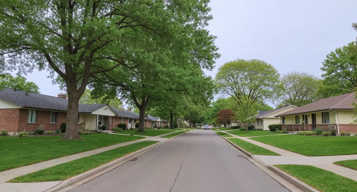
Leawood's estate-sized lots expose more linear feet of foundation perimeter to Wymore-Ladoga clay than smaller-lot Johnson County suburbs, creating larger differential moisture conditions around the foundation. The city's three development waves (1960s north, 1980s-90s central, 2000s+ south) mean northern Leawood homes have 55-65 years of clay cycling while Hallbrook and Ironwoods are crossing the 30-to-45-year threshold when poured concrete first shows symptoms.
Why Does Leawood's Soil Threaten Foundations?
Leawood sits on the same Wymore-Ladoga complex that underlies all of Johnson County — a montmorillonite clay formation with 60 to 80 percent clay content, USDA "very high" shrink-swell classification, and Hydrologic Soil Group D designation meaning it has the lowest infiltration rate and highest runoff potential in the classification system. This soil does not vary meaningfully from Leawood's northern boundary at 95th Street to the southern edge near 143rd Street. The clay is continuous beneath every development era, every lot size, and every price point in the city. What changes across Leawood is not the soil itself but the topography, drainage conditions, and the age and scale of the structures built on top of it.
Leawood's position in southern Johnson County places it within the eastern Peorian loess zone — a windblown silt deposit up to 17 feet thick that overlays or interfingers with the Wymore-Ladoga clay in unpredictable patterns. Where loess is present above the clay, the soil profile becomes a two-layer system: an upper silt layer that can collapse under saturation, sitting on top of an expansive clay layer that swells when wet and contracts when dry. These two layers move in opposing directions under the same moisture event. The foundation science page explains how this dual-mechanism loading creates compound stress on foundation footings that single-layer clay models underestimate.
Tomahawk Creek is Leawood's primary drainage feature, running through the central portion of the city as part of the broader Indian Creek watershed that connects through Overland Park and Prairie Village to the north. The creek's drainage basin creates a broad zone of elevated soil moisture through central Leawood where the clay drains more slowly after rain events than on the higher ground east and west of the creek corridor. This slower drainage means the clay stays expanded — pressing against basement walls — for longer durations. After a heavy May rainfall, homes on high ground may see the clay begin to contract within two weeks as surface moisture evaporates, while homes in the Tomahawk Creek drainage basin may hold that expanded state for three to four weeks.
The 36-inch frost depth in Leawood means that all soil within three feet of the surface undergoes annual freeze-thaw cycling, adding mechanical stress to any existing cracks or weaknesses in foundation walls and footings. Ice forming in the pore spaces of saturated clay expands approximately 9 percent by volume, widening any crack face it penetrates. Over decades, this winter ratcheting effect progressively opens hairline cracks into structural ones. Leawood's larger homes with deeper basements place more wall area within this active frost zone than the shallower foundation profiles common in smaller suburban homes.
How Did Leawood's Three Development Waves Create Different Foundation Risks?
Leawood developed in three distinct phases, each with different construction standards, lot configurations, and cumulative clay exposure — and this phased development creates a foundation risk gradient that runs roughly north to south across the city. Northern Leawood near 95th Street was built in the 1960s and early 1970s, making that housing stock 55 to 65 years old on Wymore-Ladoga clay. Central Leawood between roughly 119th and 135th Street developed through the 1980s and 1990s, with homes now 30 to 45 years into their clay exposure. Southern Leawood near 135th and 143rd Street is 2000s and 2010s construction, the newest in the city.
The northern 1960s-70s homes share a construction era with Prairie Village to the north, but Leawood's larger lots and higher construction budgets produced different foundation profiles. Where Prairie Village's postwar ranches often used concrete block basement walls, Leawood's homes from the same era were more likely to have poured concrete — a distinction that matters structurally because poured walls resist lateral clay pressure more effectively than block walls in the early decades. However, after 55 to 65 years of Wymore-Ladoga cycling, even poured concrete develops cumulative stress. Diagonal cracks at wall corners and sticking doors and windows are the signature symptoms in this age bracket, driven by differential settlement as the clay dries unevenly around the larger foundation footprint.
Central Leawood — home to Hallbrook, Leawood Estates, and the Ironwoods subdivisions — represents the city's highest-value residential developments, built during the 1980s and 1990s construction boom with poured concrete walls and larger foundation footprints than the earlier northern neighborhoods. These homes are now crossing the 30-to-45-year threshold where Johnson County's clay begins producing first-generation symptoms in poured concrete construction. The larger foundation footprints characteristic of these estate-lot homes mean more total perimeter is in contact with active clay, and differential moisture conditions are more likely across the broader footprint. A 3,000-square-foot foundation can experience meaningfully different soil moisture on its south-facing wall versus its north-facing wall — a gradient that drives the differential settlement producing floor slope and racked door frames.
Leawood's Town Center development near 119th and Nall represents a modern mixed-use project built to current codes, but the underlying soil conditions are unchanged from the clay that has been moving the city's older homes for decades. Town Center's newer foundations benefit from improved waterproofing, engineered backfill, and modern drainage design. These features delay the onset of symptoms but do not eliminate the underlying risk. The 10-to-20-year window before first-generation problems appear on Wymore-Ladoga clay means Town Center's earliest phases are approaching the timeframe when monitoring becomes appropriate.
A Leawood home in the Ironwoods subdivision has a large oak tree 15 feet from the foundation wall. During late summer, diagonal cracks appear at the corner nearest the tree. What is the most likely mechanism?
What Foundation Symptoms Are Leawood Homeowners Most Likely to See?
Differential settlement is the dominant failure mode across Leawood's housing stock, and it manifests differently in each development era. In the 1960s-70s northern homes, 55-plus years of clay cycling has typically advanced past initial cracking into visible floor slope and structural racking — where the entire frame of the house has shifted enough that multiple doors bind simultaneously and floors slope measurably across rooms. In the 1980s-90s central developments, the same settlement process is at an earlier stage: hairline diagonal cracks at drywall seams, occasional door sticking in seasonal peaks, and subtle floor changes that may only be noticeable with a level.
Leawood's estate-lot configuration amplifies one specific risk factor that smaller-lot suburbs experience less severely: uneven moisture distribution around a large foundation perimeter. A foundation with 250 linear feet of wall contact has south-facing sections that bake in summer sun while north-facing sections retain shade and moisture. West-facing walls absorb afternoon heat while east-facing walls stay cooler. This differential drying pattern pulls the clay away from the footing unevenly, creating a settlement profile where one corner or one side of the house drops while the opposite side holds. The result is the classic racking pattern — diagonal cracks tracking from the settling corner upward through the structure.
Ironwoods and other wooded-lot developments add a specific complication: mature tree root systems that draw moisture from clay in radial patterns extending 15 to 25 feet from the trunk. A large oak or maple near a foundation wall creates a localized drying zone that contracts the clay on one side of the house while the opposite side remains at ambient moisture. This tree-driven differential is a documented cause of asymmetric settlement in clay-soil suburbs. Removing the tree eliminates the drying but introduces the reverse problem — the clay re-hydrates and expands where the roots previously kept it dry, potentially generating new wall pressure. Managing trees near foundations on Wymore-Ladoga clay requires a moisture-balance approach rather than simple removal.
Basement wall bowing from lateral clay pressure, while less common in Leawood's predominantly poured concrete stock than in block-wall suburbs, does occur in homes where sustained high moisture has kept the clay expanded against the wall for extended periods. Homes in the Tomahawk Creek drainage corridor and low-lying areas where water pools after storms are the most susceptible. Horizontal cracks at or just below grade level signal that the wall has been pushed past its elastic limit — a condition that typically requires structural stabilization with wall anchors or carbon fiber reinforcement rather than crack repair alone.
When Does Foundation Damage Accelerate in Leawood?
Leawood's foundation risk follows the same annual cycle as the broader Kansas City metro — peak clay expansion from April through June as spring rainfall builds toward the May average of 5.7 inches, followed by peak contraction from late July through September when summer heat and reduced rainfall dry the clay to its annual minimum. The transition between these states drives the damage. Expansion generates lateral pressure against basement walls. Contraction pulls bearing support away from footings. The amplitude of the swing — the difference between the wettest and driest soil states — determines how much movement the foundation experiences each year.
Leawood's larger lots introduce a seasonal variable that smaller-lot suburbs experience less intensely: perimeter irrigation from landscape watering systems. Many Leawood homes have automated irrigation systems watering foundation-adjacent landscaping on a regular schedule through summer. If the irrigation zone overlaps the foundation perimeter, it artificially keeps the clay wet on the irrigated side while the non-irrigated side dries with the natural summer cycle. This creates an irrigation-driven differential moisture condition that mimics the natural sun-exposure differential but operates on a faster, more extreme cycle. Sprinkler heads spraying directly against the foundation wall are a specific concern — they concentrate water at the wall face, saturating the adjacent clay to maximum expansion on a repeating schedule.
The optimal monitoring windows are March through April and September through October — the transition months when the soil is actively moving between its wet and dry extremes. Placing reference marks on existing cracks and photographing them during both transition seasons reveals whether damage is progressing or stable. Winter's 36-inch frost penetration adds a third stress mechanism as ice forms in any existing crack faces, widening them incrementally with each freeze-thaw cycle. Leawood's deeper basements place substantial wall area within this active frost zone.
What Should Leawood Homeowners Prioritize for Foundation Protection?
Moisture management at the foundation perimeter is the single highest-leverage prevention measure for Leawood homeowners — and the estate-lot configuration means there is simply more perimeter to manage than in smaller-lot suburbs. Gutters and downspouts should discharge at least six feet from the foundation wall via extensions or buried drain lines. The grade immediately adjacent to the foundation should maintain a minimum 6-inch drop over the first ten feet in all directions — a standard that many 1980s and 1990s homes have lost as settling, mulch buildup, and landscape modifications have altered the original grading over decades. Re-establishing positive grade is a low-cost, high-return maintenance action.
Irrigation system audits are specifically relevant to Leawood's estate-lot properties because automated sprinkler systems are nearly universal and their spray patterns directly affect foundation-adjacent soil moisture. Sprinkler heads should be positioned to water landscaping without spraying the foundation wall or saturating the soil within three feet of the wall face. Adjusting spray patterns and relocating heads that discharge against the foundation is a straightforward modification that reduces the artificial wet-dry cycling that drives accelerated clay movement. The homeowner's guide covers irrigation management near foundations in detail.
For Leawood's high-value homes, the economics of foundation monitoring and early intervention differ substantially from lower-value properties because the cost of delayed repair scales with home size and finish quality. A foundation problem that might cost $8,000 to address with push piers on a 1,200-square-foot ranch in Prairie Village can exceed $25,000 on a 4,000-square-foot Leawood estate home — not because the engineering is fundamentally different, but because more piers are needed for the larger footprint and the interior access and restoration costs are higher. The cost page breaks down how project scope scales with foundation size and home value. Early detection through seasonal monitoring is the most cost-effective strategy precisely because the cost penalty for delayed intervention is highest on high-value properties.
- Leawood's estate-sized lots expose 250+ linear feet of foundation perimeter to Wymore-Ladoga clay, creating larger differential moisture conditions than smaller-lot suburbs experience.
- Three development waves (1960s-70s north, 1980s-90s central, 2000s+ south) create a north-to-south risk gradient, with Hallbrook and Ironwoods now crossing the 30-to-45-year threshold when poured concrete first shows symptoms.
- Mature trees on wooded lots in Ironwoods create localized drying zones extending 15-25 feet from the trunk, driving asymmetric settlement that produces diagonal cracking on the tree side of the foundation.
- Automated irrigation systems on estate lots can create artificial wet-dry differentials against the foundation — sprinkler heads should be positioned to avoid spraying within three feet of the wall face.
Leawood Foundation Questions
Why do Leawood's larger lot sizes increase foundation risk compared to other Johnson County suburbs?
Leawood's estate-sized lots expose more linear feet of foundation perimeter to Wymore-Ladoga clay than the smaller lots common in Prairie Village, Merriam, or central Overland Park. A home on a quarter-acre lot may have 160 linear feet of foundation wall in contact with expansive clay; a home on a half-acre or full-acre lot in Hallbrook or Leawood Estates can have 250 or more linear feet of exposure. More perimeter means more surface area where clay pressure acts on the foundation, more opportunity for differential moisture conditions around the house, and more potential entry points for water infiltration. The south and west exposures on large lots also create longer runs of sun-dried clay that contract away from the footing during summer drought — increasing the differential settlement risk that drives diagonal cracking and floor slope.
Do Leawood's newer southern developments near 135th Street have lower foundation risk than the older northern neighborhoods?
Southern Leawood near 135th and 143rd Street contains 2000s and 2010s construction that benefits from modern building codes, improved waterproofing membranes, and engineered backfill practices. However, the Wymore-Ladoga clay beneath these newer homes is identical to the clay under 1960s construction near 95th Street — the soil does not change with the era of development above it. New foundations on this clay typically take 10 to 20 years before first-generation symptoms appear as the soil cycles through enough wet-dry seasons to produce measurable movement. Homes built in 2005 to 2015 are now entering or within that initial symptom window. Modern construction delays symptom onset but does not eliminate the underlying soil risk.
How does Tomahawk Creek affect Leawood foundations differently than Turkey Creek affects Lenexa?
Tomahawk Creek runs through central Leawood as part of the same larger drainage system that connects through southern Overland Park and Prairie Village. Unlike Turkey Creek in Lenexa, which carries a more concentrated flooding history within a narrow corridor, Tomahawk Creek's influence in Leawood is distributed across a wider low-gradient drainage basin. The practical difference for foundations is that Tomahawk Creek produces broader zones of elevated soil moisture rather than concentrated flood events. Homes within the creek's drainage influence — particularly in central Leawood between 119th and State Line — experience slower soil drainage after rain events, meaning the clay stays expanded and pressing against basement walls for longer periods before drying. This sustained pressure pattern favors horizontal wall cracking over the acute settlement damage that flood events can produce.
What makes foundation repair more expensive in Leawood than in other Johnson County suburbs?
Leawood's higher average home values create a compounding cost dynamic for foundation repair. First, the homes themselves are larger — bigger foundations require more piers, more wall stabilization, and more linear footage of crack repair than the 1,200-square-foot ranches common in Prairie Village. Second, interior finishes in Leawood homes are typically higher-end, meaning the cost to remove and replace flooring, trim, and wall coverings for access to foundation walls is substantially higher than in a home with builder-grade finishes. Third, estate-lot landscaping — mature trees, hardscaping, irrigation systems — often must be partially disturbed for exterior foundation access, adding landscape restoration costs. The foundation engineering itself follows the same principles as any home on Wymore-Ladoga clay, but the total project cost reflects the scale and finish level of the structure above the foundation.
Should Leawood homeowners in Hallbrook or Ironwoods be concerned about foundation problems on homes built in the 1990s?
Hallbrook and Ironwoods represent 1980s and 1990s construction — homes now 30 to 45 years old on Wymore-Ladoga clay. This age range is the beginning of the window when poured concrete foundations on Johnson County clay begin producing visible symptoms. The larger footprints typical of these developments mean more foundation perimeter exposure, and the wooded lots in Ironwoods add a specific variable: mature tree root systems draw moisture from clay in a radial pattern around the trunk, creating localized drying zones that can extend 20 feet or more from the tree. If a large tree sits within that distance of a foundation wall, it pulls clay moisture unevenly along one section of the foundation while other sections remain at ambient moisture — a setup for differential settlement. Monitoring for diagonal cracks, door misalignment, and floor slope in these developments is appropriate at this age.