Indianola Foundation Risk — Warren County Glacial Transition, Pre-Illinoian Till, and Variable Soil Conditions
Soil mechanics, housing stock analysis, and seasonal risk data for Indianola, Iowa — where the Des Moines Lobe's glacial deposits thin and give way to older, more variable Pre-Illinoian till and loess at the southern fringe of the metro.
Indianola occupies a geological transition zone in Warren County where the Des Moines Lobe's Dows Formation glacial till thins and gives way to older Pre-Illinoian deposits, making foundation risk less predictable than in the core metro. A foundation here may sit partly on younger till and partly on weathered deposits hundreds of thousands of years older, producing differential settlement that uniform-till suburbs do not face.
What Makes Indianola's Soil Different from Core Des Moines Metro Suburbs?
Indianola occupies the geological transition where the Des Moines Lobe's Dows Formation glacial till thins and gives way to older Pre-Illinoian glacial deposits and loess — making Warren County's soil profile fundamentally more variable than the thick, relatively uniform till beneath Ankeny, Johnston, or West Des Moines. The Dows Formation, deposited 12,000 to 14,000 years ago by the Wisconsinan glaciation's Des Moines Lobe, is the dominant soil in the core metro. In Indianola, this younger till is thinner — in some locations it has been eroded away entirely, exposing the Pre-Illinoian till beneath it that has been weathering for hundreds of thousands of years.
Pre-Illinoian glacial till is geologically older and more weathered than the Dows Formation, with different clay mineralogy, different drainage characteristics, and different structural behavior under foundation loads. Older till has undergone longer chemical weathering, which alters its clay minerals and changes how it responds to moisture. Where the young Dows Formation till generates hydrostatic pressure through poor drainage and water table elevation, the Pre-Illinoian till can also produce differential bearing capacity — some sections support foundation loads adequately while adjacent sections do not, depending on their weathering history and composition.
The transition between Dows Formation and Pre-Illinoian deposits is not a clean line across Warren County — it is gradual and irregular, creating zones where the two tills intermix or where the younger till is a thin veneer over the older material. This irregularity means that a foundation in Indianola may sit partly on younger glacial till and partly on older, more weathered deposits. The two materials respond differently to moisture loading and freeze-thaw cycling, producing the conditions for differential settlement — one section of footing moves while another remains stable. This variability is the defining feature of Indianola's foundation risk and the reason that site-specific soil evaluation matters more here than in the uniform-till core metro.
A loess mantle — wind-deposited silt from Pleistocene glacial outwash — covers portions of Warren County's upland terrain, adding a third soil layer to the profile. Loess drains differently than either glacial till type: it is relatively permeable when dry but can collapse and lose structure when saturated, a behavior called hydrocompaction. A foundation sitting on a loess layer over Pre-Illinoian till faces a layered risk — the loess may settle when wet while the till beneath it generates hydrostatic pressure from below. For the mechanics of how different soil types interact with foundations, see the foundation science page.
How Do the Middle River and Warren County Drainage Patterns Affect Foundations?
The Middle River flows south and west of Indianola, and its tributary network drains portions of the city — creating zones where alluvial deposits, elevated water tables, and seasonal flood plain influence compound the already-variable glacial soil conditions. Properties along the Middle River corridor and its tributaries sit on river-deposited sediments with different properties than the upland glacial soils. These alluvial deposits can be sandier, more variable in layering, and more responsive to river stage fluctuations than the surrounding till.
Warren County's terrain has more topographic relief than Story County's flat till plain to the north — Indianola sits on gently rolling ground that creates natural drainage paths concentrating surface water into low areas and stream corridors. This rolling terrain means soil moisture conditions vary across short distances: ridge-top homes shed water efficiently while homes at the base of slopes or near drainage swales receive concentrated runoff that saturates the soil around their foundations more aggressively. On the variable glacial transition soils, this uneven moisture loading produces uneven soil response — amplifying the differential movement that the mixed-till profile already predisposes.
Spring snowmelt and the March-through-June rainfall peak raise water tables across Warren County, but the effect is most pronounced in the low-lying areas near the Middle River and its tributaries. Homes in these drainage-influenced zones experience the highest hydrostatic pressure against their basement walls during this period, and the horizontal cracks and basement moisture intrusion that result tend to worsen progressively across successive spring seasons. The rolling terrain means that homes on higher ground — including much of the Simpson College area and the residential core — face less severe but still measurable hydrostatic loading from the glacial till's poor drainage.
What Does Indianola's Housing Stock Mean for Foundation Risk?
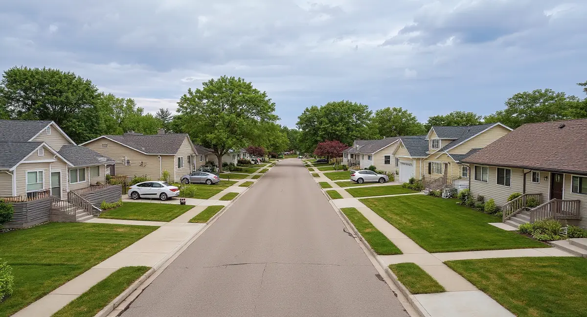
Indianola's housing stock reflects its character as a smaller, more rural community at the southern fringe of the Des Moines metro — a historic core around Simpson College and the town center, surrounded by later suburban and rural-residential development that has grown incrementally rather than in the explosive building booms seen in Ankeny or Waukee. This incremental growth pattern means construction eras are mixed across the city rather than concentrated in distinct geographic bands, and foundation types vary accordingly.
The Simpson College area and downtown Indianola contain the city's oldest residential structures — homes from the late 1800s through the 1930s built with stone, early block, and thin poured concrete foundations on soil that the builders did not understand was a glacial transition zone. These pre-1940s foundations have endured over a century of Warren County's variable soil behavior: hydrostatic pressure from the younger till, differential bearing from the older Pre-Illinoian deposits, and 42-inch frost cycling through materials that were marginal when installed. Foundation crack networks in these older homes are often extensive, and chimney separation from the main structure is common where the chimney footing has settled on different soil than the house foundation.
Mid-century homes from the 1950s through 1970s ring the historic core, built primarily with concrete block basement walls during the period when block construction was the residential standard in smaller Iowa communities. Block walls are the most vulnerable wall type to lateral hydrostatic pressure — they fail at mortar joints, producing stair-step cracks that follow the mortar bed lines. In Indianola, the variable soil adds a complication: differential settlement from the mixed glacial deposits can rack a block wall at the same time that hydrostatic pressure pushes it inward, producing compound stress patterns that require both wall stabilization and settlement correction.
Newer development on Indianola's periphery — 1990s through 2010s construction in subdivisions on the city's north and east sides — benefits from modern poured concrete walls and current code compliance, but sits on the same transitional glacial soils as the rest of the city. These homes are still young enough that the glacial soil's effects have not yet produced visible symptoms in most cases. However, homes built on the thinner Dows Formation till or on areas where Pre-Illinoian deposits are near the surface may show earlier-than-expected foundation movement because the older, more weathered till provides less consistent bearing support than the thick, younger till beneath the core metro suburbs.
Why is differential settlement more common in Indianola than in uniform-till metro suburbs like Ankeny or Johnston?
What Foundation Problems Are Most Common in Indianola?
Differential settlement is Indianola's most distinctive foundation problem — more common here than in uniform-till suburbs like Ankeny or Johnston because the glacial transition zone produces variable bearing capacity across short distances beneath a single foundation. When one section of footing rests on younger Dows Formation till and an adjacent section rests on more weathered Pre-Illinoian deposits, the two soils respond differently to moisture loading and seasonal cycling. The result is diagonal cracks originating at corners of windows and doors, sloping floors that tilt toward the lower-bearing section, and sticking doors and windows as the structure racks from uneven support.
Horizontal wall cracks from hydrostatic pressure still occur in Indianola, but they are more common on the north side of the city where the Dows Formation till is thicker and behaves more like the core metro's glacial deposits. Northern Indianola's soil profile more closely resembles Polk County's — thicker young till with poor drainage and persistent moisture loading. Block walls in the mid-century neighborhoods on Indianola's north side show the same horizontal crack patterns at mid-wall height that are common throughout the Des Moines metro, driven by the same hydrostatic pressure mechanism.
The combination of variable soil and older construction in the Simpson College area produces compound foundation failures where multiple mechanisms act simultaneously. A pre-1920s home near the college may show settlement cracks from differential bearing on mixed glacial deposits, lateral wall displacement from hydrostatic pressure, frost damage in the upper wall from 42-inch freeze-thaw cycling, and material deterioration from over a century of moisture exposure — all occurring together. Repair strategies for these compound failures typically involve multiple methods: push piers or helical piers for settlement stabilization, wall anchors for lateral displacement, and crack injection for sealing individual fractures after the structural stabilization is complete.
Garage floor and driveway settlement is a visible indicator in newer Indianola subdivisions where the attached garage slab sits on fill soil placed during construction grading. Fill soil over the transitional glacial deposits settles as it consolidates, and the rate of consolidation depends on what the fill is resting on — younger till, older till, or loess. A sinking garage floor that separates from the stem wall by a quarter inch or more per year suggests the fill is consolidating at a rate that will continue until the fill reaches its final density. Polyjacking can lift and stabilize the slab once settlement has slowed, but addressing the slab before the fill has finished consolidating risks recurrence.
When Is Foundation Risk Highest in Indianola?
The March-through-June period produces the highest foundation stress in Indianola, matching the broader Des Moines metro seasonal pattern — spring snowmelt combines with the year's heaviest rainfall to saturate the glacial soils and raise water tables to their annual peak. During this window, hydrostatic pressure against basement walls reaches its maximum, differential settlement is most active because the variable soils are at their most moisture-loaded and responsive state, and basement moisture intrusion is most likely. Homeowners who notice new cracks, worsening floor slope, or increased basement humidity during spring are seeing the direct effect of Warren County's glacial soil responding to seasonal moisture loading.
The fall wet period in October and November presents a secondary risk that is particularly relevant in Indianola because of the loess component in Warren County's soil profile. Loess is susceptible to hydrocompaction — structural collapse when saturated — and fall rainfall can trigger settlement in loess-bearing areas that then freezes in place through the winter. Soil that enters the winter season fully saturated produces more aggressive frost heave because there is more water available to form ice lenses within the 42-inch frost zone. The compounding sequence of fall saturation, winter frost heave, and spring moisture loading creates a cumulative annual stress cycle that advances foundation damage incrementally each year.
Late summer — July through September — is the lowest-stress period and the preferred window for foundation work in Indianola. Water tables recede, the variable soils dry toward their annual minimum moisture content, and excavation conditions are most favorable. This is also the best time for the site-specific soil evaluation that Indianola's transitional geology demands — testing soil conditions during the dry season reveals the baseline bearing characteristics without the confounding variable of seasonal moisture loading. The repair cost page provides metro-area pricing context, though Indianola's variable soil may produce scope variations that affect individual project costs.
What Repair Approaches Are Most Effective in Indianola's Transitional Soil?
Piering for settlement correction is more common in Indianola than in uniform-till metro suburbs because the glacial transition zone's variable bearing capacity produces more differential settlement that requires active lifting and stabilization. Push piers are driven through both the Dows Formation till and the underlying Pre-Illinoian deposits to reach competent bearing material — a depth that may be greater or more variable in Indianola than in Ankeny or Johnston where the Dows Formation provides consistent bearing at predictable depths. Helical piers offer an alternative for sites where access is limited or where torque-controlled installation provides better quality assurance in the variable soil.
Wall stabilization for lateral bowing follows the same methods used across the Des Moines metro, but Indianola's variable soil means the lateral pressure distribution may be less uniform than in thick-till communities. Carbon fiber straps arrest bowing in block walls where displacement is within their design capacity. Wall anchors provide active resistance and the potential for gradual correction. In Indianola's compound-failure scenarios — where a wall is both bowing inward from pressure and racking from differential settlement — the wall stabilization must be sequenced with the piering work to ensure the structural correction addresses all active mechanisms rather than fixing one while the other continues.
For older Simpson College-area homes with extensive deterioration, foundation wall replacement may be the most cost-effective long-term solution when the original wall materials have deteriorated beyond the point where stabilization methods can restore adequate structural capacity. A stone or early-block wall that has lost mortar integrity across large sections, displaced from plumb by several inches, and shows active moisture entry through multiple pathways may cost more to stabilize and seal incrementally than to replace with a modern poured concrete wall designed for Warren County's soil conditions. The decision between stabilization and replacement depends on the extent of deterioration, the home's structural requirements, and the relative cost of each approach.
- Warren County's glacial transition zone means the Dows Formation till thins unevenly and gives way to older Pre-Illinoian deposits, creating variable bearing capacity that makes differential settlement more common than in uniform-till suburbs.
- Simpson College-area pre-1900s foundations have endured over a century of hydrostatic pressure and 42-inch frost cycling on stone and early block materials, often requiring compound repair strategies.
- A loess mantle in parts of Warren County adds a third soil layer that drains differently -- relatively permeable when dry but prone to hydrocompaction (structural collapse) when saturated.
- Site-specific soil evaluation is more important in Indianola than in the core metro because pier depths and repair scope can vary significantly based on where the Dows Formation thins and the older deposits begin.
Indianola Foundation Questions
Why does Indianola have different soil than Ankeny or West Des Moines?
Indianola sits in Warren County at the southern edge of the Des Moines Lobe's reach — the geological transition where the younger Dows Formation glacial till thins and gives way to older Pre-Illinoian glacial deposits and loess. Ankeny and West Des Moines sit on thick, relatively uniform Dows Formation till deposited 12,000 to 14,000 years ago. Indianola's soil is a mix of this younger till and much older glacial material that has been weathering for hundreds of thousands of years. The older Pre-Illinoian till has different clay mineralogy, different drainage properties, and different structural behavior than the younger Dows Formation. This means foundation risk in Indianola is less predictable than in the core metro — the soil profile can change significantly across short distances depending on where the Dows Formation thins and the older deposits begin.
Are homes near Simpson College at higher foundation risk?
The Simpson College area contains Indianola's oldest residential housing stock — homes dating from the late 1800s through the early 1940s, built with stone, early block, and thin poured concrete foundations. These materials were not engineered for Iowa's glacial soil conditions, and more than a century of hydrostatic pressure cycling and 42-inch frost penetration has degraded them significantly. The concentration of older institutional and residential buildings around the college campus creates a zone where cumulative foundation distress is common: wide crack networks, settled corners, walls displaced from plumb, and persistent basement moisture. The age and construction quality of these foundations means they are typically candidates for more extensive repair — piering for settlement, wall reinforcement for lateral displacement — rather than the preventive maintenance that can extend the life of newer construction.
How does Indianola's glacial transition zone affect foundation repair costs?
The variable soil created by the Des Moines Lobe transition zone makes foundation repair in Indianola less predictable than in the core metro, which can affect both scope and cost. In Ankeny, where the Dows Formation till is uniformly thick, a contractor knows approximately what depth piers need to reach to find adequate bearing capacity. In Indianola, the depth to competent material varies because the Dows Formation thins unevenly and the underlying Pre-Illinoian deposits have different bearing characteristics. This variability means pier installation may require deeper driving in some locations or encounter unexpected soil conditions that change the scope mid-project. Site-specific soil evaluation is more important in Indianola than in uniform-till communities — the cost of a pre-repair soil assessment is justified by the reduction in mid-project surprises.
Does the Middle River affect foundation conditions in Indianola?
The Middle River flows south and west of Indianola, and its drainage influence extends into portions of the city through tributary streams and the broader flood plain. Properties near the Middle River corridor sit on alluvial deposits with different engineering properties than the upland glacial soils — these river-laid sediments tend to be more variable in composition and have higher, more fluctuating water tables. During spring snowmelt and heavy rainfall, the Middle River's stage rises, and the adjacent water table rises with it, increasing hydrostatic pressure against basement walls in the river's influence zone. Homes on the south and west sides of Indianola closest to the river corridor are most affected by this seasonal water table variation.
What foundation symptoms should Indianola homeowners watch for?
Because Indianola's soil profile is more variable than the core metro, foundation symptoms can present differently depending on which part of the glacial transition zone a home occupies. On thicker Dows Formation till in northern Indianola, horizontal cracks from hydrostatic pressure are the most common early indicator — similar to what homeowners in the core metro suburbs experience. On the thinner till or exposed Pre-Illinoian deposits in southern and western Indianola, differential settlement producing diagonal cracks and sloping floors is more common because the older, more weathered soil provides less uniform bearing support. Sticking doors and windows during the spring wet season are a reliable early warning sign in both soil types — they indicate the foundation is responding to seasonal moisture loading and the structure above is racking slightly as the soil moves.