Grimes, Iowa Foundation Risk Profile
Soil data, housing stock analysis, and seasonal risk patterns for Grimes homeowners — from the Polk-Dallas county glacial boundary to Highway 141's 1990s housing to the post-2000 northwest expansion north of I-80.
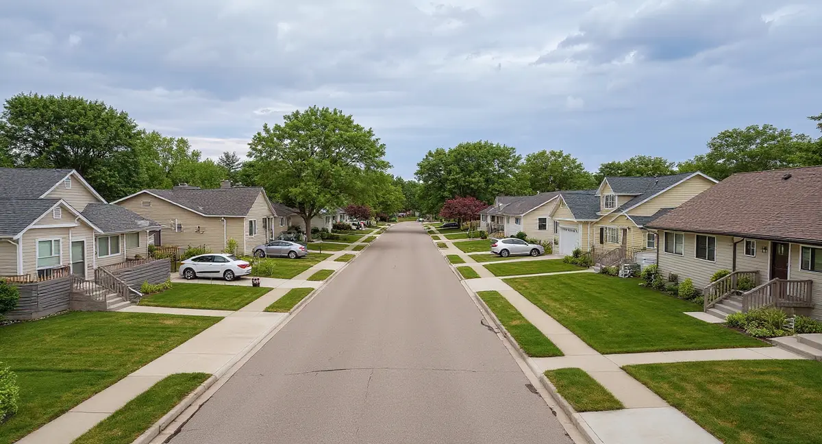
Grimes faces a compressed foundation risk timeline because nearly all of its housing stock was built after 2000 on Dows Formation glacial till that generates hydrostatic pressure when the water table rises to 2-3 feet below grade each spring. The Polk-Dallas county geological boundary running through Grimes adds a second variable: eastern homes sit on pure glacial till while western homes encounter a loess overlay that introduces collapse potential under saturation.
What Soil Sits Beneath Grimes Homes?
Grimes sits on glacial till deposited by the Des Moines Lobe — a dense, poorly draining formation called the Dows Formation that extends 45 to 60 feet below the surface and generates the primary foundation threat in this area: hydrostatic pressure from a seasonally high water table. This is not the shrink-swell clay mechanism that dominates foundation problems in other parts of the country. The glacial till beneath Grimes is a compacted mixture of clay, silt, sand, and gravel left by the last glacial advance roughly 12,000 years ago, and its low permeability traps groundwater rather than allowing it to drain away from foundation walls and footings.
Grimes straddles the Polk-Dallas county line, and this boundary represents a meaningful geological transition. The eastern portions of Grimes in Polk County rest on pure glacial till — dense, uniform, and predictably slow-draining. The western portions in Dallas County introduce a Peorian loess overlay, a windblown silt deposit that sits atop or interfingers with the glacial till. Loess modifies the pure till profile in a critical way: it is more porous when dry but structurally weak when saturated, introducing collapse potential under sustained water loading. The foundation science page covers how these two soil behaviors interact with foundation loads.
The water table across Grimes typically sits 4 to 10 feet below grade in late summer and fall, but rises to 2 to 3 feet below grade during the March-through-June spring recharge season. This seasonal swing is the engine that drives foundation damage in glacial till country. When the water table rises, it pushes laterally against basement walls and upward against floor slabs with measurable force — hydrostatic pressure that increases by roughly 62 pounds per square foot for every foot of water depth. A water table at 3 feet below grade generates enough pressure to exploit any existing crack, joint, or construction weakness in a basement wall.
The frost depth in central Iowa reaches 42 inches, meaning the freeze-thaw boundary penetrates well below the typical footing depth and into the zone where hydrostatic pressure is already acting on the foundation. Each freeze cycle expands moisture in existing cracks by approximately 9 percent, widening hairline cracks into pathways for additional water infiltration. This freeze-thaw mechanism compounds the hydrostatic pressure damage over successive winters, making every unrepaired crack from the spring pressure season a deterioration vector through the following winter.
How Does Grimes's Explosive Growth Shape Foundation Risk?
Grimes has quintupled in population since 2000, growing from roughly 3,000 residents to over 16,000, and this explosive growth means the city's housing stock is among the youngest in the entire Des Moines metropolitan area. Nearly every residential foundation in Grimes was poured after 2000, built to modern Iowa building code standards with engineered fill specifications and drainage requirements that did not exist when older Des Moines suburbs were developed in the 1960s through 1980s. This modernity is an advantage — but it is not immunity. Even well-built foundations begin showing stress indicators after 10 to 20 years of exposure to glacial till hydrostatic pressure cycles.
South Grimes along the Highway 141 corridor contains the city's oldest residential development — 1990s construction that now carries 25 to 35 years of cumulative exposure to seasonal water table fluctuation. These homes predate the population explosion and were built on lots graded to 1990s standards, which generally did not account for the long-term hydrostatic behavior of glacial till as rigorously as post-2005 engineering practice. Horizontal cracks in basement walls at or below grade — the signature of lateral hydrostatic pressure — are most likely to appear first in this older southern band of the city.
North Grimes, particularly the subdivisions north of I-80, represents the newest development frontier — homes built between 2010 and the present on land that was agricultural until immediately before construction. The conversion from farmland to residential development introduces a specific risk: decades of agricultural use create compacted plow layers and altered soil moisture profiles that differ from undisturbed glacial till. When builders regrade this land and place foundations on a mix of undisturbed till and engineered fill, the two materials settle at different rates under load, creating differential settlement that shows up as diagonal cracks at wall corners and sloping floors within the first decade.
The practical effect of Grimes's youth is a compressed risk timeline: the entire city is approaching or entering the 10-to-25-year window when first-generation hydrostatic damage becomes visible, and thousands of homes will cross that threshold within the same decade. Unlike older suburbs where foundation problems emerge gradually over a 40-year span of mixed-vintage housing, Grimes faces a cohort effect where a large share of its housing stock encounters its first structural stress indicators simultaneously. This does not make individual problems more severe, but it does mean that experienced foundation contractors familiar with glacial till hydrostatic repair will be in higher demand across this suburb in the coming years.
Why does Grimes face a 'cohort effect' for foundation damage that older Des Moines suburbs do not?
What Foundation Problems Show Up in Grimes?
The dominant foundation problem in Grimes is horizontal cracking in basement walls driven by lateral hydrostatic pressure — not the vertical settlement cracks common in drier soil environments. When the spring water table rises to 2 to 3 feet below grade, the saturated glacial till exerts lateral force against the full height of the buried basement wall. Poured concrete walls resist this pressure through internal reinforcement, but sustained or repeated loading eventually produces a horizontal crack at or just below grade level where the pressure is greatest. The horizontal cracks symptom page explains how to distinguish hydrostatic pressure cracks from shrinkage cracks and why the distinction matters for repair planning.
Basement floor slab cracking and heaving is the second most common pattern, caused by upward hydrostatic pressure acting on the underside of the slab when the water table reaches its spring peak. Unlike settlement cracking — where the slab drops — hydrostatic heaving pushes the slab upward, often at the center of the basement where the slab is farthest from the anchoring effect of the foundation walls. Homeowners may notice doors at the bottom of basement stairs becoming difficult to close, or previously flat floors developing a crown. Slab piers and polyjacking address different aspects of slab-level problems depending on whether the slab has settled or heaved.
Differential settlement in north Grimes's former-farmland subdivisions produces a distinct pattern: diagonal cracks radiating from wall corners, doors and windows binding in their frames, and measurable floor slopes that develop within the first 10 to 15 years of construction. This occurs because the foundation sits partially on dense undisturbed till and partially on regraded agricultural soil that compresses at a different rate. The result is uneven settlement — one portion of the foundation drops while another holds, racking the structural frame. Push piers or helical piers driven to stable bearing strata below the disturbed zone are the standard correction for this pattern.
Wall bowing from sustained lateral pressure is an advanced-stage problem that can develop in Grimes homes where horizontal cracks have gone unaddressed through multiple spring pressure seasons. Once a horizontal crack forms, the wall above and below the crack line can deflect inward under continued loading. If the inward deflection exceeds half an inch, the wall has moved past a maintenance-repair threshold and into structural territory. Wall anchors or carbon fiber straps arrest the movement at different stages of severity — carbon fiber for early-stage deflection under two inches, wall anchors for more advanced displacement where active recovery of wall position is required.
When Is Foundation Risk Highest in Grimes?
March through June is the peak risk window for Grimes foundations, driven by the combination of spring snowmelt, rising water table, and the heaviest rainfall months of the year. Iowa's 26 inches of average annual snowfall accumulates through the winter and releases into the soil as temperatures rise in March. This recharge — combined with spring rainfall that averages 4 to 5 inches per month from April through June — pushes the water table from its fall low of 8 to 10 feet to its spring peak of 2 to 3 feet below grade. The hydrostatic pressure against basement walls and under floor slabs reaches its annual maximum during this period.
Late fall through winter introduces the freeze-thaw deterioration cycle that compounds any damage sustained during the spring pressure season. Iowa's 42-inch frost depth means the freeze line penetrates well past the typical footing depth and into the zone where spring cracks have allowed water infiltration. Each freeze-thaw cycle widens existing cracks incrementally. A hairline crack that formed in April may be measurably wider by the following March after 30 to 40 freeze-thaw cycles have worked it open — which then allows more water entry during the next spring pressure season, creating a compounding damage loop.
The summer months from July through September represent a relative low-risk period for hydrostatic pressure as the water table drops, but this is the window when foundation cracks from spring damage are easiest to inspect and document. With the soil drier and the hydrostatic load reduced, crack widths stabilize at their minimum seasonal dimension, making it possible to set baseline measurements. Grimes homeowners who notice new cracks or moisture during the spring season should use the dry summer months to have them evaluated while conditions are stable and before the next freeze-thaw cycle begins widening them again.
What Can Grimes Homeowners Do to Reduce Foundation Risk?
Exterior drainage management is the highest-leverage prevention action for Grimes homeowners because the primary threat — hydrostatic pressure — is a water management problem at its core. Positive grading away from the foundation at a minimum slope of 6 inches over 10 feet directs surface water away from the basement wall instead of allowing it to percolate into the glacial till adjacent to the foundation. Downspout extensions carrying roof runoff at least 6 feet from the foundation wall prevent concentrated water discharge from saturating the soil directly against the basement. The homeowner's guide provides a complete drainage management checklist calibrated for glacial till conditions.
Sump pump systems with battery backup are not optional equipment in Grimes — they are a baseline necessity given the seasonal water table behavior. When the water table rises to 2 to 3 feet below grade, interior drain tile systems and sump pumps are the last line of defense against hydrostatic water intrusion through the wall-floor joint. A sump pump that fails during a spring storm event can allow rapid water accumulation in a basement. Battery backup or water-powered backup systems ensure continuous operation during the power outages that frequently accompany the spring storms driving the highest water table conditions.
Homeowners in the Polk-Dallas county boundary zone should pay particular attention to soil behavior on their specific lot because the geological transition means neighboring properties may sit on fundamentally different soil profiles. A foundation on pure glacial till behaves differently under load and moisture than one on the loess-over-till profile common on the Dallas County side. Crack injection can address isolated water entry points, but persistent hydrostatic intrusion through multiple entry points typically indicates a drainage-level problem that requires exterior or interior waterproofing intervention rather than point repairs. The cost page documents how repair scope and cost escalate when hydrostatic pressure damage advances from crack-stage to wall-displacement stage.
- Grimes straddles the Polk-Dallas county geological boundary -- eastern homes face pure glacial till hydrostatic pressure while western homes encounter a loess overlay with collapse potential under saturation.
- Nearly all Grimes housing stock dates from 2000 onward, placing the majority of homes in the 10-to-25-year window when first-generation hydrostatic damage becomes visible.
- North I-80 subdivisions built on former farmland face both hydrostatic pressure and differential settlement from regraded agricultural soil settling at different rates than undisturbed till.
- The spring water table rises from 4-10 feet to 2-3 feet below grade during March through June, generating the year's maximum hydrostatic pressure against basement walls and under floor slabs.
Grimes Foundation Questions
Why does Grimes face unique foundation risk from straddling the Polk-Dallas county line?
Grimes sits directly on the boundary between two distinct geological profiles. The eastern portion in Polk County rests on pure Des Moines Lobe glacial till from the Dows Formation — dense, poorly draining material 45 to 60 feet thick that generates hydrostatic pressure when the water table rises. The western portion in Dallas County introduces a Peorian loess overlay that modifies the glacial till with windblown silt, creating soil that is less dense but more prone to collapse under saturation. A homeowner on the east side of Grimes may face a pure hydrostatic pressure problem while a homeowner two miles west faces a combined pressure-plus-collapse risk — and neither profile behaves like the other.
Are Grimes homes at greater risk because they were built so recently?
Recent construction does not eliminate risk — it changes the timeline. Nearly all of Grimes's housing stock dates from 2000 onward, meaning these foundations are 10 to 25 years into their exposure to glacial till hydrostatic pressure. This places the majority of Grimes homes squarely in the window when first-generation problems typically appear: hairline cracks widening into structural cracks, basement walls beginning to show horizontal stress lines, and differential settlement becoming measurable at floor level. Modern building codes require better reinforcement than 1970s or 1980s standards, but code compliance does not override the geological force of a water table rising to within 2 to 3 feet of grade every spring.
What foundation problems are most common in the north I-80 development area of Grimes?
The newest subdivisions north of I-80 were built on land that transitioned directly from agricultural use to residential development. Former agricultural fields in this area carry compacted plow layers and altered drainage patterns from decades of row-crop farming. The most common early-stage problem in these neighborhoods is differential settlement where the foundation sits partially on undisturbed glacial till and partially on regraded fill material — producing diagonal cracks at wall corners and sloping floors within the first 10 to 15 years. Hydrostatic pressure from the high spring water table compounds the issue by pushing moisture through any settlement-related crack faces.
How does the Highway 141 corridor affect foundation risk in south Grimes?
South Grimes along Highway 141 contains the city's relatively older housing stock — 1990s construction that carries 25 to 35 years of cumulative exposure to glacial till conditions. These homes predate Grimes's population explosion and were typically built on smaller lots with less engineered grading than the post-2005 subdivisions to the north. Highway 141 itself acts as an impermeable surface that redirects stormwater runoff into adjacent residential areas, increasing localized hydrostatic loading during heavy rain events. Homes immediately adjacent to the highway corridor may experience more frequent basement moisture intrusion than homes set farther back in interior neighborhoods.
When should Grimes homeowners inspect their foundations for hydrostatic pressure damage?
March through June is the highest-risk window and the most important inspection period for Grimes homeowners. The spring snowmelt and rainfall season pushes the water table from its normal 4-to-10-foot depth up to 2 to 3 feet below grade, generating maximum hydrostatic pressure against basement walls and floor slabs. Look for new horizontal cracks in basement walls at or just below grade level, fresh moisture seepage at the wall-floor joint, and efflorescence — white mineral deposits — on concrete surfaces. A second inspection in late fall after the ground freezes past the 42-inch frost depth reveals whether freeze-thaw cycling has widened any cracks that developed during the spring pressure season.