Bondurant, Iowa Foundation Risk Profile
Soil data, housing stock analysis, and seasonal risk patterns for Bondurant homeowners — an eastern Des Moines growth suburb built on former farmland over pure Polk County glacial till with Des Moines River drainage influence.
Bondurant sits on pure Polk County glacial till without the loess overlay found in western suburbs, meaning water that reaches the soil around a foundation has extremely limited ability to drain away -- building hydrostatic pressure faster and holding it longer after rain events. Nearly all of Bondurant's housing stock was built on former farmland after 2000, combining the standard glacial till hydrostatic risk with a differential settlement risk from disturbed agricultural soil settling at different rates than the undisturbed till below.
What Soil Sits Beneath Bondurant Homes?
Bondurant sits on pure Des Moines Lobe glacial till from the Dows Formation — a dense, compacted mixture of clay, silt, sand, and gravel deposited roughly 12,000 years ago that extends 45 to 60 feet below the surface. Unlike western Des Moines suburbs that straddle the Polk-Dallas county line and have a loess overlay modifying the till profile, Bondurant is entirely within Polk County on unmodified glacial till. This means the soil beneath Bondurant homes has extremely low permeability — water that reaches the till does not drain away efficiently, and instead accumulates against foundation walls and under floor slabs, generating hydrostatic pressure that is the primary driver of foundation damage in this geological context.
Bondurant's position on the eastern edge of the metro places it in a drainage zone that flows toward the Des Moines River system, and this eastward drainage pattern influences groundwater behavior beneath the city. Subsurface water moving through the glacial till from higher ground to the west passes through and beneath Bondurant on its way toward the river, meaning the local water table reflects not only direct rainfall on Bondurant itself but also the cumulative recharge from a broad upland area. The foundation science page covers how groundwater movement through low-permeability soils translates into lateral and uplift forces on residential foundations.
The water table across Bondurant typically ranges from 4 to 10 feet below grade in late summer, but rises to 2 to 3 feet below grade during the March-through-June spring recharge season when snowmelt and rainfall saturate the till. At 3 feet below grade, hydrostatic pressure against a standard 8-foot basement wall acts across more than half the wall's buried height, generating enough lateral force to stress even well-reinforced poured concrete. The upward pressure against floor slabs is equally significant — a water table at 3 feet below grade pushes upward on the entire slab area with roughly 190 pounds per square foot of force, enough to heave slabs that lack adequate drainage beneath them.
Iowa's 42-inch frost depth adds a freeze-thaw deterioration mechanism on top of the hydrostatic pressure cycle. The freeze line penetrates past the typical footing depth and into the zone where spring moisture has already infiltrated through cracks and joints. Each freeze-thaw cycle expands trapped moisture by approximately 9 percent, progressively widening any crack that formed during the spring pressure season. Over a typical Iowa winter with 30 to 40 freeze-thaw transitions, a hairline crack from April can become a measurable structural crack by the following March — which then admits more water during the next spring cycle, creating a compounding deterioration loop.
How Does Bondurant's Farmland-to-Suburb Conversion Shape Foundation Risk?
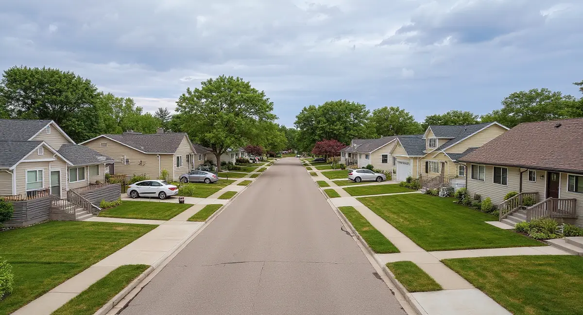
Bondurant's population roughly tripled since 2000, and nearly all of the city's residential housing stock was built on land that transitioned directly from active agricultural use to subdivision development. This farmland-to-suburb conversion is the defining characteristic of Bondurant's foundation risk profile. Agricultural land carries decades of accumulated soil modification — compacted plow layers, disrupted natural drainage from field tile installation and removal, variable density from equipment traffic patterns, and altered organic content in the upper soil horizon. When builders regrade this land and pour foundations, the engineered fill sits atop a disturbed soil profile that behaves differently than undisturbed glacial till.
The most significant construction-era risk factor in Bondurant is differential settlement caused by the boundary between engineered fill material and the underlying disturbed agricultural soil. Builders compact and grade the construction site to specification, but the soil beneath the engineered fill layer was compacted unevenly by decades of farming activity. Some zones settle more than others under the weight of a house, producing differential movement that shows up as diagonal cracks at wall corners, doors and windows binding in their frames, and measurable floor slopes. This is distinct from the hydrostatic pressure problem — it is a bearing capacity issue in the upper soil layers.
Bondurant's isolation from the metro core means its development is less continuous than western growth suburbs — subdivisions are separated by undeveloped agricultural land, creating a patchwork of developed and undeveloped parcels with different drainage characteristics. Water runs off impermeable developed surfaces (roofs, driveways, streets) and into the undeveloped agricultural parcels adjacent to subdivisions, or vice versa depending on topography. This edge effect can create localized zones of elevated soil moisture along the boundaries between developed and undeveloped land, increasing hydrostatic loading on foundations at the periphery of subdivisions that are not present in the interior.
Virtually all of Bondurant's housing stock is poured concrete construction built to post-2000 Iowa building code standards, which is a meaningful structural advantage over older suburbs but not a guarantee against hydrostatic damage. Modern poured walls with proper reinforcement resist lateral pressure more effectively than block walls or the less-reinforced poured walls common in 1970s construction. However, Bondurant's homes are now 10 to 25 years into their exposure to glacial till hydrostatic cycles, placing the majority of the housing stock in the first-generation damage window when initial cracks and moisture intrusion typically become visible.
What makes Bondurant's farmland-to-suburb conversion a distinct foundation risk factor beyond the standard glacial till hydrostatic pressure?
What Foundation Problems Show Up in Bondurant?
Horizontal cracking in basement walls at or just below grade level is the primary foundation problem in Bondurant, driven by lateral hydrostatic pressure from the saturated glacial till during the spring water table peak. The crack forms at the point of maximum lateral pressure — typically where the backfill meets the undisturbed soil, which concentrates force at a specific elevation on the wall. Unlike vertical shrinkage cracks that are common in the first year after construction and are generally cosmetic, a horizontal crack indicates the wall has been loaded past its tensile capacity at that point. The horizontal cracks symptom page explains the severity thresholds and what they mean for repair timing.
Differential settlement from the farmland conversion produces a distinct crack pattern that Bondurant homeowners should distinguish from hydrostatic damage: diagonal cracks radiating from corners of windows, doors, and wall intersections. These cracks indicate that one part of the foundation has settled more than another, racking the structural frame. The settlement is typically driven by the variable soil density beneath the foundation rather than by water pressure. In Bondurant's former-farmland context, push piers driven through the disturbed upper layers to stable bearing in the undisturbed till below are the standard correction — they bypass the problem soil entirely and transfer the foundation load to competent material.
Basement floor slab problems in Bondurant take two forms: settlement cracking where the slab drops over poorly compacted fill, and hydrostatic heaving where upward water pressure pushes the slab upward at its center. Settlement and heaving produce visually similar floor cracks but have opposite causes and require different interventions. Settlement typically occurs within the first 5 to 10 years as fill material compresses, while heaving is seasonal and follows the spring water table cycle. Polyjacking addresses settlement voids by filling the gap beneath the slab, while slab piers stabilize slabs that have experienced more severe displacement.
Water intrusion at the wall-floor joint — the cold joint where the basement wall meets the floor slab — is extremely common in Bondurant and is often the first visible sign that hydrostatic pressure is acting on the foundation. This joint is not sealed in standard residential construction; it is simply a construction joint where concrete was poured against previously cured concrete. Under hydrostatic pressure, water follows this joint into the basement. Persistent moisture at this location during spring months is not a plumbing problem or surface drainage issue — it is direct evidence of groundwater pressure. Crack injection can seal isolated entry points, but widespread wall-floor joint seepage typically requires interior drainage and sump system intervention.
When Is Foundation Risk Highest in Bondurant?
March through June is the peak risk period for Bondurant foundations, when the combination of spring snowmelt and rainfall pushes the water table to its annual maximum and generates the highest hydrostatic pressure loads of the year. Iowa averages 26 inches of snowfall that accumulates through the winter and releases into the glacial till as temperatures rise in March. April through June rainfall adds 4 to 5 inches per month on top of the snowmelt recharge. The cumulative effect raises the water table from its fall low of 8 to 10 feet to its spring peak of 2 to 3 feet below grade across a roughly 60-day window. Bondurant's eastern drainage position and pure glacial till amplify this effect because the till drains so slowly that pressure persists for weeks after rain events end.
The secondary risk mechanism operates from November through March when Iowa's 42-inch frost depth drives freeze-thaw cycling that widens any cracks created during the spring pressure season. Each freeze cycle expands trapped moisture in existing cracks, and each thaw allows additional water to penetrate deeper into the crack face. After a full winter of 30 to 40 cycles, cracks that were hairline in June can be visibly wider by March — and the wider crack then admits more water during the next spring pressure peak. This compounding cycle is the reason that unaddressed cracks in glacial till country deteriorate faster than homeowners typically expect.
July through October is the lowest-risk period for active hydrostatic damage and the best window for foundation inspection, documentation, and repair. The water table drops to its annual minimum, hydrostatic loads are at their lowest, and crack widths stabilize. Bondurant homeowners who noticed moisture, new cracks, or floor changes during the spring should use this dry window to have the damage evaluated and to complete any repairs before the next freeze-thaw season begins. Repair materials — including injection resins and anchor grouts — also cure more reliably in summer temperatures than in the cold and wet conditions of spring.
Central Iowa's climate produces roughly 36 to 39 inches of annual rainfall, with summer temperatures averaging 86 degrees and winter temperatures averaging 12 degrees — a 74-degree annual swing that creates thermal expansion and contraction stress in concrete on top of the hydrostatic and freeze-thaw forces. This thermal cycling is a tertiary deterioration factor that compounds the primary hydrostatic damage. Concrete expands in summer heat and contracts in winter cold, and the movement is not uniform across a foundation because sun-exposed walls expand more than shaded walls. The cumulative effect over 20 years of thermal cycling adds incremental stress to every existing crack and joint in the foundation.
What Can Bondurant Homeowners Do to Reduce Foundation Risk?
Exterior grading and drainage management is the most effective prevention measure for Bondurant homeowners because it directly reduces the volume of water reaching the glacial till adjacent to the foundation. Positive grading away from the foundation at a minimum slope of 6 inches over 10 feet prevents surface water from pooling against the basement wall. Downspout extensions carrying roof runoff at least 6 feet from the foundation prevent concentrated discharge from saturating the soil in one location. In Bondurant's former-farmland context, homeowners should also verify that lot grading has not been altered by landscaping or settled fill — many post-construction grading changes inadvertently redirect water back toward the foundation. The homeowner's guide provides a drainage management checklist.
Sump pump systems with battery backup are essential equipment in Bondurant given the seasonal water table behavior and the pure glacial till's resistance to natural drainage. Interior drain tile connected to a sump pit provides the last line of defense against hydrostatic water intrusion during the spring peak. A sump pump failure during a spring storm — when power outages are most common — can result in rapid basement flooding because the water table is already near the slab elevation and there is no natural drainage path through the till. Battery backup or water-powered backup systems are not optional upgrades in this geological context; they are baseline protection.
Homeowners in subdivisions adjacent to undeveloped agricultural land should monitor the boundary zone for signs of elevated moisture loading. The edge effect between impermeable developed surfaces and open agricultural land can concentrate water along the transition, increasing hydrostatic pressure on foundations at the periphery of the subdivision. Checking for foundation cracks, efflorescence, and moisture at the wall-floor joint during the March-through-June peak season identifies whether the edge effect is contributing to localized pressure increases. The cost page documents how early intervention at the crack stage prevents escalation to the wall-displacement stage where repair costs increase significantly.
Seasonal inspection discipline is particularly important for Bondurant because the entire city's housing stock is passing through the first-generation damage window simultaneously. A brief walk-through of the basement in April — checking walls for new horizontal cracks, the wall-floor joint for moisture, and floors for new unevenness — and a second check in November before the freeze season starts takes 15 minutes and can identify problems when they are still in the maintenance-repair range. Waiting until a stair-step crack has propagated across a full wall panel or a chimney has separated from the house structure means the damage has progressed past the early-intervention threshold.
- Bondurant sits on pure Polk County glacial till without the loess overlay found in western suburbs, meaning hydrostatic pressure builds faster and persists longer after rain events.
- Nearly all housing was built on former farmland after 2000, combining standard glacial till hydrostatic risk with differential settlement from disturbed agricultural soil settling at different rates.
- The edge effect between developed subdivisions and adjacent undeveloped farmland can create localized zones of elevated soil moisture along subdivision perimeters.
- Seasonal inspection discipline is critical because the entire city's housing stock is passing through the 10-to-25-year first-generation damage window simultaneously.
Bondurant Foundation Questions
Why does Bondurant's location on the eastern edge of the metro create different foundation risks than western suburbs?
Bondurant sits on the eastern reach of the Des Moines Lobe glacial till, where surface water drains toward the Des Moines River rather than away from it as in western suburbs. This eastward drainage pattern means groundwater moves through the glacial till toward the river system, and Bondurant's relatively low topographic position collects subsurface water from upland areas to the west. The result is a water table that can be persistently higher than in western suburbs at comparable elevations, generating greater sustained hydrostatic pressure against foundations. Western growth suburbs like Grimes and Waukee sit on slightly higher ground relative to their local drainage systems and benefit from the Polk-Dallas county loess overlay that provides somewhat better infiltration.
Does building on former farmland increase foundation risk for Bondurant homes?
Yes. Bondurant's subdivisions were built almost entirely on land that was in active agricultural use until immediately before development. Decades of row-crop farming create compacted plow layers at 8 to 12 inches below the original surface, altered subsurface drainage patterns from field tile systems, and variable soil density where equipment traffic has compressed some areas more than others. When builders regrade this land and pour foundations, the engineered fill and the underlying disturbed agricultural soil settle at different rates than the undisturbed glacial till deeper below. This differential compaction produces uneven settlement — diagonal cracks at corners, sloping floors, and binding doors — within the first 10 to 15 years after construction.
What foundation symptoms should Bondurant homeowners watch for during spring?
The March through June spring season is when hydrostatic pressure peaks in Bondurant as snowmelt and rainfall push the water table from its normal 4-to-10-foot depth up to 2 to 3 feet below grade. The first symptoms to appear are typically moisture or efflorescence at the basement wall-floor joint, followed by horizontal hairline cracks in basement walls at or just below grade level. More advanced cases show measurable wall bowing where the lateral pressure has deflected the wall inward. Homeowners should also check for new floor slab cracks or areas where the basement floor feels uneven — upward hydrostatic pressure against the slab can cause heaving at the center of the basement where the slab is least constrained.
How does Bondurant's pure glacial till differ from the mixed soil in western Des Moines suburbs?
Bondurant sits entirely within Polk County on pure Des Moines Lobe glacial till from the Dows Formation — 45 to 60 feet of dense, poorly draining material without the Peorian loess overlay found in Dallas County suburbs to the west. Pure glacial till has extremely low permeability, meaning water that enters the soil around a foundation has very limited ability to drain away. Western suburbs like West Des Moines and Waukee have a loess component that provides slightly better drainage characteristics in the upper soil profile. The practical difference for Bondurant homeowners is that hydrostatic pressure builds faster and persists longer after rain events because the till traps water more completely against foundation walls.
Are Bondurant's newer homes safe from foundation problems because they were built to modern code?
Modern building codes require better concrete reinforcement, engineered backfill, and drainage provisions than the standards applied to 1970s or 1980s construction — but code compliance does not override geology. Bondurant's homes are predominantly 10 to 25 years old, which places them in the window when first-generation hydrostatic damage typically becomes visible. The glacial till generates the same lateral pressure against a 2015-built wall as it does against a 1975-built wall; the newer wall simply starts from a stronger baseline. Homeowners should not assume that a recently built home is exempt from inspection, particularly after the spring pressure season when the water table has been at its annual peak for two to three months.