Altoona, Iowa Foundation Risk Profile
Soil data, housing stock analysis, and seasonal risk patterns for Altoona homeowners — from the mature 1970s core to the Spring Creek drainage corridor to the newer eastern expansion along the I-80 corridor.
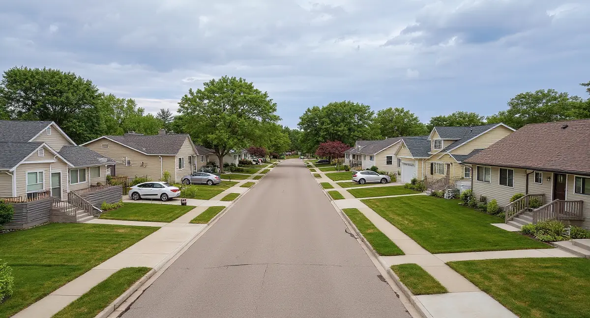
Altoona's mixed-era housing stock -- spanning 1970s construction through 2010s development -- creates a foundation risk profile that varies dramatically by neighborhood, with 40-to-50-year-old homes in the core showing advanced hydrostatic damage while newer eastern homes are entering their first-generation damage window. Spring Creek and Four Mile Creek drainage corridors elevate the water table in adjacent neighborhoods, amplifying hydrostatic pressure beyond what upland homes experience on the same Polk County glacial till.
What Soil Sits Beneath Altoona Homes?
Altoona sits on Polk County glacial till from the Des Moines Lobe — the same Dows Formation that underlies the broader eastern metro, a compacted mixture of clay, silt, sand, and gravel deposited roughly 12,000 years ago that extends 45 to 60 feet below the surface. This formation is dense and poorly draining, which means the primary foundation threat in Altoona is hydrostatic pressure from groundwater that cannot move efficiently through the till. Water accumulates against foundation walls and under floor slabs rather than draining away, and the pressure it generates increases with every inch the water table rises during the spring recharge season.
Spring Creek and Four Mile Creek are the defining drainage features in Altoona, and they create distinct hydrostatic risk zones across the city's residential areas. Groundwater in glacial till migrates slowly toward these creek channels, establishing corridors of elevated water table along the creek alignments. Homes within a few hundred feet of either creek corridor experience higher baseline water tables and more persistent hydrostatic pressure than homes on higher ground between the drainage systems. The creeks also carry concentrated stormwater during rain events, and because the surrounding till has extremely low infiltration capacity, runoff volume overwhelms the channels and floods adjacent low-lying areas during heavy rain. The foundation science page covers how hydrostatic pressure translates into measurable force against residential foundation walls.
The Adventureland and Prairie Meadows commercial zone occupies a significant area of central Altoona with impermeable surface — parking lots, building footprints, and roadways — that redirects rainfall into the surrounding drainage network rather than allowing it to infiltrate in place. This commercial drainage effect concentrates water along the perimeter of the developed zone and into the creek systems, increasing soil saturation in residential areas downslope. Homes south and east of the commercial corridor sit in the receiving zone for this redirected runoff, which adds hydrostatic load beyond what natural rainfall patterns alone would produce.
Iowa's 42-inch frost depth penetrates well past the typical footing depth in Altoona, driving a freeze-thaw deterioration mechanism that compounds hydrostatic damage over successive winters. When the freeze line reaches 42 inches below grade, any moisture that has infiltrated through cracks or joints in the foundation wall expands by approximately 9 percent as it freezes. This expansion widens existing cracks incrementally with each cycle. Over a typical Iowa winter with 30 to 40 freeze-thaw transitions, the cumulative widening transforms spring-formed hairline cracks into measurable pathways for the next season's hydrostatic water entry — a self-reinforcing deterioration loop that accelerates year over year if left unaddressed.
How Does Altoona's Mixed-Era Housing Stock Shape Foundation Risk?
Altoona's housing stock spans four decades — from 1970s construction in the city's mature core to 2010s development in the eastern expansion areas — creating a foundation risk profile that varies dramatically by neighborhood and era. This breadth distinguishes Altoona from the growth suburbs surrounding it. Bondurant to the northeast is almost entirely post-2000 construction; Altoona has homes with 50 years of cumulative glacial till exposure sitting within a mile of homes with 10 years of exposure. The geological forces are identical across the city, but the structural response to those forces depends entirely on how long the foundation has been subjected to them and what construction standards were in place when it was built.
Core Altoona — the established neighborhoods west of the Adventureland commercial area — contains the city's 1970s and 1980s housing stock, built with poured concrete basements to the construction standards of that era. These foundations have endured 40 to 50 spring hydrostatic pressure cycles, 40 to 50 winters of freeze-thaw crack widening, and the cumulative thermal expansion and contraction stress of central Iowa's 74-degree annual temperature swing. The 1970s-era poured walls typically carry less reinforcing steel than current code requires, making them more vulnerable to lateral pressure over time. Horizontal cracks in these older walls are frequently advanced — not just hairline indicators but measurable displacements where the wall has deflected inward under decades of sustained pressure.
The 1990s development wave filled in the areas between core Altoona and the commercial zone, producing homes that now carry 25 to 35 years of cumulative exposure. These homes represent a middle ground: they were built to better standards than the 1970s stock but have accumulated enough hydrostatic cycling to produce visible symptoms in many cases. The 1990s homes are frequently in the transition from early-stage to mid-stage damage — foundation cracks that formed as hairlines in the first decade have widened through successive freeze-thaw seasons, and some walls show the beginning of measurable bowing where horizontal cracks have compromised the wall's structural continuity.
East Altoona's 2000s and 2010s construction represents the newest housing in the city, built on former agricultural and undeveloped land east of the established core. Like Bondurant and other eastern growth areas, these homes were built on regraded farmland where the soil profile was disturbed by decades of agricultural use before residential construction. The foundation risk in east Altoona combines the standard glacial till hydrostatic pressure problem with the farmland-conversion differential settlement risk — foundations sitting on mixed undisturbed till and regraded agricultural soil that settle at different rates. These homes are 10 to 20 years old, placing them at the beginning of the first-generation damage window.
Why do homes near Spring Creek and Four Mile Creek in Altoona experience faster foundation crack progression than homes on higher ground?
What Foundation Problems Are Most Common in Altoona?
Horizontal wall cracking from lateral hydrostatic pressure is the dominant foundation problem across all eras of Altoona housing, but its severity varies directly with the age of the structure. In core Altoona's 1970s homes, horizontal cracks have frequently progressed past the hairline stage to visible wall displacement — the wall above the crack line has deflected inward by a quarter inch or more, indicating that the wall has been loaded past its elastic limit and is now in a structural failure progression. In 1990s homes, horizontal cracks are typically visible but not yet producing measurable displacement. In east Altoona's post-2000 homes, the cracks may still be at the hairline stage or just beginning to appear during spring pressure peaks. The horizontal cracks symptom page details the severity thresholds.
Wall bowing in core Altoona's older homes is the advanced-stage consequence of unaddressed horizontal cracks, and it represents the most structurally urgent condition in the city's foundation inventory. Once a horizontal crack has compromised the wall's structural continuity, continued hydrostatic loading pushes the wall inward above and below the crack line. If inward deflection exceeds half an inch, the wall has crossed from a maintenance-repair condition into structural territory requiring active intervention. Carbon fiber straps arrest early-stage bowing where deflection is under two inches. Wall anchors address more advanced displacement and can gradually recover wall position over successive tightening cycles if the soil conditions allow anchor plates to achieve adequate bearing beyond the pressure zone.
Differential settlement in east Altoona's former-farmland subdivisions produces diagonal cracks at wall corners and window openings, sloping floors, and binding doors and windows — a pattern distinct from the hydrostatic-driven horizontal cracking in the older core. The settlement occurs because regraded agricultural soil compresses at a different rate than the undisturbed till beneath it, causing one section of the foundation to drop relative to another. Push piers or helical piers are the standard correction: steel shafts driven through the unstable upper layers to bearing in the competent glacial till below, then connected to the foundation with steel brackets that transfer the structural load to stable material.
Creek-corridor homes near Spring Creek and Four Mile Creek experience an amplified version of the hydrostatic pressure problem, with more frequent basement moisture intrusion, higher rates of wall-floor joint seepage, and faster crack progression than homes on higher ground between the drainages. The persistently elevated water table along the creek corridors means these foundations never fully unload between spring pressure seasons — the hydrostatic pressure may decrease in summer but does not drop to zero. This sustained loading accelerates damage progression compared to homes where the water table drops below the footing level during dry months. Crack injection can seal isolated entry points, but homes in the creek corridors frequently require comprehensive interior drainage systems to manage the volume of hydrostatic water entry.
When Is Foundation Risk Highest in Altoona?
March through June is the peak risk period for Altoona foundations, driven by the spring water table rise that generates maximum hydrostatic pressure against basement walls and under floor slabs. Iowa's 26 inches of average annual snowfall accumulates through winter and releases into the glacial till as March temperatures rise. Spring rainfall adds 4 to 5 inches per month from April through June. The combined recharge pushes the water table from its fall-winter baseline of 6 to 10 feet below grade to its spring peak of 2 to 3 feet below grade. At Altoona's creek corridor locations, the water table can rise higher still, approaching slab elevation during sustained wet periods and generating both lateral pressure against walls and uplift pressure against floor slabs.
The freeze-thaw season from November through March drives the secondary damage mechanism — crack widening from ice expansion that compounds the spring hydrostatic damage. Iowa's 42-inch frost depth means the entire foundation wall from grade down to below the footing is within the freeze zone. Moisture that infiltrated through spring-formed cracks freezes and expands, then thaws and allows deeper water penetration, then freezes again. After 30 to 40 cycles across a typical Iowa winter, every unrepaired crack from the spring season is measurably wider — and the next spring's hydrostatic pressure pushes through the widened crack more aggressively. In core Altoona's older homes, this compounding effect has been operating for 40 to 50 winters.
July through October is the lowest-risk period and the optimal inspection and repair window for Altoona homeowners. The water table retreats to its annual minimum, hydrostatic loads drop to their lowest levels, and crack widths stabilize at their dry-season dimensions. This is the time to evaluate whether spring damage is progressing or stable, to set baseline crack measurements for comparison across the next spring cycle, and to complete any structural repairs before winter freeze-thaw begins widening existing cracks. Concrete repair materials — epoxy injections, carbon fiber adhesives, and anchor grouts — also perform most reliably in the warm, dry conditions of summer.
Central Iowa's climate data frames the annual stress cycle precisely: summer temperatures averaging 86 degrees, winter temperatures averaging 12 degrees, 36 to 39 inches of annual rainfall concentrated in the April-through-June wet season, and 26 inches of snowfall providing spring recharge. The 74-degree annual temperature swing adds thermal expansion and contraction stress to concrete foundation walls — a tertiary factor that compounds the primary hydrostatic and freeze-thaw mechanisms. South-facing and west-facing walls experience the greatest thermal cycling amplitude due to direct sun exposure, which is why vertical cracks from thermal stress tend to appear first on sun-exposed walls before becoming visible on shaded north-facing walls.
What Can Altoona Homeowners Do to Reduce Foundation Risk?
Exterior drainage management is the highest-leverage prevention action for Altoona homeowners because hydrostatic pressure — the primary threat — is fundamentally a water management problem. Positive grading away from the foundation at a minimum slope of 6 inches over 10 feet directs surface water away from basement walls. Downspout extensions carrying roof runoff at least 6 feet from the foundation wall prevent concentrated water discharge from saturating the till directly against the wall. For creek-corridor homes near Spring Creek or Four Mile Creek, these standard measures are necessary but may not be sufficient — the elevated water table in these locations is driven by regional groundwater flow, not just site-specific surface drainage. The homeowner's guide provides a drainage checklist calibrated for glacial till conditions.
Sump pump systems with battery backup are baseline equipment for Altoona homes, particularly for the 1970s and 1980s core housing stock where decades of hydrostatic cycling have created multiple potential water entry points. Interior drain tile connected to a properly sized sump pit intercepts water at the wall-floor joint before it floods the basement. Battery backup ensures continuous operation during the spring storm events that produce both the highest water table conditions and the most frequent power outages. Homes in the creek corridors may require higher-capacity pump systems than standard residential units because the sustained water table elevation produces higher inflow volumes than typical intermittent seepage.
Core Altoona homeowners with 1970s and 1980s homes should prioritize annual inspection of basement walls for horizontal crack progression, particularly in the months immediately following the spring pressure peak. The difference between a maintenance-level repair and a major structural intervention often comes down to catching horizontal crack progression before wall displacement exceeds half an inch. Placing reference marks at crack endpoints and measuring crack width with a crack gauge during the July-through-October dry window establishes a baseline for comparison year over year. If crack width or wall displacement is increasing annually, the damage is active and progressing — not historical and stable. The cost page documents how repair scope and cost escalate from early-stage crack injection to mid-stage carbon fiber reinforcement to advanced-stage wall anchor installation.
East Altoona homeowners on former farmland should watch for differential settlement indicators — diagonal cracks at wall corners, sloping floors, and garage floor sinking — during the first 15 years after construction. The farmland-conversion settlement risk is separate from the hydrostatic pressure risk, and both can operate simultaneously on the same foundation. A home showing diagonal settlement cracks at its corners and horizontal hydrostatic cracks in its basement walls is experiencing two distinct geological forces that require different repair approaches. Addressing one without evaluating the other leads to incomplete repair that fails to resolve the full damage mechanism. A qualified evaluation should distinguish between the two patterns and prescribe the appropriate combination of interventions — piers for settlement, reinforcement for lateral pressure.
- Altoona's 1970s-1980s core housing carries 40-50 years of cumulative hydrostatic pressure cycling on walls with less reinforcing steel than current code requires, making advanced-stage wall displacement the most structurally urgent condition in the city.
- Spring Creek and Four Mile Creek drainage corridors create zones of persistently elevated water table where foundations never fully unload between spring pressure seasons.
- The Adventureland and Prairie Meadows commercial zone redirects rainfall runoff into surrounding residential drainage, increasing hydrostatic loading on homes south and east of the commercial corridor.
- Core Altoona homeowners should prioritize annual inspection of basement walls for horizontal crack progression, particularly after the March-through-June spring pressure peak.
Altoona Foundation Questions
Why do Altoona's 1970s and 1980s homes face more severe foundation problems than newer construction?
Altoona's core neighborhoods were built in the 1970s and 1980s with poured concrete basement walls that have now endured 40 to 50 years of hydrostatic pressure cycling from the glacial till. Each spring, the water table rises and pushes laterally against these walls; each winter, freeze-thaw widens any cracks that formed. After four to five decades of this compounding cycle, walls that started with hairline stress cracks now carry measurable horizontal displacement. The 1970s-era construction also predates modern reinforcement standards — these walls typically have less steel reinforcement than current Iowa code requires, making them less resistant to the lateral loads the till imposes. Newer construction in east Altoona benefits from better reinforcement but has less cumulative exposure.
How do Spring Creek and Four Mile Creek affect foundation risk in Altoona?
Spring Creek and Four Mile Creek are the primary surface drainage corridors through Altoona, and they influence foundation risk in two ways. First, the creek corridors create localized zones of elevated water table where groundwater naturally migrates toward the creek channels, meaning homes within a few hundred feet of either creek experience higher and more persistent hydrostatic pressure against their foundations than homes on higher ground between the drainages. Second, the creek systems carry concentrated stormwater during rain events, and the low-permeability glacial till prevents rapid infiltration — so water backs up in the creek corridors and floods adjacent low-lying areas, adding direct water loading against foundations on top of the baseline hydrostatic pressure.
Does the Adventureland and Prairie Meadows commercial area affect residential foundation risk nearby?
The Adventureland and Prairie Meadows commercial zone covers a large area of impermeable surface — parking lots, buildings, and roadways — that prevents rainfall from infiltrating into the soil where it falls. Instead, this water runs off as surface flow into the surrounding drainage network and into the glacial till at the perimeter of the developed area. Residential neighborhoods downslope from the commercial zone receive this redirected runoff, which increases soil saturation and hydrostatic pressure beyond what the natural rainfall alone would produce. Homes south and east of the commercial corridor, where the topography slopes toward the creek systems, are most affected by this concentrated drainage input.
What is the difference between foundation problems in core Altoona and east Altoona?
Core Altoona — the established neighborhoods west of the Adventureland area — contains 1970s through 1990s housing with 30 to 50 years of cumulative glacial till exposure. The dominant problems here are advanced-stage: horizontal wall cracks that have progressed to measurable bowing, differential settlement that has accumulated over decades to produce visible floor slopes, and deteriorated wall-floor joints from repeated hydrostatic water entry. East Altoona's 2000s and 2010s construction shows early-stage problems: hairline horizontal cracks forming during spring pressure peaks, initial moisture intrusion at wall-floor joints, and minor differential settlement from the farmland-to-residential soil conversion. The same geological forces are at work in both areas — the difference is cumulative exposure time.
When should Altoona homeowners schedule a foundation inspection?
The optimal inspection window is July through October, after the spring water table peak has receded and before winter freeze-thaw cycling begins. During this dry period, cracks are at their minimum seasonal width and hydrostatic loads are at their lowest, making it possible to assess the true structural condition of the foundation without the confounding factor of active water pressure. Homeowners who noticed new moisture, cracks, or floor changes during the March-through-June spring season should prioritize a summer evaluation. A secondary check in late November, after the first hard freeze, reveals whether the 42-inch frost penetration has widened any existing cracks — this determines whether freeze-thaw damage is compounding the spring hydrostatic damage.